How far is Wilmington, NC from Walnut Cove, NC?
The driving distance from Wilmington, NC to Walnut Cove, NC is about 239.4 miles (385.3 km), with a travel time of about 04h 41m by car.
- The straight-line flight distance is about 189.2 miles (304.5 km).
- For a round trip, plan for roughly 09h 22m of driving time before adding stops, traffic, or weather delays.
- A comfortable departure window is usually 6:00 AM to 8:00 AM EDT.
Reverse, save, or send this route
This drive is better planned with a longer stop or an overnight stay. Copy the route link, send it to another device, or print a clean version before you head out.
This drive is better planned with a longer stop or an overnight stay.
Flight Distance
Driving Distance
Gas Cost Calculator
Leave and Arrive Planner
Pick a departure time to see your estimated arrival and same-day return window.
Drive time stays fixed at 04h 41m.
An early departure helps you fit a real stop into the day without turning the return into a late-night drive.
You are leaving earlier than the recommended window, which gives you extra margin for breaks and traffic.
Halfway Point
A useful midpoint for breaks, coffee, or meeting in the middle.
Town in North Carolina, United States
Route Weather Snapshot
Check the forecast at both ends before you head out.
Partly Cloudy
Clear then Patchy Fog
Driving Route Map
The map below follows the saved road route between Wilmington and Walnut Cove.
Turn-by-Turn Driving Directions
Step-by-step road directions between Wilmington and Walnut Cove.
-
1
Start on South 3rd Street
1.7 mi · 4 min · South 3rd Street
-
2
Keep slight right to continue on Martin Luther King Jr Parkway
4.7 mi · 7 min · Martin Luther King Jr Parkway
-
3
Turn left onto North College Road
1.2 mi · 2 min · North College Road
-
4
Continue on Michael Jordan Highway
107.3 mi · 1 hr 55 min · Michael Jordan Highway
-
5
Keep slight left
86.1 mi · 1 hr 39 min
-
6
Keep slight right
1871 ft · 25 sec
-
7
Take the exit slight right toward I 785 North, I 840 West
1 km · 1 min
-
8
Merge slight left onto Greensboro Urban Loop
13.6 mi · 16 min · Greensboro Urban Loop
-
9
Take the exit slight right toward US 220: Battleground Avenue
1704 ft · 42 sec
-
10
Keep slight right to continue on US 220 North
124 m · 14 sec
-
11
Turn right onto Battleground Avenue
3.9 mi · 6 min · Battleground Avenue
-
12
Keep slight right to continue on Battleground Avenue
4 mi · 6 min · Battleground Avenue
-
13
Take the exit slight right toward US 158: Stokesdale, Reidsville
1809 ft · 53 sec
-
14
Turn left
4.4 mi · 7 min
-
15
Turn straight onto Belews Creek Road
5.3 mi · 8 min · Belews Creek Road
-
16
Turn right
5.1 mi · 7 min
-
17
At the end of the road, turn right onto South Main Street
2466 ft · 1 min · South Main Street
-
18
Arrive at your destination
0 m · 1 sec · North Main Street
Car Route Details
A richer read on the saved driving route between Wilmington and Walnut Cove.
Highway-focused drive
Most of the mileage stays on named highways, so the important moments are ramps, exits, merges, and the final local approach.
Michael Jordan Highway
Continue on Michael Jordan Highway
107 mi · 01h 55m
Route Summary
A quick read on whether this route feels easy, ambitious, or worth planning around.
A longer out-and-back drive
This is still possible in one day, but it becomes a long driving day. Leaving early and planning your stop window matters more here.
Partly Cloudy leaving Wilmington and Clear then Patchy Fog near Walnut Cove.
Trip Questions
Direct answers travelers usually want before committing to the drive.
How long does it take to drive from Wilmington to Walnut Cove?
The road trip is about 239.4 miles (385.3 km) and usually takes 04h 41m in normal driving conditions.
Is this a same-day trip or an overnight route?
This is still possible in one day, but it becomes a long driving day. Leaving early and planning your stop window matters more here.
What is the halfway point on this route?
Garner is a useful midpoint, sitting about 119.7 miles from Wilmington and 119.7 miles from Walnut Cove.
How much longer is the road route than the straight-line distance?
The direct path is about 189.2 miles (304.5 km), while the road route adds roughly 50.2 extra miles because roads do not follow the straight air line.
When is the best time to leave for this route?
A good departure window is usually 6:00 AM to 8:00 AM EDT. If you want a more comfortable same-day return, try to leave by 7:38 AM EDT.
How much will gas cost for this route?
Using about 28.3 MPG, regular gas is estimated at $33.47 one way or $66.94 round trip. Estimated CO2 is about 75.1 kg one way.
What should you check before leaving?
Before you leave, expect Partly Cloudy around Wilmington and Clear then Patchy Fog near Walnut Cove.
Stop Ideas Near Garner
Useful break, food, and waypoint ideas within about 15 miles of the route midpoint.
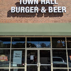
Town Hall Burger and Beer

Garner Town Hall
Clayton Utilities

Angier Police Department And Town Hall
Transit and Meeting Points
Useful pickup, handoff, or rendezvous points close to Garner.
Raleigh Union Station
North Carolina State Fair station
Cary
Selma–Smithfield
Flight Path Map
This map shows the direct air route between Wilmington and Walnut Cove. Straight-line distance: 189.23 mi (304.53 km).

#1 Wilmington
The largest city in the state of North Carolina.
| Population | 124,794 |
| Coordinates | 34.2257300, -77.9447100 |
| Altitude | 9 |
| Country | United States |

#2 Walnut Cove
City in Stokes County, North Carolina, United States of America
| Population | 1,532 |
| Coordinates | 36.2954100, -80.1417100 |
| Altitude | 200 |
| Country | United States |
End: Walnut Cove (-80.14171, 36.29541)
Estimated Travel Time
Distance: 385 km by road
| Speed | Time |
|---|---|
| 30 mph (48.3 km/h) | 07h 58m |
| 40 mph (64.37 km/h) | 05h 59m |
| 50 mph (80.47 km/h) | 04h 47m |
| 60 mph (96.56 km/h) | 03h 59m |
| 70 mph (112.65 km/h) | 03h 25m |
| 80 mph (129 km/h) | 02h 59m |
Fuel, Round Trip and CO2
Estimated fuel cost and emissions for this route.
| Fuel | $/gal | One way | Round trip |
|---|---|---|---|
| Regular gas | $3.96 | $33.47 | $66.94 |
| Mid-grade | $4.43 | $37.43 | $74.85 |
| Premium | $4.78 | $40.37 | $80.75 |
| Diesel | $5.62 | $47.52 | $95.05 |
Assumes 8.3 L/100 km (about 28.3 MPG). CO2 is an estimate and varies by vehicle, fuel blend, traffic, and terrain.
Prices in North Carolina · Jul 15, 2026
Distance to Other Cities
Planning a road trip? See the full trip guide on Trip.ovh — stops, fuel costs, weather, and departure timing.