How far is Westmont, CA from Buffalo Grove, IL?
The driving distance from Westmont, CA to Buffalo Grove, IL is about 2033.2 miles (3272.1 km), with a travel time of about 35h 45m by car.
- The straight-line flight distance is about 1734.9 miles (2792 km).
- For a round trip, plan for roughly 71h 30m of driving time before adding stops, traffic, or weather delays.
- A comfortable departure window is usually 6:00 AM to 7:30 AM PDT.
Reverse, save, or send this route
This drive is better planned with a longer stop or an overnight stay. Copy the route link, send it to another device, or print a clean version before you head out.
This drive is better planned with a longer stop or an overnight stay.
Flight Distance
Driving Distance
Gas Cost Calculator
Leave and Arrive Planner
Pick a departure time to see your estimated arrival and same-day return window.
Drive time stays fixed at 35h 45m.
Starting early still helps, but most travelers will want a longer stop or an overnight stay on a route this long.
You are leaving earlier than the recommended window, which gives you extra margin for breaks and traffic.
Halfway Point
A useful midpoint for breaks, coffee, or meeting in the middle.
Census designated place
Route Weather Snapshot
Check the forecast at both ends before you head out.
Patchy Fog then Partly Sunny
Driving Route Map
The map below follows the saved road route between Westmont and Buffalo Grove.
Turn-by-Turn Driving Directions
Step-by-step road directions between Westmont and Buffalo Grove.
-
1
Start on the route
52 m · 14 sec
-
2
Turn right onto West 105th Street
638 ft · 35 sec · West 105th Street
-
3
Turn left onto Denker Avenue
103 m · 17 sec · Denker Avenue
-
4
Turn left onto West 106th Street
1330 ft · 49 sec · West 106th Street
-
5
Turn right onto South Normandie Avenue
3275 ft · 1 min · South Normandie Avenue
-
6
Turn left onto West Imperial Highway
2593 ft · 55 sec · West Imperial Highway
-
7
Turn right onto South Vermont Avenue
614 ft · 12 sec · South Vermont Avenue
-
8
Turn slight left
138 m · 21 sec
-
9
Turn left onto West 116th Place
1405 ft · 26 sec · West 116th Place
-
10
Take the ramp straight toward I 105 East
1477 ft · 36 sec
-
11
Merge slight left onto Century Freeway
10.1 mi · 12 min · Century Freeway
-
12
Keep slight left to continue on I 605 North
1.1 km · 1 min
-
13
Keep slight left to continue on I 605 North
1555 ft · 40 sec
-
14
Merge slight left onto San Gabriel River Freeway
11.6 mi · 13 min · San Gabriel River Freeway
-
15
Take the exit slight right toward I 10 West, I 10 East: Los Angeles, San Bernardino
932 ft · 23 sec
-
16
Keep slight right to continue on I 10 East: San Bernardino
1685 ft · 41 sec
-
17
Merge slight left onto San Bernardino Freeway
1 mi · 1 min · San Bernardino Freeway
-
18
Keep slight right to continue on San Bernardino Freeway
2.2 mi · 3 min · San Bernardino Freeway
-
19
Keep slight right to continue on San Bernardino Freeway
2 mi · 2 min · San Bernardino Freeway
-
20
Keep slight right to continue on San Bernardino Freeway
1.1 mi · 1 min · San Bernardino Freeway
-
21
Keep slight right to continue on San Bernardino Freeway
1.5 mi · 2 min · San Bernardino Freeway
-
22
Keep slight right to continue on San Bernardino Freeway
1.4 mi · 2 min · San Bernardino Freeway
-
23
Keep slight right to continue on San Bernardino Freeway
2 mi · 2 min · San Bernardino Freeway
-
24
Keep slight right to continue on San Bernardino Freeway
2.1 mi · 2 min · San Bernardino Freeway
-
25
Keep slight right to continue on San Bernardino Freeway
4 mi · 5 min · San Bernardino Freeway
-
26
Keep slight left to continue on I-10 Metro ExpressLanes
7.4 mi · 8 min · I-10 Metro ExpressLanes
-
27
Take the exit slight right
120 m · 10 sec
-
28
Merge slight right onto San Bernardino Freeway
1.5 mi · 2 min · San Bernardino Freeway
-
29
Take the exit slight right toward I 15 North: Barstow, Las Vegas
1.5 km · 2 min
-
30
Merge slight left onto Ontario Freeway
14 mi · 15 min · Ontario Freeway
-
31
Continue on Barstow and Mojave Freeway
6.8 mi · 7 min · Barstow and Mojave Freeway
-
32
Continue on CHP Officer Larry L. Wetterling and San Bernardino County Sheriff's Lieutenant Alfred E. Stewart Memorial Highway
5.4 mi · 6 min · CHP Officer Larry L. Wetterling and San Bernardino County Sheriff's Lieutenant Alfred E. Stewart Memorial Highway
-
33
Continue on Barstow and Mojave Freeway
45.6 mi · 49 min · Barstow and Mojave Freeway
-
34
Keep slight left to continue on Barstow and Mojave Freeway
112 mi · 2 hr · Barstow and Mojave Freeway
-
35
Continue on Las Vegas Freeway
123.8 mi · 2 hr 10 min · Las Vegas Freeway
-
36
Continue on Veterans Memorial Highway
161.6 mi · 2 hr 41 min · Veterans Memorial Highway
-
37
Take the exit slight right toward I 70 East: Richfield, Denver
2705 ft · 1 min
-
38
Continue straight
501.3 mi · 8 hr 40 min
-
39
Keep slight left to continue on Heartland Expressway
12.6 mi · 15 min · Heartland Expressway
-
40
Keep slight right to continue on Heartland Expressway
174.7 mi · 2 hr 55 min · Heartland Expressway
-
41
Merge slight left
474.5 mi · 8 hr 11 min
-
42
Keep slight right to continue on I 35, I 80 East: Chicago, Minneapolis, Kansas City
14.4 mi · 17 min
-
43
Keep slight left
173.2 mi · 3 hr 9 min
-
44
Take the exit slight right toward I 88 East, IL 92 East: Sterling, Rock Falls
1895 ft · 54 sec
-
45
Continue straight
43.8 mi · 47 min
-
46
Continue on Ronald Reagan Memorial Tollway
88.3 mi · 1 hr 38 min · Ronald Reagan Memorial Tollway
-
47
Take the exit slight right toward I 355 Toll North: Northwest Suburbs
1.1 km · 2 min
-
48
Merge slight left onto Veterans Memorial Tollway
10.6 mi · 13 min · Veterans Memorial Tollway
-
49
Merge slight left
5.6 mi · 7 min
-
50
Keep slight left
6.9 mi · 9 min
-
51
Take the exit slight right toward IL 53, IL 68: Dundee Road
1797 ft · 44 sec
-
52
Turn right onto West Dundee Road
1.5 km · 2 min · West Dundee Road
-
53
Turn left onto North Arlington Heights Road
1 mi · 2 min · North Arlington Heights Road
-
54
Turn right onto Lake Cook Road
1.2 mi · 2 min · Lake Cook Road
-
55
Turn right onto South Buffalo Grove Road
814 ft · 20 sec · South Buffalo Grove Road
-
56
Turn left onto Aptakisic Road
31 m · 5 sec · Aptakisic Road
-
57
Arrive at your destination
0 m · 1 sec · Aptakisic Road
Car Route Details
A richer read on the saved driving route between Westmont and Buffalo Grove.
Long-distance drive
This route is long enough that fuel, rest stops, weather, and timing matter more than any single maneuver.
I 70 East
Continue straight
501 mi · 08h 41m
Route Summary
A quick read on whether this route feels easy, ambitious, or worth planning around.
Better with a longer stop
This route is long enough that most travelers will be better off planning an overnight stay or a more deliberate stop window.
Patchy Fog then Partly Sunny leaving Westmont and Smoke near Buffalo Grove.
Trip Questions
Direct answers travelers usually want before committing to the drive.
How long does it take to drive from Westmont to Buffalo Grove?
The road trip is about 2033.2 miles (3272.1 km) and usually takes 35h 45m in normal driving conditions.
Is this a same-day trip or an overnight route?
This route is long enough that most travelers will be better off planning an overnight stay or a more deliberate stop window.
What is the halfway point on this route?
Applewood is a useful midpoint, sitting about 1015.3 miles from Westmont and 1017.9 miles from Buffalo Grove.
How much longer is the road route than the straight-line distance?
The direct path is about 1734.9 miles (2792 km), while the road route adds roughly 298.3 extra miles because roads do not follow the straight air line.
When is the best time to leave for this route?
A good departure window is usually 6:00 AM to 7:30 AM PDT. Starting early still helps, but most travelers will want a longer stop or an overnight stay on a route this long.
How much will gas cost for this route?
Using about 28.3 MPG, regular gas is estimated at $413.87 one way or $827.74 round trip. Estimated CO2 is about 637.6 kg one way.
Do you cross a time zone on this route?
Yes. There is about a 2 hour time difference between Westmont and Buffalo Grove, so arrival and return times should be read in local time.
What should you check before leaving?
Before you leave, expect Patchy Fog then Partly Sunny around Westmont and Smoke near Buffalo Grove.
Stop Ideas Near Applewood
Useful break, food, and waypoint ideas within about 15 miles of the route midpoint.

Municipal Court Park

Denver City Council
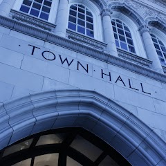
Town Hall Arts Center

City of Littleton
Transit and Meeting Points
Useful pickup, handoff, or rendezvous points close to Applewood.
Union Station
Denver (Bus Station), Colorado
Boulder, Colorado
Pine Junction, CO
Flight Path Map
This map shows the direct air route between Westmont and Buffalo Grove. Straight-line distance: 1734.86 mi (2791.99 km).

#1 Westmont
City in DuPage County, Illinois, United States of America
| Population | 31,853 |
| Coordinates | 33.9414000, -118.3023000 |
| Altitude | 66 |
| Country | United States |

#2 Buffalo Grove
Village in Illinois, United States of America
| Population | 41,496 |
| Coordinates | 42.1514100, -87.9597900 |
| Altitude | 207 |
| Country | United States |
End: Buffalo Grove (-87.95979, 42.15141)
Estimated Travel Time
Distance: 3272 km by road
| Speed | Time |
|---|---|
| 30 mph (48.3 km/h) | 67h 44m |
| 40 mph (64.37 km/h) | 50h 49m |
| 50 mph (80.47 km/h) | 40h 39m |
| 60 mph (96.56 km/h) | 33h 53m |
| 70 mph (112.65 km/h) | 29h 02m |
| 80 mph (129 km/h) | 25h 21m |
Fuel, Round Trip and CO2
Estimated fuel cost and emissions for this route.
| Fuel | $/gal | One way | Round trip |
|---|---|---|---|
| Regular gas | $5.77 | $413.87 | $827.74 |
| Mid-grade | $6.07 | $435.17 | $870.35 |
| Premium | $6.24 | $447.87 | $895.75 |
| Diesel | $7.57 | $542.86 | $1,085.71 |
Assumes 8.3 L/100 km (about 28.3 MPG). CO2 is an estimate and varies by vehicle, fuel blend, traffic, and terrain.
Prices in California · Jul 17, 2026
Distance to Other Cities
Planning a road trip? See the full trip guide on Trip.ovh — stops, fuel costs, weather, and departure timing.