How far is Welch, WV from Parkersburg, WV?
The driving distance from Welch, WV to Parkersburg, WV is about 182.1 miles (293.1 km), with a travel time of about 03h 13m by car.
- The straight-line flight distance is about 126.7 miles (203.9 km).
- For a round trip, plan for roughly 06h 27m of driving time before adding stops, traffic, or weather delays.
- A comfortable departure window is usually 6:00 AM to 8:00 AM EDT.
Reverse, save, or send this route
This drive is better planned with a longer stop or an overnight stay. Copy the route link, send it to another device, or print a clean version before you head out.
This drive is better planned with a longer stop or an overnight stay.
Flight Distance
Driving Distance
Gas Cost Calculator
Leave and Arrive Planner
Pick a departure time to see your estimated arrival and same-day return window.
Drive time stays fixed at 03h 13m.
An early departure helps you fit a real stop into the day without turning the return into a late-night drive.
You are leaving earlier than the recommended window, which gives you extra margin for breaks and traffic.
Halfway Point
A useful midpoint for breaks, coffee, or meeting in the middle.
Town in Kanawha County, West Virginia, United States
Route Weather Snapshot
Check the forecast at both ends before you head out.
Showers And Thunderstorms
Showers And Thunderstorms then Chance Showers And Thunderstorms
Driving Route Map
The map below follows the saved road route between Welch and Parkersburg.
Turn-by-Turn Driving Directions
Step-by-step road directions between Welch and Parkersburg.
-
1
Start on Wyoming Street
722 ft · 12 sec · Wyoming Street
-
2
Turn straight onto McDowell Street
1910 ft · 34 sec · McDowell Street
-
3
Turn right onto Stewart Street
17.2 mi · 26 min · Stewart Street
-
4
At the end of the road, turn left onto River Drive Avenue
1.3 km · 57 sec · River Drive Avenue
-
5
Turn right onto Main Avenue
1668 ft · 22 sec · Main Avenue
-
6
Turn right onto Twin Falls Road
6.7 mi · 8 min · Twin Falls Road
-
7
Turn left
5.4 mi · 6 min
-
8
Continue straight
5.8 mi · 7 min
-
9
Turn slight right onto Slab Fork Road
2.2 mi · 5 min · Slab Fork Road
-
10
Turn left onto Coalfields Expressway
4.4 mi · 5 min · Coalfields Expressway
-
11
Continue on Robert C. Byrd Drive
3.1 mi · 4 min · Robert C. Byrd Drive
-
12
Take the exit slight right
2721 ft · 58 sec
-
13
Keep slight right
1665 ft · 41 sec
-
14
Merge slight left onto West Virginia Turnpike
58.2 mi · 1 hr 9 min · West Virginia Turnpike
-
15
Keep slight right to continue on I 77 North: Parkersburg
1.9 mi · 2 min
-
16
Keep slight left to continue on I 77 North: Parkersburg
70 mi · 1 hr 15 min
-
17
Take the exit slight right toward WV 95: Downtown Parkersburg
1654 ft · 42 sec
-
18
Turn left onto Camden Avenue
57 m · 7 sec · Camden Avenue
-
19
Turn left onto West Virginia Route 95
2.1 mi · 3 min · West Virginia Route 95
-
20
Continue on Camden Avenue
1.3 km · 2 min · Camden Avenue
-
21
Turn right onto Division Street
1.6 km · 2 min · Division Street
-
22
Turn left onto Ann Street
132 m · 23 sec · Ann Street
-
23
Turn left onto 4th Street
131 m · 22 sec · 4th Street
-
24
Turn left onto Juliana Street
103 m · 11 sec · Juliana Street
-
25
Arrive at your destination
0 m · 1 sec · Juliana Street
Car Route Details
A richer read on the saved driving route between Welch and Parkersburg.
Highway-focused drive
Most of the mileage stays on named highways, so the important moments are ramps, exits, merges, and the final local approach.
I 77 North
Keep slight left to continue on I 77 North: Parkersburg
70 mi · 01h 15m
Route Summary
A quick read on whether this route feels easy, ambitious, or worth planning around.
A longer out-and-back drive
This is still possible in one day, but it becomes a long driving day. Leaving early and planning your stop window matters more here.
Showers And Thunderstorms leaving Welch and Showers And Thunderstorms then Chance Showers And Thunderstorms near Parkersburg.
Trip Questions
Direct answers travelers usually want before committing to the drive.
How long does it take to drive from Welch to Parkersburg?
The road trip is about 182.1 miles (293.1 km) and usually takes 03h 13m in normal driving conditions.
Is this a same-day trip or an overnight route?
This is still possible in one day, but it becomes a long driving day. Leaving early and planning your stop window matters more here.
What is the halfway point on this route?
Chesapeake is a useful midpoint, sitting about 91 miles from Welch and 91.2 miles from Parkersburg.
How much longer is the road route than the straight-line distance?
The direct path is about 126.7 miles (203.9 km), while the road route adds roughly 55.4 extra miles because roads do not follow the straight air line.
When is the best time to leave for this route?
A good departure window is usually 6:00 AM to 8:00 AM EDT. If you want a more comfortable same-day return, try to leave by 10:32 AM EDT.
How much will gas cost for this route?
Using about 28.3 MPG, regular gas is estimated at $25.47 one way or $50.94 round trip. Estimated CO2 is about 57.1 kg one way.
What should you check before leaving?
Before you leave, expect Showers And Thunderstorms around Welch and Showers And Thunderstorms then Chance Showers And Thunderstorms near Parkersburg.
Stop Ideas Near Chesapeake
Useful break, food, and waypoint ideas within about 15 miles of the route midpoint.

Parks and Recreation

Kanawha County Magistrate Court
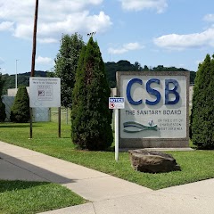
Charleston Sanitary Board

Belle City Offices
Transit and Meeting Points
Useful pickup, handoff, or rendezvous points close to Chesapeake.
Charleston
Montgomery
Thurmond
Prince
Flight Path Map
This map shows the direct air route between Welch and Parkersburg. Straight-line distance: 126.71 mi (203.92 km).

#1 Welch
City in McDowell County, West Virginia, United States
| Population | 1,575 |
| Coordinates | 37.4328900, -81.5845500 |
| Altitude | 402 |
| Country | United States |

#2 Parkersburg
City in and county seat of Wood County, West Virginia
| Population | 29,009 |
| Coordinates | 39.2667400, -81.5615100 |
| Altitude | 187 |
| Country | United States |
End: Juliana Street (-81.56142, 39.266643)
Estimated Travel Time
Distance: 293 km by road
| Speed | Time |
|---|---|
| 30 mph (48.3 km/h) | 06h 04m |
| 40 mph (64.37 km/h) | 04h 33m |
| 50 mph (80.47 km/h) | 03h 38m |
| 60 mph (96.56 km/h) | 03h 02m |
| 70 mph (112.65 km/h) | 02h 36m |
| 80 mph (129 km/h) | 02h 16m |
Fuel, Round Trip and CO2
Estimated fuel cost and emissions for this route.
| Fuel | $/gal | One way | Round trip |
|---|---|---|---|
| Regular gas | $3.96 | $25.47 | $50.94 |
| Mid-grade | $4.43 | $28.48 | $56.96 |
| Premium | $4.78 | $30.72 | $61.45 |
| Diesel | $5.62 | $36.16 | $72.32 |
Assumes 8.3 L/100 km (about 28.3 MPG). CO2 is an estimate and varies by vehicle, fuel blend, traffic, and terrain.
Prices in West Virginia · Jun 27, 2026
Distance to Other Cities
Planning a road trip? See the full trip guide on Trip.ovh — stops, fuel costs, weather, and departure timing.