How far is Vandenberg Village, CA from Long Beach, CA?
The driving distance from Vandenberg Village, CA to Long Beach, CA is about 178.3 miles (286.9 km), with a travel time of about 03h 18m by car.
- The straight-line flight distance is about 145.5 miles (234.1 km).
- For a round trip, plan for roughly 06h 36m of driving time before adding stops, traffic, or weather delays.
- A comfortable departure window is usually 6:00 AM to 8:00 AM PDT.
Reverse, save, or send this route
This drive is better planned with a longer stop or an overnight stay. Copy the route link, send it to another device, or print a clean version before you head out.
This drive is better planned with a longer stop or an overnight stay.
Flight Distance
Driving Distance
Gas Cost Calculator
Leave and Arrive Planner
Pick a departure time to see your estimated arrival and same-day return window.
Drive time stays fixed at 03h 18m.
An early departure helps you fit a real stop into the day without turning the return into a late-night drive.
You are leaving earlier than the recommended window, which gives you extra margin for breaks and traffic.
Halfway Point
A useful midpoint for breaks, coffee, or meeting in the middle.
The most populous city in Ventura County, California.
Route Weather Snapshot
Check the forecast at both ends before you head out.
Patchy Fog
Patchy Fog then Mostly Sunny
Driving Route Map
The map below follows the saved road route between Vandenberg Village and Long Beach.
Turn-by-Turn Driving Directions
Step-by-step road directions between Vandenberg Village and Long Beach.
-
1
Start on Aldebaran Avenue
9 m · 3 sec · Aldebaran Avenue
-
2
Turn right onto Constellation Road
1.2 km · 2 min · Constellation Road
-
3
Take the ramp left
941 ft · 26 sec
-
4
Merge slight left onto Cabrillo Highway
1.5 mi · 2 min · Cabrillo Highway
-
5
Take the exit straight toward Lampoc
2.9 mi · 5 min
-
6
Turn left onto East Ocean Avenue
1.3 mi · 2 min · East Ocean Avenue
-
7
Turn right onto San Julian Road
16.3 mi · 22 min · San Julian Road
-
8
Continue on Cabrillo Highway
1.5 mi · 2 min · Cabrillo Highway
-
9
Take the exit right
1607 ft · 25 sec
-
10
Merge slight left onto El Camino Real
47.2 mi · 55 min · El Camino Real
-
11
Continue on Ventura Freeway
65.2 mi · 1 hr 15 min · Ventura Freeway
-
12
Take the exit slight right toward I 405 North, I 405 South: Sacramento, Santa Monica
758 ft · 19 sec
-
13
Keep slight right to continue on I 405 South: San Diego Freeway, Santa Monica
1584 ft · 39 sec
-
14
Keep slight left to continue on I 405 South: San Diego Freeway
553 ft · 14 sec
-
15
Merge slight left onto San Diego Freeway
13.3 mi · 15 min · San Diego Freeway
-
16
Keep slight right to continue on San Diego Freeway
18 mi · 21 min · San Diego Freeway
-
17
Take the exit slight right toward I 710 South: Long Beach
115 m · 9 sec
-
18
Continue on I 710 South: Long Beach
1624 ft · 40 sec
-
19
Merge slight left onto Long Beach Freeway
2.4 mi · 3 min · Long Beach Freeway
-
20
Continue on Seaside Freeway
2637 ft · 41 sec · Seaside Freeway
-
21
Take the exit slight left toward Downtown Long Beach, Convention Center, Aquarium
1821 ft · 38 sec
-
22
Continue on Shoreline Drive
1.3 mi · 2 min · Shoreline Drive
-
23
Turn left onto South Chestnut Place
923 ft · 30 sec · South Chestnut Place
-
24
Turn right onto West Ocean Boulevard
2661 ft · 2 min · West Ocean Boulevard
-
25
Continue on East Ocean Boulevard
533 ft · 22 sec · East Ocean Boulevard
-
26
Arrive at your destination
0 m · 1 sec · East Ocean Boulevard
Car Route Details
A richer read on the saved driving route between Vandenberg Village and Long Beach.
Highway-focused drive
Most of the mileage stays on named highways, so the important moments are ramps, exits, merges, and the final local approach.
Ventura Freeway
Continue on Ventura Freeway
65.2 mi · 01h 15m
Route Summary
A quick read on whether this route feels easy, ambitious, or worth planning around.
A longer out-and-back drive
This is still possible in one day, but it becomes a long driving day. Leaving early and planning your stop window matters more here.
Patchy Fog leaving Vandenberg Village and Patchy Fog then Mostly Sunny near Long Beach.
Trip Questions
Direct answers travelers usually want before committing to the drive.
How long does it take to drive from Vandenberg Village to Long Beach?
The road trip is about 178.3 miles (286.9 km) and usually takes 03h 18m in normal driving conditions.
Is this a same-day trip or an overnight route?
This is still possible in one day, but it becomes a long driving day. Leaving early and planning your stop window matters more here.
What is the halfway point on this route?
Ventura is a useful midpoint, sitting about 87.2 miles from Vandenberg Village and 91 miles from Long Beach.
How much longer is the road route than the straight-line distance?
The direct path is about 145.5 miles (234.1 km), while the road route adds roughly 32.8 extra miles because roads do not follow the straight air line.
When is the best time to leave for this route?
A good departure window is usually 6:00 AM to 8:00 AM PDT. If you want a more comfortable same-day return, try to leave by 10:24 AM PDT.
How much will gas cost for this route?
Using about 28.3 MPG, regular gas is estimated at $36.29 one way or $72.57 round trip. Estimated CO2 is about 55.9 kg one way.
What should you check before leaving?
Before you leave, expect Patchy Fog around Vandenberg Village and Patchy Fog then Mostly Sunny near Long Beach.
Stop Ideas Near Ventura
Useful break, food, and waypoint ideas within about 15 miles of the route midpoint.

Bella Capri Inn & Suites
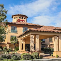
Hampton Inn & Suites Camarillo

Ventura City Hall (formerly the Ventura County Courthouse - California Historical Landmark #847)
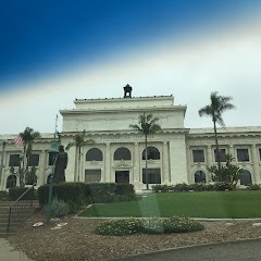
San Buenaventura City Hall
Transit and Meeting Points
Useful pickup, handoff, or rendezvous points close to Ventura.
Ventura
Oxnard Transportation Center
Santa Paula, California
Carpinteria station
Flight Path Map
This map shows the direct air route between Vandenberg Village and Long Beach. Straight-line distance: 145.49 mi (234.14 km).

#1 Vandenberg Village
Census-designated place in Santa Barbara County, California
| Population | 6,497 |
| Coordinates | 34.7083200, -120.4676600 |
| Altitude | 113 |
| Country | United States |

#2 Long Beach
The second most populous city in California, Long Beach is a major center for business, manufacturing, and tourism.
| Population | 454,681 |
| Coordinates | 33.7669600, -118.1892300 |
| Altitude | 9 |
| Country | United States |
End: E Ocean Boulevard (-118.189233, 33.766923)
Estimated Travel Time
Distance: 287 km by road
| Speed | Time |
|---|---|
| 30 mph (48.3 km/h) | 05h 56m |
| 40 mph (64.37 km/h) | 04h 27m |
| 50 mph (80.47 km/h) | 03h 33m |
| 60 mph (96.56 km/h) | 02h 58m |
| 70 mph (112.65 km/h) | 02h 32m |
| 80 mph (129 km/h) | 02h 13m |
Fuel, Round Trip and CO2
Estimated fuel cost and emissions for this route.
| Fuel | $/gal | One way | Round trip |
|---|---|---|---|
| Regular gas | $5.77 | $36.29 | $72.57 |
| Mid-grade | $6.07 | $38.16 | $76.31 |
| Premium | $6.24 | $39.27 | $78.54 |
| Diesel | $7.57 | $47.60 | $95.19 |
Assumes 8.3 L/100 km (about 28.3 MPG). CO2 is an estimate and varies by vehicle, fuel blend, traffic, and terrain.
Prices in California · Jun 27, 2026
Distance to Other Cities
Planning a road trip? See the full trip guide on Trip.ovh — stops, fuel costs, weather, and departure timing.