How far is Upland, PA from Bristol, PA?
The driving distance from Upland, PA to Bristol, PA is about 63.5 miles (102.2 km), with a travel time of about 01h 19m by car.
- The straight-line flight distance is about 51 miles (82.1 km).
- For a round trip, plan for roughly 02h 39m of driving time before adding stops, traffic, or weather delays.
- A comfortable departure window is usually 8:00 AM to 10:00 AM EDT.
Reverse, save, or send this route
This route works well as a day trip with time at the destination. Copy the route link, send it to another device, or print a clean version before you head out.
This route works well as a day trip with time at the destination.
Flight Distance
Driving Distance
Gas Cost Calculator
Leave and Arrive Planner
Pick a departure time to see your estimated arrival and same-day return window.
Drive time stays fixed at 01h 19m.
A morning start gives you useful time at the destination and keeps the return out of the late evening.
You are leaving earlier than the recommended window, which gives you extra margin for breaks and traffic.
Halfway Point
A useful midpoint for breaks, coffee, or meeting in the middle.
Census-designated place in Montgomery County, Pennsylvania, United States
Route Weather Snapshot
Check the forecast at both ends before you head out.
Driving Route Map
The map below follows the saved road route between Upland and Bristol.
Turn-by-Turn Driving Directions
Step-by-step road directions between Upland and Bristol.
-
1
Start on Clonmell Upland Road
2 mi · 3 min · Clonmell Upland Road
-
2
Turn right onto West Doe Run Road
1663 ft · 54 sec · West Doe Run Road
-
3
Turn left onto Unionville Wawaset Road
4.6 mi · 9 min · Unionville Wawaset Road
-
4
Continue on Bridge Road
1.5 km · 2 min · Bridge Road
-
5
Turn left onto South Creek Road
1.3 mi · 2 min · South Creek Road
-
6
Keep slight right to continue on West Miner Street
1.8 mi · 4 min · West Miner Street
-
7
Turn left onto South Brandywine Street
138 m · 13 sec · South Brandywine Street
-
8
Turn right onto West Market Street
1.3 mi · 3 min · West Market Street
-
9
Turn straight onto Paoli Pike
698 ft · 24 sec
-
10
Turn straight onto Paoli Pike
2981 ft · 1 min · Paoli Pike
-
11
Take the ramp left toward US 202 North, US 322 West
1015 ft · 25 sec
-
12
Merge slight left onto West Chester Bypass
15.6 mi · 21 min · West Chester Bypass
-
13
Take the exit slight right toward I 76 West: New Jersey, Harrisburg
1814 ft · 41 sec
-
14
Keep slight left to continue on Mall Boulevard
1331 ft · 21 sec
-
15
Keep slight left to continue on I 76 West: New Jersey, Harrisburg
533 ft · 8 sec
-
16
Merge slight left onto Schuylkill Expressway
2317 ft · 53 sec · Schuylkill Expressway
-
17
Keep slight right to continue on I 276 East: Allentown, New York City
1255 ft · 43 sec
-
18
Merge slight left onto Pennsylvania Turnpike
30.7 mi · 35 min · Pennsylvania Turnpike
-
19
Take the exit slight right toward US 13: Levittown, Bristol
1.5 km · 2 min
-
20
Continue on Pennsylvania Turnpike
110 m · 9 sec · Pennsylvania Turnpike
-
21
Keep slight right to continue on US 13 South: Bristol
109 m · 9 sec
-
22
Merge slight left onto Bristol Pike
3039 ft · 1 min · Bristol Pike
-
23
Turn slight left onto Beaver Street
920 ft · 37 sec · Beaver Street
-
24
Turn left onto Jefferson Avenue
2752 ft · 1 min · Jefferson Avenue
-
25
Turn right onto Pond Street
901 ft · 34 sec · Pond Street
-
26
Turn left
28 m · 12 sec
-
27
Arrive at your destination
0 m · 1 sec
Car Route Details
A richer read on the saved driving route between Upland and Bristol.
Turn-heavy local drive
The route has frequent decision points for its length, so lane choice and turn timing will matter more than cruising speed.
Pennsylvania Turnpike
Merge slight left onto Pennsylvania Turnpike
30.7 mi · 00h 35m
Route Summary
A quick read on whether this route feels easy, ambitious, or worth planning around.
A comfortable day-trip route
This route works well as a day trip. You can leave in the morning, spend meaningful time at the destination, and still return the same day.
Smoke leaving Upland and Smoke near Bristol.
Trip Questions
Direct answers travelers usually want before committing to the drive.
How long does it take to drive from Upland to Bristol?
The road trip is about 63.5 miles (102.2 km) and usually takes 01h 19m in normal driving conditions.
Is this a same-day trip or an overnight route?
This route works well as a day trip. You can leave in the morning, spend meaningful time at the destination, and still return the same day.
What is the halfway point on this route?
King of Prussia is a useful midpoint, sitting about 31.8 miles from Upland and 31.8 miles from Bristol.
How much longer is the road route than the straight-line distance?
The direct path is about 51 miles (82.1 km), while the road route adds roughly 12.5 extra miles because roads do not follow the straight air line.
When is the best time to leave for this route?
A good departure window is usually 8:00 AM to 10:00 AM EDT. If you want a more comfortable same-day return, try to leave by 3:50 PM EDT.
How much will gas cost for this route?
Using about 28.3 MPG, regular gas is estimated at $9.15 one way or $18.31 round trip. Estimated CO2 is about 19.9 kg one way.
What should you check before leaving?
Before you leave, expect Smoke around Upland and Smoke near Bristol.
Stop Ideas Near King of Prussia
Useful break, food, and waypoint ideas within about 15 miles of the route midpoint.

Bluestone Lane City Hall Coffee Shop

Dilworth Park
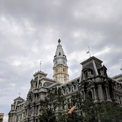
Philadelphia Marriage License

City Hall
Transit and Meeting Points
Useful pickup, handoff, or rendezvous points close to King of Prussia.
Paoli
Ardmore
Exton
North Philadelphia station
Flight Path Map
This map shows the direct air route between Upland and Bristol. Straight-line distance: 51.03 mi (82.12 km).

#1 Upland
Borough in Delaware County, Pennsylvania
| Population | 3,347 |
| Coordinates | 39.8865000, -75.7743900 |
| Altitude | 162 |
| Country | United States |

#2 Bristol
The most populous city in Bucks County, Pennsylvania.
| Population | 53,311 |
| Coordinates | 40.1006700, -74.8518300 |
| Altitude | 6 |
| Country | United States |
End: (-74.85185, 40.100681)
Estimated Travel Time
Distance: 102 km by road
| Speed | Time |
|---|---|
| 30 mph (48.3 km/h) | 02h 06m |
| 40 mph (64.37 km/h) | 01h 35m |
| 50 mph (80.47 km/h) | 01h 16m |
| 60 mph (96.56 km/h) | 01h 03m |
| 70 mph (112.65 km/h) | 00h 54m |
| 80 mph (129 km/h) | 00h 47m |
Fuel, Round Trip and CO2
Estimated fuel cost and emissions for this route.
| Fuel | $/gal | One way | Round trip |
|---|---|---|---|
| Regular gas | $4.09 | $9.15 | $18.31 |
| Mid-grade | $4.60 | $10.30 | $20.60 |
| Premium | $4.95 | $11.10 | $22.19 |
| Diesel | $5.98 | $13.40 | $26.79 |
Assumes 8.3 L/100 km (about 28.3 MPG). CO2 is an estimate and varies by vehicle, fuel blend, traffic, and terrain.
Prices in Pennsylvania · Jul 17, 2026
Distance to Other Cities
Planning a road trip? See the full trip guide on Trip.ovh — stops, fuel costs, weather, and departure timing.