How far is Teays Valley, WV from Charleston, WV?
Fastest route
The route from Teays Valley, West Virginia, USA to Charleston, West Virginia, USA is approximately 20.1 miles and takes about 23 minutes via I-64 E.
Directions
- Head southeast on Teays Valley Road toward Carls Ln.
- Pass by Dairy Queen Grill & Chill (on the left in 1 mi).
- Turn left onto US-35 N.
- Use the right lane to merge onto I-64 E via the ramp to Charleston.
- Take exit 58C for US-60 toward Lee St.
- Turn right onto US-60 E/Lee St W.
- Turn right onto Dickinson St.
Tips & Suggestions
- 🚗 Make sure to follow the signs for I-64 E.
- ⚠️ Stay in the right lane when merging onto I-64 E.
- 📋 Take note of exit 58C for US-60 toward Lee St.
- 📍 Use GPS or a navigation app for real-time traffic updates.
- ⏰ Allow for additional travel time if there are traffic conditions.
- 🚦 Observe traffic signals and road signs for a safe journey.
- 📱 Keep your phone charged for emergency purposes and for using navigation apps.
Reverse, save, or send this route
This is an easy same-day return drive. Copy the route link, send it to another device, or print a clean version before you head out.
This is an easy same-day return drive.
Flight Distance
Driving Distance
Gas Cost Calculator
Leave and Arrive Planner
Pick a departure time to see your estimated arrival and same-day return window.
Drive time stays fixed at 00h 23m.
This is a short drive, so your comfort window is wide. Traffic and current weather matter more than the clock.
This departure sits inside the recommended comfort window for the route.
Halfway Point
A useful midpoint for breaks, coffee, or meeting in the middle.
Census-designated place in Kanawha County, West Virginia
Route Weather Snapshot
Check the forecast at both ends before you head out.
Mostly Sunny
Mostly Clear
Driving Route Map
The map below follows the saved road route between Teays Valley and Charleston.
Turn-by-Turn Driving Directions
Step-by-step road directions between Teays Valley and Charleston.
-
1
Start on County Route 33
1.5 mi · 2 min · County Route 33
-
2
Turn slight left
119 m · 7 sec
-
3
Take the ramp slight right
2603 ft · 1 min
-
4
Merge slight left
17.1 mi · 19 min
-
5
Take the exit slight right toward US 60: Civic Center
1175 ft · 32 sec
-
6
Turn right onto Lee St Bridge
158 m · 9 sec · Lee St Bridge
-
7
Continue on Lee Street East
1.1 km · 1 min · Lee Street East
-
8
Turn right onto Dickinson Street
11 m · 1 sec · Dickinson Street
-
9
Arrive at your destination
0 m · 1 sec · Dickinson Street
Car Route Details
A richer read on the saved driving route between Teays Valley and Charleston.
Turn-heavy local drive
The route has frequent decision points for its length, so lane choice and turn timing will matter more than cruising speed.
County Route 33
Merge slight left
17.1 mi · 00h 19m
Route Summary
A quick read on whether this route feels easy, ambitious, or worth planning around.
A short regional drive
This route is short enough to handle as a quick errand, commute, or easy same-day return without much planning overhead.
Mostly Sunny leaving Teays Valley and Mostly Clear near Charleston.
Trip Questions
Direct answers travelers usually want before committing to the drive.
How long does it take to drive from Teays Valley to Charleston?
The road trip is about 21 miles (33.8 km) and usually takes 00h 23m in normal driving conditions.
Is this a same-day trip or an overnight route?
This route is short enough to handle as a quick errand, commute, or easy same-day return without much planning overhead.
What is the halfway point on this route?
Cross Lanes is a useful midpoint, sitting about 10.1 miles from Teays Valley and 10.9 miles from Charleston.
How much longer is the road route than the straight-line distance?
The direct path is about 17.5 miles (28.2 km), while the road route adds roughly 3.5 extra miles because roads do not follow the straight air line.
When is the best time to leave for this route?
A good departure window is usually 7:00 AM to 7:00 PM EDT. If you want a more comfortable same-day return, try to leave by 7:44 PM EDT.
How much will gas cost for this route?
Using about 28.3 MPG, regular gas is estimated at $2.93 one way or $5.86 round trip. Estimated CO2 is about 6.6 kg one way.
What should you check before leaving?
Before you leave, expect Mostly Sunny around Teays Valley and Mostly Clear near Charleston.
Stop Ideas Near Cross Lanes
Useful break, food, and waypoint ideas within about 15 miles of the route midpoint.

City Park

Kanawha County Magistrate Court
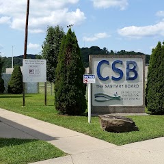
Charleston Sanitary Board
Parks and Recreation
Transit and Meeting Points
Useful pickup, handoff, or rendezvous points close to Cross Lanes.
Charleston
Montgomery
Huntington
Ashland Transportation Center
Flight Path Map
This map shows the direct air route between Teays Valley and Charleston. Straight-line distance: 17.5 mi (28.16 km).
#1 Teays Valley
Census designated place
| Population | 13,175 |
| Coordinates | 38.4500900, -81.9293000 |
| Altitude | 203 |
| Country | United States |

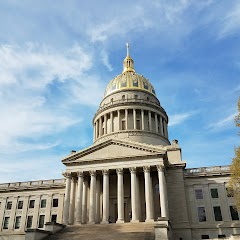
#2 Charleston
The capital of West Virginia.
| Population | 45,879 |
| Coordinates | 38.3498200, -81.6326200 |
| Altitude | 182 |
| Country | United States |
End: Dickinson Street (-81.632578, 38.349779)
Estimated Travel Time
Distance: 34 km by road
| Speed | Time |
|---|---|
| 30 mph (48.3 km/h) | 00h 41m |
| 40 mph (64.37 km/h) | 00h 31m |
| 50 mph (80.47 km/h) | 00h 25m |
| 60 mph (96.56 km/h) | 00h 20m |
| 70 mph (112.65 km/h) | 00h 17m |
| 80 mph (129 km/h) | 00h 15m |
Fuel, Round Trip and CO2
Estimated fuel cost and emissions for this route.
| Fuel | $/gal | One way | Round trip |
|---|---|---|---|
| Regular gas | $3.96 | $2.93 | $5.86 |
| Mid-grade | $4.43 | $3.28 | $6.55 |
| Premium | $4.78 | $3.54 | $7.07 |
| Diesel | $5.62 | $4.16 | $8.32 |
Assumes 8.3 L/100 km (about 28.3 MPG). CO2 is an estimate and varies by vehicle, fuel blend, traffic, and terrain.
Prices in West Virginia · Jun 16, 2026
Distance to Other Cities
Planning a road trip? See the full trip guide on Trip.ovh — stops, fuel costs, weather, and departure timing.