How far is Stockton, CA from Placerville, CA?
The driving distance from Stockton, CA to Placerville, CA is about 78.2 miles (125.8 km), with a travel time of about 01h 39m by car.
- The straight-line flight distance is about 59.7 miles (96 km).
- For a round trip, plan for roughly 03h 18m of driving time before adding stops, traffic, or weather delays.
- A comfortable departure window is usually 8:00 AM to 10:00 AM PDT.
Reverse, save, or send this route
This route works well as a day trip with time at the destination. Copy the route link, send it to another device, or print a clean version before you head out.
This route works well as a day trip with time at the destination.
Flight Distance
Driving Distance
Gas Cost Calculator
Leave and Arrive Planner
Pick a departure time to see your estimated arrival and same-day return window.
Drive time stays fixed at 01h 39m.
A morning start gives you useful time at the destination and keeps the return out of the late evening.
This departure sits inside the recommended comfort window for the route.
Halfway Point
A useful midpoint for breaks, coffee, or meeting in the middle.
A census-designated place in Sacramento County, California.
Route Weather Snapshot
Check the forecast at both ends before you head out.
Clear
Driving Route Map
The map below follows the saved road route between Stockton and Placerville.
Turn-by-Turn Driving Directions
Step-by-step road directions between Stockton and Placerville.
-
1
Start on East Fremont Street
36 m · 8 sec · East Fremont Street
-
2
Turn right onto North El Dorado Street
1.1 km · 1 min · North El Dorado Street
-
3
Turn right onto East Harding Way
1 mi · 3 min · East Harding Way
-
4
Turn left onto North Wilson Way
2.5 mi · 4 min · North Wilson Way
-
5
Take the ramp straight
816 ft · 20 sec
-
6
Merge slight right
26.6 mi · 31 min
-
7
Take the exit slight right toward Grant Line Road
1770 ft · 45 sec
-
8
Turn right onto Grant Line Road
2.2 mi · 3 min · Grant Line Road
-
9
Turn left onto Bradshaw Road
2.6 mi · 4 min · Bradshaw Road
-
10
Enter the roundabout and take exit 2 toward Bradshaw Road
28 m · 2 sec · Bradshaw Road
-
11
Exit the roundabout onto Bradshaw Road
8.7 mi · 12 min · Bradshaw Road
-
12
Take the ramp straight toward US 50 East: South Lake Tahoe
1851 ft · 45 sec
-
13
Merge slight left onto El Dorado Freeway
32.9 mi · 38 min · El Dorado Freeway
-
14
Turn right onto Bedford Avenue
79 m · 15 sec · Bedford Avenue
-
15
Turn left onto Main Street
56 m · 6 sec · Main Street
-
16
Arrive at your destination
0 m · 1 sec · Main Street
Car Route Details
A richer read on the saved driving route between Stockton and Placerville.
Interchange-aware route
The drive includes several ramps, exits, or merges, so checking the next few maneuvers before busy interchanges is useful.
El Dorado Freeway
Merge slight left onto El Dorado Freeway
32.9 mi · 00h 38m
Route Summary
A quick read on whether this route feels easy, ambitious, or worth planning around.
A comfortable day-trip route
This route works well as a day trip. You can leave in the morning, spend meaningful time at the destination, and still return the same day.
Clear leaving Stockton and Clear near Placerville.
Trip Questions
Direct answers travelers usually want before committing to the drive.
How long does it take to drive from Stockton to Placerville?
The road trip is about 78.2 miles (125.8 km) and usually takes 01h 39m in normal driving conditions.
Is this a same-day trip or an overnight route?
This route works well as a day trip. You can leave in the morning, spend meaningful time at the destination, and still return the same day.
What is the halfway point on this route?
Florin is a useful midpoint, sitting about 39.1 miles from Stockton and 39.1 miles from Placerville.
How much longer is the road route than the straight-line distance?
The direct path is about 59.7 miles (96 km), while the road route adds roughly 18.5 extra miles because roads do not follow the straight air line.
When is the best time to leave for this route?
A good departure window is usually 8:00 AM to 10:00 AM PDT. If you want a more comfortable same-day return, try to leave by 3:12 PM PDT.
How much will gas cost for this route?
Using about 28.3 MPG, regular gas is estimated at $15.92 one way or $31.84 round trip. Estimated CO2 is about 24.5 kg one way.
What should you check before leaving?
Before you leave, expect Clear around Stockton and Clear near Placerville.
Stop Ideas Near Florin
Useful break, food, and waypoint ideas within about 15 miles of the route midpoint.
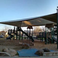
North Point Park
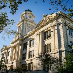
Sacramento City Hall
City of Refuge Sacramento

City of Sacramento
Transit and Meeting Points
Useful pickup, handoff, or rendezvous points close to Florin.
Elk Grove, California
Sacramento (State Capitol), California
Sacramento Valley Station
Davis station
Flight Path Map
This map shows the direct air route between Stockton and Placerville. Straight-line distance: 59.63 mi (95.97 km).

#1 Stockton
The fifth most populous city in California and the center of the Stockton metropolitan area.
| Population | 312,716 |
| Coordinates | 37.9577000, -121.2907800 |
| Altitude | 4 |
| Country | United States |

#2 Placerville
City in California
| Population | 11,077 |
| Coordinates | 38.7296300, -120.7985500 |
| Altitude | 569 |
| Country | United States |
End: Placerville (-120.79855, 38.72963)
Estimated Travel Time
Distance: 126 km by road
| Speed | Time |
|---|---|
| 30 mph (48.3 km/h) | 02h 36m |
| 40 mph (64.37 km/h) | 01h 57m |
| 50 mph (80.47 km/h) | 01h 33m |
| 60 mph (96.56 km/h) | 01h 18m |
| 70 mph (112.65 km/h) | 01h 07m |
| 80 mph (129 km/h) | 00h 58m |
Fuel, Round Trip and CO2
Estimated fuel cost and emissions for this route.
| Fuel | $/gal | One way | Round trip |
|---|---|---|---|
| Regular gas | $5.77 | $15.92 | $31.84 |
| Mid-grade | $6.07 | $16.74 | $33.48 |
| Premium | $6.24 | $17.23 | $34.46 |
| Diesel | $7.57 | $20.88 | $41.77 |
Assumes 8.3 L/100 km (about 28.3 MPG). CO2 is an estimate and varies by vehicle, fuel blend, traffic, and terrain.
Prices in California · Jun 10, 2026
Distance to Other Cities
Planning a road trip? See the full trip guide on Trip.ovh — stops, fuel costs, weather, and departure timing.