How far is St. Charles, IL from Belleville, IL?
Fastest route
The distance from St. Charles, Illinois, to Belleville, Illinois, is approximately 298 miles (480 kilometers). The fastest route with traffic conditions is via I-55 S, and it includes tolls. The estimated travel time is 4 hours and 43 minutes.
Directions
- Head north on S 5th Ave toward E Main St.
- Turn right at the 1st cross street onto E Main St.
- Turn right onto S Tyler Rd.
- Turn right onto S Kirk Rd.
- Continue onto N Farnsworth Ave.
- Use the right lane to merge onto I-88 E via the ramp to Chicago (Toll road).
- Follow I-55 S to IL-159 S/Vandalia St in Collinsville Township. Take exit 15A from I-55 S (Toll road).
- Take exit 131 for I-355 S toward Joliet (Toll road).
- Keep left and merge onto I-355 S (Toll road).
- Keep left at the fork to stay on I-355 S (Toll road).
- Use the 2nd from the right lane to take exit 12A for I-55 S/Joliet Road toward St. Louis.
- Keep left at the fork, follow signs for South Joliet Road.
- Keep left, follow signs for I-55 S/St. Louis, and merge onto I-55 S.
- Keep right at the fork to stay on I-55 S, following signs for St. Louis/Springfield.
- Keep left at the fork to stay on I-55 S, following signs for St. Louis.
- Take exit 15A to merge onto IL-159 S/Vandalia St toward Collinsville.
- Continue on IL-159 S until you reach E F St in Belleville.
Tips & Suggestions
- 🚗 Plan for Gas: Ensure your vehicle has enough fuel for the journey, as it's a long drive.
- 🚫 Avoid Rush Hour: Try to plan your trip to avoid peak traffic hours to save time.
- 🛣️ Alternate Routes: Check for alternate routes in case of unexpected road closures or delays.
- 🍔 Rest Stops: Take regular breaks during the journey to rest, stretch, and grab a meal.
- 📱 GPS or Maps: Use GPS navigation or maps to stay on track and avoid getting lost.
- 💵 Prepare for Tolls: Have some cash or electronic payment ready for toll booths along the route.
- 🚦 Check Traffic Updates: Stay informed about traffic conditions to adjust your travel plans accordingly.
Reverse, save, or send this route
This drive is better planned with a longer stop or an overnight stay. Copy the route link, send it to another device, or print a clean version before you head out.
This drive is better planned with a longer stop or an overnight stay.
Flight Distance
Driving Distance
Gas Cost Calculator
Leave and Arrive Planner
Pick a departure time to see your estimated arrival and same-day return window.
Drive time stays fixed at 04h 59m.
An early departure helps you fit a real stop into the day without turning the return into a late-night drive.
You are leaving earlier than the recommended window, which gives you extra margin for breaks and traffic.
Halfway Point
A useful midpoint for breaks, coffee, or meeting in the middle.
City in Logan County, Illinois, United States
Route Weather Snapshot
Check the forecast at both ends before you head out.
Sunny
Sunny
Driving Route Map
The map below follows the saved road route between St. Charles and Belleville.
Turn-by-Turn Driving Directions
Step-by-step road directions between St. Charles and Belleville.
-
1
Start on South 5th Avenue
2350 ft · 56 sec · South 5th Avenue
-
2
Turn sharp right onto South Riverside Avenue
701 ft · 22 sec · South Riverside Avenue
-
3
Turn left onto Prairie Street
1.7 mi · 4 min · Prairie Street
-
4
Turn left onto South Randall Road
676 ft · 22 sec · South Randall Road
-
5
Continue on Randall Road
2.6 mi · 5 min · Randall Road
-
6
Continue on North Randall Road
3.3 mi · 5 min · North Randall Road
-
7
Turn right onto Orchard Road
11.2 mi · 19 min · Orchard Road
-
8
Continue on Minkler Road
1.5 km · 2 min · Minkler Road
-
9
Enter the roundabout and take exit 1 toward Minkler Road
39 m · 4 sec · Minkler Road
-
10
Exit the roundabout onto Minkler Road
3.4 mi · 5 min · Minkler Road
-
11
At the end of the road, turn right onto East Schoolhouse Road
2391 ft · 47 sec · East Schoolhouse Road
-
12
Turn left onto Ashley Road
3.8 mi · 5 min · Ashley Road
-
13
Turn right onto Caton Farm Road
1.5 mi · 2 min · Caton Farm Road
-
14
Turn left
7.2 mi · 10 min
-
15
Continue on North Bridge Street
1.3 mi · 2 min · North Bridge Street
-
16
Continue straight
22.1 mi · 26 min
-
17
Take the exit right toward I 55 South: Bloomington
1864 ft · 46 sec
-
18
Merge slight left
62.4 mi · 1 hr 7 min
-
19
Keep slight right to continue on I 55 South: Saint Louis, Springfield
64.8 mi · 1 hr 10 min
-
20
Keep slight left to continue on I 55 South: Saint Louis
77.9 mi · 1 hr 24 min
-
21
Take the exit slight right toward IL 159 South: Collinsville
1434 ft · 48 sec
-
22
Continue on Vandalia Street
3 mi · 5 min · Vandalia Street
-
23
Continue on South Morrison Avenue
1.3 mi · 2 min · South Morrison Avenue
-
24
Continue on North Illinois Street
9.3 mi · 15 min · North Illinois Street
-
25
Turn left onto East F Street
18 m · 3 sec · East F Street
-
26
Arrive at your destination
0 m · 1 sec · East F Street
Car Route Details
A richer read on the saved driving route between St. Charles and Belleville.
Highway-focused drive
Most of the mileage stays on named highways, so the important moments are ramps, exits, merges, and the final local approach.
I 55 South
Keep slight left to continue on I 55 South: Saint Louis
77.9 mi · 01h 24m
Route Summary
A quick read on whether this route feels easy, ambitious, or worth planning around.
A longer out-and-back drive
This is still possible in one day, but it becomes a long driving day. Leaving early and planning your stop window matters more here.
Sunny leaving St. Charles and Sunny near Belleville.
Trip Questions
Direct answers travelers usually want before committing to the drive.
How long does it take to drive from St. Charles to Belleville?
The road trip is about 297.6 miles (478.9 km) and usually takes 04h 59m in normal driving conditions.
Is this a same-day trip or an overnight route?
This is still possible in one day, but it becomes a long driving day. Leaving early and planning your stop window matters more here.
What is the halfway point on this route?
Atlanta is a useful midpoint, sitting about 139.7 miles from St. Charles and 157.8 miles from Belleville.
How much longer is the road route than the straight-line distance?
The direct path is about 250.6 miles (403.3 km), while the road route adds roughly 47 extra miles because roads do not follow the straight air line.
When is the best time to leave for this route?
A good departure window is usually 6:00 AM to 8:00 AM CDT. If you want a more comfortable same-day return, try to leave by 7:00 AM CDT.
How much will gas cost for this route?
Using about 28.3 MPG, regular gas is estimated at $39.60 one way or $79.19 round trip. Estimated CO2 is about 93.3 kg one way.
What should you check before leaving?
Before you leave, expect Sunny around St. Charles and Sunny near Belleville.
Stop Ideas Near Atlanta
Useful break, food, and waypoint ideas within about 15 miles of the route midpoint.

Route 66 Original Alignment- Driveable!
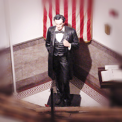
City of Lincoln
Transit and Meeting Points
Useful pickup, handoff, or rendezvous points close to Atlanta.
Lincoln
Uptown Station
Peoria, Illinois
Springfield station
Flight Path Map
This map shows the direct air route between St. Charles and Belleville. Straight-line distance: 250.6 mi (403.3 km).

#1 St. Charles
Chicago suburb in Kane and DuPage counties of Illinois, United States
| Population | 32,974 |
| Coordinates | 41.9141900, -88.3086900 |
| Altitude | 223 |
| Country | United States |

#2 Belleville
The county seat of St.
| Population | 40,536 |
| Coordinates | 38.5200500, -89.9839900 |
| Altitude | 157 |
| Country | United States |
End: East F Street (-89.983993, 38.519971)
Estimated Travel Time
Distance: 479 km by road
| Speed | Time |
|---|---|
| 30 mph (48.3 km/h) | 09h 54m |
| 40 mph (64.37 km/h) | 07h 26m |
| 50 mph (80.47 km/h) | 05h 57m |
| 60 mph (96.56 km/h) | 04h 57m |
| 70 mph (112.65 km/h) | 04h 15m |
| 80 mph (129 km/h) | 03h 42m |
Fuel, Round Trip and CO2
Estimated fuel cost and emissions for this route.
| Fuel | $/gal | One way | Round trip |
|---|---|---|---|
| Regular gas | $3.77 | $39.60 | $79.19 |
| Mid-grade | $4.25 | $44.66 | $89.31 |
| Premium | $4.65 | $48.87 | $97.73 |
| Diesel | $5.30 | $55.69 | $111.38 |
Assumes 8.3 L/100 km (about 28.3 MPG). CO2 is an estimate and varies by vehicle, fuel blend, traffic, and terrain.
Prices in Illinois · Jul 29, 2026
Distance to Other Cities
Planning a road trip? See the full trip guide on Trip.ovh — stops, fuel costs, weather, and departure timing.