How far is Savannah, GA from Willacoochee, GA?
The driving distance from Savannah, GA to Willacoochee, GA is about 166.2 miles (267.5 km), with a travel time of about 03h 25m by car.
- The straight-line flight distance is about 125.4 miles (201.8 km).
- For a round trip, plan for roughly 06h 50m of driving time before adding stops, traffic, or weather delays.
- A comfortable departure window is usually 6:00 AM to 8:00 AM EDT.
Reverse, save, or send this route
This drive is better planned with a longer stop or an overnight stay. Copy the route link, send it to another device, or print a clean version before you head out.
This drive is better planned with a longer stop or an overnight stay.
Flight Distance
Driving Distance
Gas Cost Calculator
Leave and Arrive Planner
Pick a departure time to see your estimated arrival and same-day return window.
Drive time stays fixed at 03h 25m.
An early departure helps you fit a real stop into the day without turning the return into a late-night drive.
You are leaving earlier than the recommended window, which gives you extra margin for breaks and traffic.
Halfway Point
A useful midpoint for breaks, coffee, or meeting in the middle.
Census-designated place in Glynn County, Georgia
Route Weather Snapshot
Check the forecast at both ends before you head out.
Mostly Sunny
Mostly Sunny
Driving Route Map
The map below follows the saved road route between Savannah and Willacoochee.
Turn-by-Turn Driving Directions
Step-by-step road directions between Savannah and Willacoochee.
-
1
Start on the route
44 m · 13 sec
-
2
Turn right onto North Fahm Street
22 m · 7 sec · North Fahm Street
-
3
Turn right onto West Bay Street
1.8 mi · 3 min · West Bay Street
-
4
Turn left onto Collins Street
110 m · 7 sec · Collins Street
-
5
Continue on Augusta Avenue
139 m · 9 sec · Augusta Avenue
-
6
Take the ramp right toward GA 21 South
995 ft · 24 sec
-
7
Merge slight left onto William F. Lynes Parkway
1.4 km · 1 min · William F. Lynes Parkway
-
8
Take the exit slight right toward I 16, US 17 North: Macon, Savannah
1032 ft · 20 sec
-
9
Keep slight right to continue on I 16 West: Macon
1104 ft · 21 sec
-
10
Merge slight left onto Jim Gillis Historic Savannah Parkway
5.9 mi · 7 min · Jim Gillis Historic Savannah Parkway
-
11
Take the exit slight right toward I 95 North: Airport, Florence SC
121 m · 5 sec
-
12
Keep slight left
1.6 km · 2 min
-
13
Merge slight left
55.6 mi · 1 hr
-
14
Take the exit slight right toward GA 99
2204 ft · 54 sec
-
15
Keep slight left to continue on GA 99: GA 99
65 m · 5 sec
-
16
Enter the roundabout and take exit 1 toward the route
6 m · 1 sec
-
17
Exit the roundabout
2.4 mi · 3 min
-
18
Enter the roundabout and take exit 2 toward Grants Ferry Road
29 m · 1 sec · Grants Ferry Road
-
19
Exit the roundabout onto Grants Ferry Road
6.2 mi · 9 min · Grants Ferry Road
-
20
Turn slight left
6.9 mi · 9 min
-
21
Turn right
11.4 mi · 15 min
-
22
Continue straight
4.8 mi · 6 min
-
23
Continue straight
4.6 mi · 7 min
-
24
Continue straight
19 mi · 25 min
-
25
Turn right onto Memorial Drive
1.2 mi · 2 min · Memorial Drive
-
26
Continue on Carswell Avenue
3.7 mi · 7 min · Carswell Avenue
-
27
Turn right onto South Georgia Parkway
5.6 mi · 7 min · South Georgia Parkway
-
28
Continue on Albany Highway
6.6 mi · 8 min · Albany Highway
-
29
Continue straight
3.4 mi · 4 min
-
30
Continue straight
5.1 mi · 6 min
-
31
Continue straight
4.6 mi · 5 min
-
32
Continue straight
4.5 mi · 6 min
-
33
Continue straight
9.9 mi · 12 min
-
34
Arrive at your destination
0 m · 1 sec · Main Street
Car Route Details
A richer read on the saved driving route between Savannah and Willacoochee.
Highway-focused drive
Most of the mileage stays on named highways, so the important moments are ramps, exits, merges, and the final local approach.
I 95 North
Merge slight left
55.6 mi · 01h 00m
Route Summary
A quick read on whether this route feels easy, ambitious, or worth planning around.
A longer out-and-back drive
This is still possible in one day, but it becomes a long driving day. Leaving early and planning your stop window matters more here.
Mostly Sunny leaving Savannah and Mostly Sunny near Willacoochee.
Trip Questions
Direct answers travelers usually want before committing to the drive.
How long does it take to drive from Savannah to Willacoochee?
The road trip is about 166.2 miles (267.5 km) and usually takes 03h 25m in normal driving conditions.
Is this a same-day trip or an overnight route?
This is still possible in one day, but it becomes a long driving day. Leaving early and planning your stop window matters more here.
What is the halfway point on this route?
Dock Junction is a useful midpoint, sitting about 83.1 miles from Savannah and 83.1 miles from Willacoochee.
How much longer is the road route than the straight-line distance?
The direct path is about 125.4 miles (201.8 km), while the road route adds roughly 40.8 extra miles because roads do not follow the straight air line.
When is the best time to leave for this route?
A good departure window is usually 6:00 AM to 8:00 AM EDT. If you want a more comfortable same-day return, try to leave by 10:10 AM EDT.
How much will gas cost for this route?
Using about 28.3 MPG, regular gas is estimated at $23.21 one way or $46.42 round trip. Estimated CO2 is about 52.1 kg one way.
What should you check before leaving?
Before you leave, expect Mostly Sunny around Savannah and Mostly Sunny near Willacoochee.
Stop Ideas Near Dock Junction
Useful break, food, and waypoint ideas within about 15 miles of the route midpoint.

Historic Brunswick Courthouse
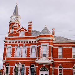
Brunswick Old City Hall

Brunswick Housing Authority
Transit and Meeting Points
Useful pickup, handoff, or rendezvous points close to Dock Junction.
Jesup
Jacksonville
Savannah
Flight Path Map
This map shows the direct air route between Savannah and Willacoochee. Straight-line distance: 125.37 mi (201.77 km).

#1 Savannah
The second most populous city in Georgia.
| Population | 143,632 |
| Coordinates | 32.0835400, -81.0998300 |
| Altitude | 6 |
| Country | United States |

#2 Willacoochee
City in Atkinson County, Georgia, United States of America
| Population | 1,389 |
| Coordinates | 31.3407600, -83.0459800 |
| Altitude | 74 |
| Country | United States |
End: Willacoochee (-83.04598, 31.34076)
Estimated Travel Time
Distance: 267 km by road
| Speed | Time |
|---|---|
| 30 mph (48.3 km/h) | 05h 32m |
| 40 mph (64.37 km/h) | 04h 09m |
| 50 mph (80.47 km/h) | 03h 19m |
| 60 mph (96.56 km/h) | 02h 46m |
| 70 mph (112.65 km/h) | 02h 22m |
| 80 mph (129 km/h) | 02h 04m |
Fuel, Round Trip and CO2
Estimated fuel cost and emissions for this route.
| Fuel | $/gal | One way | Round trip |
|---|---|---|---|
| Regular gas | $3.96 | $23.21 | $46.42 |
| Mid-grade | $4.43 | $25.95 | $51.91 |
| Premium | $4.78 | $28.00 | $56.00 |
| Diesel | $5.62 | $32.96 | $65.91 |
Assumes 8.3 L/100 km (about 28.3 MPG). CO2 is an estimate and varies by vehicle, fuel blend, traffic, and terrain.
Prices in Georgia · Jun 10, 2026
Distance to Other Cities
Planning a road trip? See the full trip guide on Trip.ovh — stops, fuel costs, weather, and departure timing.