How far is Sandown, NH from Dover, NH?
Fastest route
This route from Sandown, New Hampshire 03873, to Dover, New Hampshire covers a distance of approximately 29.0 miles (46.7 kilometers) and takes approximately 52 minutes to drive. The directions include major roads like NH-125 N and NH-155 N.
Directions
- 🚗 Head north on Fremont Rd toward Old Railroad Grde/Old Railroads Grounds.
- 🛣️ Continue on NH-111A E and take NH-125 N and NH-155 N to NH-4 in Dover.
- 🚦 Turn right onto Red Brook Rd.
- ➡️ Turn right onto NH-107 S/NH-111A E and pass by Wendy's.
- 🚙 Turn left to stay on NH-155 N.
- 🔄 Continue onto W Knox Marsh Rd, then take the 1st exit at the traffic circle onto Silver St.
- 🏠 Turn left onto Lexington St, right onto Washington St, and finally left onto Chestnut St. Turn right onto Central Ave.
Tips & Suggestions
- ⏱️ Allow some extra time for potential traffic delays, especially during peak hours.
- ⛽ Make sure your vehicle has enough fuel before starting the journey.
- 🗺️ Consider using a GPS or navigation app to stay on track and avoid getting lost.
- 🚓 Observe speed limits and traffic rules to ensure a safe trip.
- 🍽️ If you prefer, pack some snacks and drinks for the journey.
- 🚧 Be aware of road construction or detours that may affect the route.
- 🌳 Enjoy the scenic drive along NH-125 N and NH-155 N!
Reverse, save, or send this route
This route works well as a day trip with time at the destination. Copy the route link, send it to another device, or print a clean version before you head out.
This route works well as a day trip with time at the destination.
Flight Distance
Driving Distance
Gas Cost Calculator
Leave and Arrive Planner
Pick a departure time to see your estimated arrival and same-day return window.
Drive time stays fixed at 00h 50m.
A morning start gives you useful time at the destination and keeps the return out of the late evening.
You are leaving earlier than the recommended window, which gives you extra margin for breaks and traffic.
Halfway Point
A useful midpoint for breaks, coffee, or meeting in the middle.
Route Weather Snapshot
Check the forecast at both ends before you head out.
Mostly Sunny
Driving Route Map
The map below follows the saved road route between Sandown and Dover.
Turn-by-Turn Driving Directions
Step-by-step road directions between Sandown and Dover.
-
1
Start on Fremont Road
3.2 mi · 8 min · Fremont Road
-
2
Continue on Sandown Road
1.1 km · 2 min · Sandown Road
-
3
Turn right onto South Road
1.5 mi · 4 min · South Road
-
4
At the end of the road, turn left onto Danville Road
725 ft · 16 sec · Danville Road
-
5
Turn right onto Red Brook Road
1.1 km · 2 min · Red Brook Road
-
6
Turn right onto Main Street
1.4 km · 2 min · Main Street
-
7
Turn left onto Brentwood Road
1809 ft · 36 sec · Brentwood Road
-
8
Continue on Middle Road
1.5 km · 2 min · Middle Road
-
9
Turn left onto Officer Stephen Arkell Memorial Highway
3.1 mi · 4 min · Officer Stephen Arkell Memorial Highway
-
10
Continue on Calef Highway
10 mi · 16 min · Calef Highway
-
11
Enter the roundabout and take exit 1 toward Lee Circle
8 m · 1 sec · Concord Road
-
12
Exit the rotary onto Concord Road
1.3 mi · 2 min · Concord Road
-
13
Take the exit slight right toward NH 155: Lee, Madbury
1082 ft · 36 sec
-
14
Turn left onto Turtle Pond Road
1.2 mi · 2 min · Turtle Pond Road
-
15
Continue on Lee Road
1.3 mi · 2 min · Lee Road
-
16
Continue on Manchester Road
106 m · 8 sec · Manchester Road
-
17
Continue on Knox Marsh Road
3.2 mi · 5 min · Knox Marsh Road
-
18
Enter the roundabout and take exit 1 toward Silver Street
4 m · 1 sec · Silver Street
-
19
Exit the roundabout onto Silver Street
3199 ft · 1 min · Silver Street
-
20
Turn left onto Locust Street
1117 ft · 32 sec · Locust Street
-
21
Turn straight onto Chestnut Street
1956 ft · 60 sec · Chestnut Street
-
22
Turn right onto Third Street
715 ft · 28 sec · Third Street
-
23
Turn sharp right onto Central Avenue
65 m · 6 sec · Central Avenue
-
24
Turn left
35 m · 5 sec
-
25
Arrive at your destination
0 m · 1 sec
Car Route Details
A richer read on the saved driving route between Sandown and Dover.
Turn-heavy local drive
The route has frequent decision points for its length, so lane choice and turn timing will matter more than cruising speed.
Calef Highway
Continue on Calef Highway
10 mi · 00h 16m
Route Summary
A quick read on whether this route feels easy, ambitious, or worth planning around.
A comfortable day-trip route
This route works well as a day trip. You can leave in the morning, spend meaningful time at the destination, and still return the same day.
Mostly Sunny leaving Sandown and Mostly Sunny near Dover.
Trip Questions
Direct answers travelers usually want before committing to the drive.
How long does it take to drive from Sandown to Dover?
The road trip is about 29.6 miles (47.6 km) and usually takes 00h 50m in normal driving conditions.
Is this a same-day trip or an overnight route?
This route works well as a day trip. You can leave in the morning, spend meaningful time at the destination, and still return the same day.
What is the halfway point on this route?
Epping is a useful midpoint, sitting about 15 miles from Sandown and 14.5 miles from Dover.
How much longer is the road route than the straight-line distance?
The direct path is about 24.4 miles (39.3 km), while the road route adds roughly 5.2 extra miles because roads do not follow the straight air line.
When is the best time to leave for this route?
A good departure window is usually 8:00 AM to 10:00 AM EDT. If you want a more comfortable same-day return, try to leave by 4:50 PM EDT.
How much will gas cost for this route?
Using about 28.3 MPG, regular gas is estimated at $4.10 one way or $8.21 round trip. Estimated CO2 is about 9.2 kg one way.
What should you check before leaving?
Before you leave, expect Mostly Sunny around Sandown and Mostly Sunny near Dover.
Stop Ideas Near Epping
Useful break, food, and waypoint ideas within about 15 miles of the route midpoint.

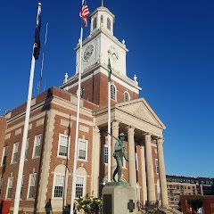
Old City Hall
Dover City Hall
Transit and Meeting Points
Useful pickup, handoff, or rendezvous points close to Epping.
Exeter station
Durham–UNH station
Portsmouth, New Hampshire
Dover Transportation Center
Flight Path Map
This map shows the direct air route between Sandown and Dover. Straight-line distance: 24.41 mi (39.29 km).

#1 Sandown
Town in New Hampshire
| Population | 6,551 |
| Coordinates | 42.9287000, -71.1870100 |
| Altitude | 69 |
| Country | United States |

#2 Dover
County seat city in Strafford County, New Hampshire, United States
| Population | 32,443 |
| Coordinates | 43.1978600, -70.8736700 |
| Altitude | 19 |
| Country | United States |
End: (-70.873668, 43.197876)
Estimated Travel Time
Distance: 48 km by road
| Speed | Time |
|---|---|
| 30 mph (48.3 km/h) | 00h 59m |
| 40 mph (64.37 km/h) | 00h 44m |
| 50 mph (80.47 km/h) | 00h 35m |
| 60 mph (96.56 km/h) | 00h 29m |
| 70 mph (112.65 km/h) | 00h 25m |
| 80 mph (129 km/h) | 00h 22m |
Fuel, Round Trip and CO2
Estimated fuel cost and emissions for this route.
| Fuel | $/gal | One way | Round trip |
|---|---|---|---|
| Regular gas | $3.95 | $4.10 | $8.21 |
| Mid-grade | $4.46 | $4.64 | $9.27 |
| Premium | $4.86 | $5.05 | $10.10 |
| Diesel | $6.00 | $6.24 | $12.47 |
Assumes 8.3 L/100 km (about 28.3 MPG). CO2 is an estimate and varies by vehicle, fuel blend, traffic, and terrain.
Prices in New Hampshire · Jul 26, 2026
Distance to Other Cities
Planning a road trip? See the full trip guide on Trip.ovh — stops, fuel costs, weather, and departure timing.