How far is San Diego, CA from Big River, CA?
The driving distance from San Diego, CA to Big River, CA is about 273.7 miles (440.4 km), with a travel time of about 05h 23m by car.
- The straight-line flight distance is about 189.3 miles (304.6 km).
- For a round trip, plan for roughly 10h 46m of driving time before adding stops, traffic, or weather delays.
- A comfortable departure window is usually 6:00 AM to 8:00 AM PDT.
Reverse, save, or send this route
This drive is better planned with a longer stop or an overnight stay. Copy the route link, send it to another device, or print a clean version before you head out.
This drive is better planned with a longer stop or an overnight stay.
Flight Distance
Driving Distance
Gas Cost Calculator
Leave and Arrive Planner
Pick a departure time to see your estimated arrival and same-day return window.
Drive time stays fixed at 05h 23m.
An early departure helps you fit a real stop into the day without turning the return into a late-night drive.
You are leaving earlier than the recommended window, which gives you extra margin for breaks and traffic.
Halfway Point
A useful midpoint for breaks, coffee, or meeting in the middle.
Place in Riverside County, California, United States
Route Weather Snapshot
Check the forecast at both ends before you head out.
Mostly Cloudy
Mostly Cloudy
Driving Route Map
The map below follows the saved road route between San Diego and Big River.
Turn-by-Turn Driving Directions
Step-by-step road directions between San Diego and Big River.
-
1
Start on Front Street
8 m · 6 sec · Front Street
-
2
Turn left onto West Broadway
3088 ft · 1 min · West Broadway
-
3
Turn left onto 11th Avenue
1146 ft · 25 sec · 11th Avenue
-
4
Continue on Cabrillo Parkway
2.4 mi · 3 min · Cabrillo Parkway
-
5
Continue on Cabrillo Freeway
8.3 mi · 10 min · Cabrillo Freeway
-
6
Keep slight left
2688 ft · 35 sec
-
7
Continue on Semper Fi Highway
1.8 mi · 2 min · Semper Fi Highway
-
8
Continue on Escondido Freeway
3.1 mi · 4 min · Escondido Freeway
-
9
Continue on Tony Gwynn Memorial Freeway
4.6 mi · 5 min · Tony Gwynn Memorial Freeway
-
10
Continue on Escondido Freeway
5.9 mi · 7 min · Escondido Freeway
-
11
Keep slight left to continue on Escondido Freeway
6.9 mi · 8 min · Escondido Freeway
-
12
Continue on Avocado Highway
21.9 mi · 23 min · Avocado Highway
-
13
Continue on Escondido Freeway
4.4 mi · 5 min · Escondido Freeway
-
14
Take the exit slight right toward CA 79 North: Winchester Road
1382 ft · 38 sec
-
15
Turn right onto Winchester Road
13.3 mi · 19 min · Winchester Road
-
16
Turn right onto Domenigoni Parkway
4.9 mi · 6 min · Domenigoni Parkway
-
17
Turn left onto Sanderson Avenue
1117 ft · 21 sec · Sanderson Avenue
-
18
Continue on South Sanderson Avenue
2.1 mi · 4 min · South Sanderson Avenue
-
19
Continue on North Sanderson Avenue
7.2 mi · 11 min · North Sanderson Avenue
-
20
Continue on Lamb Canyon Road
5.7 mi · 7 min · Lamb Canyon Road
-
21
Continue on Beaumont Avenue
1746 ft · 34 sec · Beaumont Avenue
-
22
Take the exit right toward I 10 East
1200 ft · 29 sec
-
23
Merge slight left onto Pearl Harbor Memorial Highway
17.2 mi · 18 min · Pearl Harbor Memorial Highway
-
24
Keep slight left to continue on Sonny Bono Memorial Freeway
32.5 mi · 35 min · Sonny Bono Memorial Freeway
-
25
Keep slight left to continue on Sonny Bono Memorial Freeway
1.1 mi · 1 min · Sonny Bono Memorial Freeway
-
26
Continue on Pearl Harbor Memorial Highway
45.6 mi · 49 min · Pearl Harbor Memorial Highway
-
27
Take the exit slight right toward Desert Center, Chuckwalla Valley Raceway
1126 ft · 18 sec
-
28
Turn left onto Rice Road
44.2 mi · 51 min · Rice Road
-
29
Continue straight
36.1 mi · 46 min
-
30
Turn right onto Rio Mesa Drive
1.4 mi · 3 min · Rio Mesa Drive
-
31
Turn left onto Alamo Road
1719 ft · 1 min · Alamo Road
-
32
Turn right onto Sierra Vista Road
1805 ft · 1 min · Sierra Vista Road
-
33
Turn right onto Koloko Court
74 m · 11 sec · Koloko Court
-
34
Arrive at your destination
0 m · 1 sec · Koloko Court
Car Route Details
A richer read on the saved driving route between San Diego and Big River.
Highway-focused drive
Most of the mileage stays on named highways, so the important moments are ramps, exits, merges, and the final local approach.
Pearl Harbor Memorial Highway
Continue on Pearl Harbor Memorial Highway
45.6 mi · 00h 49m
Route Summary
A quick read on whether this route feels easy, ambitious, or worth planning around.
A longer out-and-back drive
This is still possible in one day, but it becomes a long driving day. Leaving early and planning your stop window matters more here.
Mostly Cloudy leaving San Diego and Mostly Cloudy near Big River.
Trip Questions
Direct answers travelers usually want before committing to the drive.
How long does it take to drive from San Diego to Big River?
The road trip is about 273.7 miles (440.4 km) and usually takes 05h 23m in normal driving conditions.
Is this a same-day trip or an overnight route?
This is still possible in one day, but it becomes a long driving day. Leaving early and planning your stop window matters more here.
What is the halfway point on this route?
Bermuda Dunes is a useful midpoint, sitting about 136.8 miles from San Diego and 136.8 miles from Big River.
How much longer is the road route than the straight-line distance?
The direct path is about 189.3 miles (304.6 km), while the road route adds roughly 84.4 extra miles because roads do not follow the straight air line.
When is the best time to leave for this route?
A good departure window is usually 6:00 AM to 8:00 AM PDT. If you want a more comfortable same-day return, try to leave by 6:14 AM PDT.
How much will gas cost for this route?
Using about 28.3 MPG, regular gas is estimated at $55.73 one way or $111.46 round trip. Estimated CO2 is about 85.8 kg one way.
What should you check before leaving?
Before you leave, expect Mostly Cloudy around San Diego and Mostly Cloudy near Big River.
Stop Ideas Near Bermuda Dunes
Useful break, food, and waypoint ideas within about 15 miles of the route midpoint.

Turtle Back Mesa Bed & Breakfast
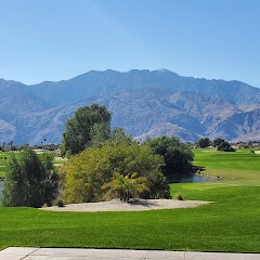
Cimarron Golf Resort

DoubleTree by Hilton Hotel Golf Resort Palm Springs

Outdoor Resort Palm Springs
Transit and Meeting Points
Useful pickup, handoff, or rendezvous points close to Bermuda Dunes.
La Quinta, CA
Indio, California
Palm Desert, CA
Palm Springs Downtown, CA
Flight Path Map
This map shows the direct air route between San Diego and Big River. Straight-line distance: 189.24 mi (304.55 km).

#1 San Diego
The eighth most populous city in the United States and the center of the San Diego metropolitan area.
| Population | 1,422,420 |
| Coordinates | 32.7157100, -117.1647200 |
| Altitude | 20 |
| Country | United States |

#2 Big River
Unincorporated community in Mendocino County, California, United States
| Population | 1,327 |
| Coordinates | 34.1400200, -114.3613400 |
| Altitude | 134 |
| Country | United States |
End: Big River (-114.36134, 34.14002)
Estimated Travel Time
Distance: 440 km by road
| Speed | Time |
|---|---|
| 30 mph (48.3 km/h) | 09h 07m |
| 40 mph (64.37 km/h) | 06h 50m |
| 50 mph (80.47 km/h) | 05h 28m |
| 60 mph (96.56 km/h) | 04h 33m |
| 70 mph (112.65 km/h) | 03h 54m |
| 80 mph (129 km/h) | 03h 24m |
Fuel, Round Trip and CO2
Estimated fuel cost and emissions for this route.
| Fuel | $/gal | One way | Round trip |
|---|---|---|---|
| Regular gas | $5.77 | $55.73 | $111.46 |
| Mid-grade | $6.07 | $58.60 | $117.20 |
| Premium | $6.24 | $60.31 | $120.61 |
| Diesel | $7.57 | $73.10 | $146.19 |
Assumes 8.3 L/100 km (about 28.3 MPG). CO2 is an estimate and varies by vehicle, fuel blend, traffic, and terrain.
Prices in California · Jul 19, 2026
Distance to Other Cities
Planning a road trip? See the full trip guide on Trip.ovh — stops, fuel costs, weather, and departure timing.