How far is San Bernardino, CA from Indio, CA?
The driving distance from San Bernardino, CA to Indio, CA is about 74.3 miles (119.5 km), with a travel time of about 01h 25m by car.
- The straight-line flight distance is about 67.1 miles (108 km).
- For a round trip, plan for roughly 02h 51m of driving time before adding stops, traffic, or weather delays.
- A comfortable departure window is usually 8:00 AM to 10:00 AM PDT.
Reverse, save, or send this route
This route works well as a day trip with time at the destination. Copy the route link, send it to another device, or print a clean version before you head out.
This route works well as a day trip with time at the destination.
Flight Distance
Driving Distance
Gas Cost Calculator
Leave and Arrive Planner
Pick a departure time to see your estimated arrival and same-day return window.
Drive time stays fixed at 01h 25m.
A morning start gives you useful time at the destination and keeps the return out of the late evening.
You are leaving earlier than the recommended window, which gives you extra margin for breaks and traffic.
Halfway Point
A useful midpoint for breaks, coffee, or meeting in the middle.
Census-designated place in Riverside County, California, United States
Route Weather Snapshot
Check the forecast at both ends before you head out.
Driving Route Map
The map below follows the saved road route between San Bernardino and Indio.
Turn-by-Turn Driving Directions
Step-by-step road directions between San Bernardino and Indio.
-
1
Start on West 5th Street
1 km · 1 min · West 5th Street
-
2
Turn right onto North Waterman Avenue
3.1 mi · 5 min · North Waterman Avenue
-
3
Take the ramp slight right toward I 10 East: Redlands
1202 ft · 29 sec
-
4
Keep slight left to continue on I 10 East
1198 ft · 31 sec
-
5
Merge slight left onto Pearl Harbor Memorial Highway
38.5 mi · 42 min · Pearl Harbor Memorial Highway
-
6
Keep slight left to continue on Sonny Bono Memorial Freeway
29.4 mi · 32 min · Sonny Bono Memorial Freeway
-
7
Take the exit slight right toward Monroe Street, Central Indio
1508 ft · 38 sec
-
8
Turn right onto Monroe Street
1.1 km · 1 min · Monroe Street
-
9
Turn left onto Fred Waring Drive
140 m · 13 sec · Fred Waring Drive
-
10
Turn right onto Indio Boulevard
1.1 mi · 2 min · Indio Boulevard
-
11
Turn right onto Fargo Street
31 m · 5 sec · Fargo Street
-
12
Arrive at your destination
0 m · 1 sec · Fargo Street
Car Route Details
A richer read on the saved driving route between San Bernardino and Indio.
Highway-focused drive
Most of the mileage stays on named highways, so the important moments are ramps, exits, merges, and the final local approach.
Pearl Harbor Memorial Highway
Merge slight left onto Pearl Harbor Memorial Highway
38.5 mi · 00h 42m
Route Summary
A quick read on whether this route feels easy, ambitious, or worth planning around.
A comfortable day-trip route
This route works well as a day trip. You can leave in the morning, spend meaningful time at the destination, and still return the same day.
Sunny leaving San Bernardino and Sunny near Indio.
Trip Questions
Direct answers travelers usually want before committing to the drive.
How long does it take to drive from San Bernardino to Indio?
The road trip is about 74.3 miles (119.5 km) and usually takes 01h 25m in normal driving conditions.
Is this a same-day trip or an overnight route?
This route works well as a day trip. You can leave in the morning, spend meaningful time at the destination, and still return the same day.
What is the halfway point on this route?
Cabazon is a useful midpoint, sitting about 37.1 miles from San Bernardino and 37.2 miles from Indio.
How much longer is the road route than the straight-line distance?
The direct path is about 67.1 miles (108 km), while the road route adds roughly 7.2 extra miles because roads do not follow the straight air line.
When is the best time to leave for this route?
A good departure window is usually 8:00 AM to 10:00 AM PDT. If you want a more comfortable same-day return, try to leave by 3:38 PM PDT.
How much will gas cost for this route?
Using about 28.3 MPG, regular gas is estimated at $15.11 one way or $30.23 round trip. Estimated CO2 is about 23.3 kg one way.
What should you check before leaving?
Before you leave, expect Sunny around San Bernardino and Sunny near Indio.
Stop Ideas Near Cabazon
Useful break, food, and waypoint ideas within about 15 miles of the route midpoint.

Khyra Beaucrest Ranch
Highland Springs Ranch & Inn

Hampton Inn & Suites Banning-Beaumont
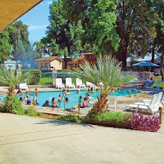
Cherry Valley Lakes RV Resort
Transit and Meeting Points
Useful pickup, handoff, or rendezvous points close to Cabazon.
Cabazon, CA
Palm Springs
Palm Springs Downtown, CA
Palm Springs (Buses), California
Flight Path Map
This map shows the direct air route between San Bernardino and Indio. Straight-line distance: 67.1 mi (107.99 km).

#1 San Bernardino
The second most populous city in San Bernardino County, California.
| Population | 217,491 |
| Coordinates | 34.1083400, -117.2897700 |
| Altitude | 321 |
| Country | United States |

#2 Indio
A city in Riverside County, California.
| Population | 91,919 |
| Coordinates | 33.7207000, -116.2167700 |
| Altitude | -4 |
| Country | United States |
End: Indio (-116.21677, 33.7207)
Estimated Travel Time
Distance: 120 km by road
| Speed | Time |
|---|---|
| 30 mph (48.3 km/h) | 02h 28m |
| 40 mph (64.37 km/h) | 01h 51m |
| 50 mph (80.47 km/h) | 01h 29m |
| 60 mph (96.56 km/h) | 01h 14m |
| 70 mph (112.65 km/h) | 01h 03m |
| 80 mph (129 km/h) | 00h 55m |
Fuel, Round Trip and CO2
Estimated fuel cost and emissions for this route.
| Fuel | $/gal | One way | Round trip |
|---|---|---|---|
| Regular gas | $5.77 | $15.11 | $30.23 |
| Mid-grade | $6.07 | $15.89 | $31.79 |
| Premium | $6.24 | $16.36 | $32.71 |
| Diesel | $7.57 | $19.83 | $39.65 |
Assumes 8.3 L/100 km (about 28.3 MPG). CO2 is an estimate and varies by vehicle, fuel blend, traffic, and terrain.
Prices in California · Jun 10, 2026
Distance to Other Cities
Planning a road trip? See the full trip guide on Trip.ovh — stops, fuel costs, weather, and departure timing.