How far is Salem, NJ from Lakewood, NJ?
Fastest route
The route from Salem, New Jersey to Lakewood, New Jersey 08701 is approximately 96.2 miles (154.8 kilometers) long and would take around 1 hour and 39 minutes under normal traffic conditions.
Directions
-
Get on NJ Tpke in Carneys Point Township from NJ-45 N, Pointers Auburn Rd, and Hawks Bridge Rd.
- Head north on NJ-45 N/Market St toward Center Dr.
- Continue to follow NJ-45 N.
- Turn left onto Bypass Rd/Rte 540.
- Turn right onto Pointers Auburn Rd/Rte 540.
- Continue to follow Pointers Auburn Rd.
- Continue straight onto Hawks Bridge Rd.
- Slight right toward Wiley Rd.
- Slight right onto Wiley Rd.
- Slight left onto the ramp to US-40 E/Atlantic City.
-
Continue on NJ Tpke. Take I-195 E to US-9 S in Howell Township. Take exit 28A from I-195 E (Toll road).
- Continue on NJ Tpke.
- Keep left at the fork to stay on NJ Tpke, following signs for New Jersey Tpke (Toll road).
- Continue onto I-95 N/NJ Tpke (Toll road).
- Take exit 7A to merge onto I-195 E toward Shore Pts.
- Take exit 28A to merge onto US-9 S toward Lakewood.
-
Follow US-9 S and Madison Ave to your destination in Lakewood.
- Follow US-9 S.
- Continue on Madison Ave.
- Turn right onto Dr Martin Luther King Dr.
Tips & Suggestions
- 🚗 Make sure to check the traffic conditions before starting your journey.
- ⛽ Plan your fuel stops along the way to avoid running out of gas.
- 🍴 Consider stopping at restaurants or rest areas for meals and breaks.
- 📱 Use a navigation app or GPS device for real-time directions and traffic updates.
- 🚧 Be aware of any road construction or detours that may affect your route.
- 💰 Keep some cash or change on hand for tolls on the NJ Tpke.
- 🕒 Leave with some extra time in case of unexpected delays.
- 🚫 Observe traffic rules and regulations, and drive safely throughout your journey.
Reverse, save, or send this route
This route works well as a day trip with time at the destination. Copy the route link, send it to another device, or print a clean version before you head out.
This route works well as a day trip with time at the destination.
Flight Distance
Driving Distance
Gas Cost Calculator
Leave and Arrive Planner
Pick a departure time to see your estimated arrival and same-day return window.
Drive time stays fixed at 01h 39m.
A morning start gives you useful time at the destination and keeps the return out of the late evening.
You are leaving earlier than the recommended window, which gives you extra margin for breaks and traffic.
Halfway Point
A useful midpoint for breaks, coffee, or meeting in the middle.
Township of New Jersey
Route Weather Snapshot
Check the forecast at both ends before you head out.
Mostly Sunny
Partly Sunny
Driving Route Map
The map below follows the saved road route between Salem and Lakewood.
Turn-by-Turn Driving Directions
Step-by-step road directions between Salem and Lakewood.
-
1
Start on West Broadway
2860 ft · 43 sec · West Broadway
-
2
Turn right onto Front Street
1040 ft · 14 sec · Front Street
-
3
Continue on South Broadway
2.6 mi · 3 min · South Broadway
-
4
Continue on Broadway Road
1595 ft · 23 sec · Broadway Road
-
5
Continue on South Broadway
5.2 mi · 7 min · South Broadway
-
6
Take the exit slight right toward US 40 East, NJTP: Hook Road, Atlantic City
92 m · 8 sec
-
7
Turn straight onto Old Pennsville-Auburn Road
953 ft · 20 sec · Old Pennsville-Auburn Road
-
8
Take the ramp left toward US 40 East: Atlantic City
1427 ft · 35 sec
-
9
Merge slight left onto New Jersey Turnpike
1.9 mi · 2 min · New Jersey Turnpike
-
10
Take the exit slight left
1039 ft · 14 sec
-
11
Continue straight
899 ft · 12 sec
-
12
Merge slight right onto New Jersey Turnpike
46.7 mi · 54 min · New Jersey Turnpike
-
13
Keep slight right to continue on New Jersey Turnpike
10.6 mi · 12 min · New Jersey Turnpike
-
14
Take the exit slight right toward I 195: Trenton, Shore Points
1.3 mi · 4 min
-
15
Keep slight right to continue on I 195 East: Shore Points
1525 ft · 45 sec
-
16
Merge slight left onto Central Jersey Expressway
20.5 mi · 24 min · Central Jersey Expressway
-
17
Take the exit slight right toward US 9 South: Lakewood
1336 ft · 33 sec
-
18
Merge slight left onto US Highway 9
3.6 mi · 6 min · US Highway 9
-
19
Continue on Madison Avenue
1.6 km · 2 min · Madison Avenue
-
20
Turn left onto 8th Street
14 m · 2 sec · 8th Street
-
21
Arrive at your destination
0 m · 1 sec · 8th Street
Car Route Details
A richer read on the saved driving route between Salem and Lakewood.
Highway-focused drive
Most of the mileage stays on named highways, so the important moments are ramps, exits, merges, and the final local approach.
New Jersey Turnpike
Merge slight right onto New Jersey Turnpike
46.7 mi · 00h 54m
Route Summary
A quick read on whether this route feels easy, ambitious, or worth planning around.
A comfortable day-trip route
This route works well as a day trip. You can leave in the morning, spend meaningful time at the destination, and still return the same day.
Mostly Sunny leaving Salem and Partly Sunny near Lakewood.
Trip Questions
Direct answers travelers usually want before committing to the drive.
How long does it take to drive from Salem to Lakewood?
The road trip is about 94.9 miles (152.7 km) and usually takes 01h 39m in normal driving conditions.
Is this a same-day trip or an overnight route?
This route works well as a day trip. You can leave in the morning, spend meaningful time at the destination, and still return the same day.
What is the halfway point on this route?
Moorestown is a useful midpoint, sitting about 47.9 miles from Salem and 47 miles from Lakewood.
How much longer is the road route than the straight-line distance?
The direct path is about 75.6 miles (121.7 km), while the road route adds roughly 19.3 extra miles because roads do not follow the straight air line.
When is the best time to leave for this route?
A good departure window is usually 8:00 AM to 10:00 AM EDT. If you want a more comfortable same-day return, try to leave by 3:12 PM EDT.
How much will gas cost for this route?
Using about 28.3 MPG, regular gas is estimated at $13.69 one way or $27.38 round trip. Estimated CO2 is about 29.8 kg one way.
What should you check before leaving?
Before you leave, expect Mostly Sunny around Salem and Partly Sunny near Lakewood.
Stop Ideas Near Moorestown
Useful break, food, and waypoint ideas within about 15 miles of the route midpoint.

Bluestone Lane City Hall Coffee Shop

Dilworth Park
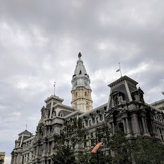
Philadelphia Marriage License

City Hall
Transit and Meeting Points
Useful pickup, handoff, or rendezvous points close to Moorestown.
Cherry Hill, New Jersey
Pennsauken, NJ
Cornwells Heights
Lindenwold
Flight Path Map
This map shows the direct air route between Salem and Lakewood. Straight-line distance: 75.6 mi (121.67 km).

#1 Salem
City in Salem County, New Jersey, USA
| Population | 4,713 |
| Coordinates | 39.5717800, -75.4671400 |
| Altitude | 3 |
| Country | United States |

#2 Lakewood
Township in Ocean County, New Jersey
| Population | 107,439 |
| Coordinates | 40.0978900, -74.2176400 |
| Altitude | 23 |
| Country | United States |
End: 8th Street (-74.217623, 40.097792)
Estimated Travel Time
Distance: 153 km by road
| Speed | Time |
|---|---|
| 30 mph (48.3 km/h) | 03h 09m |
| 40 mph (64.37 km/h) | 02h 22m |
| 50 mph (80.47 km/h) | 01h 53m |
| 60 mph (96.56 km/h) | 01h 34m |
| 70 mph (112.65 km/h) | 01h 21m |
| 80 mph (129 km/h) | 01h 11m |
Fuel, Round Trip and CO2
Estimated fuel cost and emissions for this route.
| Fuel | $/gal | One way | Round trip |
|---|---|---|---|
| Regular gas | $4.09 | $13.69 | $27.38 |
| Mid-grade | $4.60 | $15.41 | $30.81 |
| Premium | $4.95 | $16.60 | $33.19 |
| Diesel | $5.98 | $20.03 | $40.07 |
Assumes 8.3 L/100 km (about 28.3 MPG). CO2 is an estimate and varies by vehicle, fuel blend, traffic, and terrain.
Prices in New Jersey · Apr 18, 2026
Distance to Other Cities
Planning a road trip? See the full trip guide on Trip.ovh — stops, fuel costs, weather, and departure timing.