How far is Roosevelt, NY from Nassau, 23?
The driving distance from Roosevelt, NY to Nassau, 23 is about 1313.3 miles (2113.6 km), with a travel time of about 25h 02m by car.
- The straight-line flight distance is about 1100.8 miles (1771.5 km).
- For a round trip, plan for roughly 50h 04m of driving time before adding stops, traffic, or weather delays.
- A comfortable departure window is usually 6:00 AM to 7:30 AM EDT.
Reverse, save, or send this route
This drive is better planned with a longer stop or an overnight stay. Copy the route link, send it to another device, or print a clean version before you head out.
This drive is better planned with a longer stop or an overnight stay.
Flight Distance
Driving Distance
Gas Cost Calculator
Leave and Arrive Planner
Pick a departure time to see your estimated arrival and same-day return window.
Drive time stays fixed at 25h 02m.
Starting early still helps, but most travelers will want a longer stop or an overnight stay on a route this long.
You are leaving earlier than the recommended window, which gives you extra margin for breaks and traffic.
Halfway Point
A useful midpoint for breaks, coffee, or meeting in the middle.
Civil town in Florence County, Wisconsin
Route Weather Snapshot
Check the forecast at both ends before you head out.
Mostly Cloudy then Rain Showers
Driving Route Map
The map below follows the saved road route between Roosevelt and Nassau.
Turn-by-Turn Driving Directions
Step-by-step road directions between Roosevelt and Nassau.
-
1
Start on Mollineaux Street
112 m · 19 sec · Mollineaux Street
-
2
Turn right onto Washington Avenue
81 m · 13 sec · Washington Avenue
-
3
At the end of the road, turn right onto Babylon Turnpike
141 m · 10 sec · Babylon Turnpike
-
4
Continue on Nassau Road
1.1 km · 1 min · Nassau Road
-
5
Turn left onto Pine Street
46 m · 3 sec · Pine Street
-
6
Take the ramp straight toward SO West
992 ft · 25 sec
-
7
Merge slight left onto Southern State Parkway
7.5 mi · 10 min · Southern State Parkway
-
8
Continue on Belt Parkway
1.3 mi · 1 min · Belt Parkway
-
9
Keep slight right to continue on Belt Parkway
2.4 mi · 4 min · Belt Parkway
-
10
Keep slight left to continue on Belt Parkway
17.2 mi · 26 min · Belt Parkway
-
11
Take the exit slight right toward I 278 West: Verrazano Bridge, Staten Island
3056 ft · 1 min
-
12
Keep slight right to continue on Verrazzano-Narrows Bridge Lower Level
1964 ft · 48 sec
-
13
Merge slight right onto Gowanus Expressway
759 ft · 9 sec · Gowanus Expressway
-
14
Continue on Verrazzano-Narrows Bridge
1.4 mi · 2 min · Verrazzano-Narrows Bridge
-
15
Continue on Staten Island Expressway
6.3 mi · 10 min · Staten Island Expressway
-
16
Keep slight left to continue on Staten Island Expressway
1.1 mi · 2 min · Staten Island Expressway
-
17
Continue on Goethals Bridge
1.4 mi · 2 min · Goethals Bridge
-
18
Take the exit slight left toward I 95 Toll: New Jersey Turnpike
1 km · 2 min
-
19
Keep slight right to continue on I 95 South, NJTP South: Trenton
750 ft · 12 sec
-
20
Keep slight left
2405 ft · 37 sec
-
21
Merge slight left onto New Jersey Turnpike
47.2 mi · 54 min · New Jersey Turnpike
-
22
Keep slight left to continue on New Jersey Turnpike
48.9 mi · 56 min · New Jersey Turnpike
-
23
Take the exit slight left
1193 ft · 16 sec
-
24
Continue straight
1760 ft · 23 sec
-
25
Merge slight right onto New Jersey Turnpike
2 mi · 2 min · New Jersey Turnpike
-
26
Merge slight left
3.4 mi · 6 min
-
27
Take the exit slight right toward DE 9: New Castle, Veterans Memorial Park, Wilmington
146 m · 8 sec
-
28
Keep slight left to continue on DE 9 South: New Castle, Veterans Memorial Park
885 ft · 15 sec
-
29
Keep slight left
1838 ft · 31 sec
-
30
Merge slight left onto Delaware Turnpike
11.6 mi · 14 min · Delaware Turnpike
-
31
Keep slight left to continue on Delaware Turnpike
2.2 mi · 3 min · Delaware Turnpike
-
32
Continue on John F. Kennedy Memorial Highway
41.3 mi · 48 min · John F. Kennedy Memorial Highway
-
33
Keep slight left to continue on Express Toll Lanes
6.5 mi · 8 min · Express Toll Lanes
-
34
Keep slight left to continue on Express Toll Lanes
1.2 mi · 2 min · Express Toll Lanes
-
35
Merge slight right onto Harbor Tunnel Thruway
3.8 mi · 5 min · Harbor Tunnel Thruway
-
36
Continue on Baltimore Harbor Tunnel
1.4 mi · 2 min · Baltimore Harbor Tunnel
-
37
Continue on Harbor Tunnel Thruway
2.2 mi · 3 min · Harbor Tunnel Thruway
-
38
Continue on Harbor Tunnel Throughway
2567 ft · 40 sec · Harbor Tunnel Throughway
-
39
Keep slight left to continue on Harbor Tunnel Throughway
2671 ft · 42 sec · Harbor Tunnel Throughway
-
40
Continue on Harbor Tunnel Thruway
1.3 mi · 2 min · Harbor Tunnel Thruway
-
41
Take the exit slight right toward MD 295 South: Essex, BWI Marshall Airport
2423 ft · 59 sec
-
42
Merge slight left onto Baltimore-Washington Parkway
27.1 mi · 37 min · Baltimore-Washington Parkway
-
43
Keep slight left to continue on US 50 East: Richmond, Annapolis
2902 ft · 35 sec
-
44
Continue on Kenilworth Avenue Freeway
2.2 mi · 3 min · Kenilworth Avenue Freeway
-
45
Continue on Anacostia Freeway
2.1 mi · 4 min · Anacostia Freeway
-
46
Take the exit slight right toward I 695 : Downtown
1553 ft · 38 sec
-
47
Keep slight right to continue on I 695 West: Downtown
612 ft · 15 sec
-
48
Merge slight left onto Southeast Freeway
1.9 mi · 3 min · Southeast Freeway
-
49
Continue on Southwest Freeway
1.1 km · 1 min · Southwest Freeway
-
50
Continue on Francis Case Memorial Bridge
1.1 mi · 2 min · Francis Case Memorial Bridge
-
51
Continue on Henry G. Shirley Memorial Highway
9.4 mi · 12 min · Henry G. Shirley Memorial Highway
-
52
Continue on Henry G. Shirley Memorial Highway
36.3 mi · 43 min · Henry G. Shirley Memorial Highway
-
53
Keep slight left
48.6 mi · 53 min
-
54
Take the exit slight left toward I 295 South: Williamsburg, Norfolk, Va Beach
1.9 mi · 2 min
-
55
Merge slight right onto Korean War Veterans Memorial Highway
42.2 mi · 46 min · Korean War Veterans Memorial Highway
-
56
Merge slight right onto I 95 South: Emporia, Rocky Mount NC
172.5 mi · 3 hr 9 min
-
57
Keep slight left
385.6 mi · 6 hr 57 min
-
58
Take the exit slight right toward I 295 East: Jacksonville Beaches, East Beltway
1.5 km · 2 min
-
59
Keep slight left to continue on I 295: Jaxport Terminals, Jacksonville Beaches, East Beltway
1311 ft · 32 sec
-
60
Merge slight left onto East Beltway
9.3 mi · 11 min · East Beltway
-
61
Keep slight left to continue on East Beltway
7.3 mi · 8 min · East Beltway
-
62
Keep slight right to continue on East Beltway
5.6 mi · 6 min · East Beltway
-
63
Keep slight left to continue on I 795 South: Saint Augustine
5.1 mi · 6 min
-
64
Take the exit slight left toward I 95 South: Daytona Beach
1.1 km · 1 min
-
65
Merge slight left
202.9 mi · 3 hr 38 min
-
66
Take the exit slight right toward FL 70: Okeechobee, Fort Pierce
2396 ft · 58 sec
-
67
Keep slight right to continue on FL 70 West: Okeechobee
150 m · 12 sec
-
68
Merge slight left onto Okeechobee Road
2745 ft · 58 sec · Okeechobee Road
-
69
Take the ramp left
1090 ft · 35 sec
-
70
Keep slight left to continue on Miami, Florida's Turnpike South
2588 ft · 1 min
-
71
Merge slight left onto Florida's Turnpike
108.4 mi · 2 hr · Florida's Turnpike
-
72
Take the exit slight right toward I 95, US 441, SR 826 West
1760 ft · 43 sec
-
73
Keep slight left to continue on I 95, US 441
1.3 km · 2 min
-
74
Keep slight left to continue on I 95 South
752 ft · 18 sec
-
75
Merge slight left
11.4 mi · 15 min
-
76
Take the exit slight right toward Rickenbacker Causeway, Key Biscayne
1013 ft · 27 sec
-
77
Continue on Mary Brickell Road
129 m · 8 sec · Mary Brickell Road
-
78
Continue on Southwest 26th Road
155 m · 16 sec · Southwest 26th Road
-
79
Continue on Southeast 26th Road
123 m · 13 sec · Southeast 26th Road
-
80
Continue on Rickenbacker Causeway
5.7 mi · 10 min · Rickenbacker Causeway
-
81
Continue on Crandon Boulevard
2.3 mi · 7 min · Crandon Boulevard
-
82
Turn left
610 ft · 45 sec
-
83
Arrive at your destination
0 m · 1 sec
Car Route Details
A richer read on the saved driving route between Roosevelt and Nassau.
Long-distance drive
This route is long enough that fuel, rest stops, weather, and timing matter more than any single maneuver.
I 95 South
Keep slight left
386 mi · 06h 57m
Route Summary
A quick read on whether this route feels easy, ambitious, or worth planning around.
Better with a longer stop
This route is long enough that most travelers will be better off planning an overnight stay or a more deliberate stop window.
Mostly Cloudy then Rain Showers near Roosevelt.
Trip Questions
Direct answers travelers usually want before committing to the drive.
How long does it take to drive from Roosevelt to Nassau?
The road trip is about 1313.3 miles (2113.6 km) and usually takes 25h 02m in normal driving conditions.
Is this a same-day trip or an overnight route?
This route is long enough that most travelers will be better off planning an overnight stay or a more deliberate stop window.
What is the halfway point on this route?
Florence is a useful midpoint, sitting about 655.2 miles from Roosevelt and 658.2 miles from Nassau.
How much longer is the road route than the straight-line distance?
The direct path is about 1100.8 miles (1771.5 km), while the road route adds roughly 212.5 extra miles because roads do not follow the straight air line.
When is the best time to leave for this route?
A good departure window is usually 6:00 AM to 7:30 AM EDT. Starting early still helps, but most travelers will want a longer stop or an overnight stay on a route this long.
How much will gas cost for this route?
Using about 28.3 MPG, regular gas is estimated at $206.12 one way or $412.24 round trip. Estimated CO2 is about 411.8 kg one way.
What should you check before leaving?
Before leaving, the latest forecast around Roosevelt is Mostly Cloudy then Rain Showers.
Stop Ideas Near Florence
Useful break, food, and waypoint ideas within about 15 miles of the route midpoint.
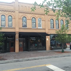
Town Hall
Florence City Manager
Transit and Meeting Points
Useful pickup, handoff, or rendezvous points close to Florence.
Florence
Dillon
Kingstree
Hamlet
Flight Path Map
This map shows the direct air route between Roosevelt and Nassau. Straight-line distance: 1100.73 mi (1771.46 km).


End: Nassau (-77.34306, 25.05823)
Estimated Travel Time
Distance: 2114 km by road
| Speed | Time |
|---|---|
| 30 mph (48.3 km/h) | 43h 45m |
| 40 mph (64.37 km/h) | 32h 50m |
| 50 mph (80.47 km/h) | 26h 15m |
| 60 mph (96.56 km/h) | 21h 53m |
| 70 mph (112.65 km/h) | 18h 45m |
| 80 mph (129 km/h) | 16h 23m |
Fuel, Round Trip and CO2
Estimated fuel cost and emissions for this route.
| Fuel | $/gal | One way | Round trip |
|---|---|---|---|
| Regular gas | $4.45 | $206.12 | $412.24 |
| Mid-grade | $4.98 | $230.87 | $461.73 |
| Premium | $5.38 | $249.40 | $498.80 |
| Diesel | $6.51 | $301.63 | $603.25 |
Assumes 8.3 L/100 km (about 28.3 MPG). CO2 is an estimate and varies by vehicle, fuel blend, traffic, and terrain.
Prices in New York · Oct 15, 2026