How far is Robbinsdale, MN from Edina, MN?
Fastest route
The distance from Robbinsdale, Minnesota to Edina, Minnesota is approximately 11.2 miles (18 kilometers). The fastest route is currently via MN-100 S, and the estimated travel time is around 14 minutes.
Tips & Suggestions
- 🚗 Plan Ahead: Before starting your journey, it's always a good idea to plan your route and familiarize yourself with the directions. This will help ensure a smoother and stress-free travel experience.
- ⛽ Fuel Up: Check your fuel levels before embarking on the trip. Make sure you have enough gas to reach your destination comfortably or consider refueling along the way if needed.
- 🚦 Traffic Updates: Keep an eye on traffic conditions along the MN-100 S route. Use real-time traffic updates to avoid congestion and choose the most efficient path.
- 🕒 Time of Travel: Consider the time of day you'll be traveling. Rush hours and peak times may result in heavier traffic, so plan accordingly to minimize delays.
- 🚧 Construction Zones: Stay informed about any ongoing construction or roadwork that may impact your route. Follow signs and drive cautiously through these areas.
- 📱 Navigation Assistance: Utilize navigation apps or GPS devices to guide you along the way. They can provide turn-by-turn directions and alternative routes if necessary.
- 🛣️ Stay Alert: Stay focused on the road and adhere to traffic laws. Pay attention to road signs, signals, and other vehicles to ensure a safe and enjoyable journey.
Reverse, save, or send this route
This is an easy same-day return drive. Copy the route link, send it to another device, or print a clean version before you head out.
This is an easy same-day return drive.
Flight Distance
Driving Distance
Gas Cost Calculator
Leave and Arrive Planner
Pick a departure time to see your estimated arrival and same-day return window.
Drive time stays fixed at 00h 13m.
This is a short drive, so your comfort window is wide. Traffic and current weather matter more than the clock.
This departure sits inside the recommended comfort window for the route.
Halfway Point
A useful midpoint for breaks, coffee, or meeting in the middle.
The most populous city in Hennepin County, Minnesota.
Route Weather Snapshot
Check the forecast at both ends before you head out.
Showers And Thunderstorms Likely then Chance Showers And Thunderstorms
Chance Showers And Thunderstorms
Driving Route Map
The map below follows the saved road route between Robbinsdale and Edina.
Turn-by-Turn Driving Directions
Step-by-step road directions between Robbinsdale and Edina.
-
1
Start on 42nd Avenue North
2965 ft · 1 min · 42nd Avenue North
-
2
Turn left onto MN 100 South
1503 ft · 37 sec
-
3
Merge slight left
9.8 mi · 12 min
-
4
Take the exit slight right toward MN 62 East
1139 ft · 28 sec
-
5
Merge slight left onto Crosstown Highway
39 m · 2 sec · Crosstown Highway
-
6
Take the exit slight right toward MN 100 North
1293 ft · 32 sec
-
7
Merge slight left
71 m · 3 sec
-
8
Arrive at your destination
0 m · 1 sec
Car Route Details
A richer read on the saved driving route between Robbinsdale and Edina.
Turn-heavy local drive
The route has frequent decision points for its length, so lane choice and turn timing will matter more than cruising speed.
MN 100 South
Merge slight left
9.78 mi · 00h 12m
Route Summary
A quick read on whether this route feels easy, ambitious, or worth planning around.
A short regional drive
This route is short enough to handle as a quick errand, commute, or easy same-day return without much planning overhead.
Showers And Thunderstorms Likely then Chance Showers And Thunderstorms leaving Robbinsdale and Chance Showers And Thunderstorms near Edina.
Trip Questions
Direct answers travelers usually want before committing to the drive.
How long does it take to drive from Robbinsdale to Edina?
The road trip is about 11.2 miles (18 km) and usually takes 00h 13m in normal driving conditions.
Is this a same-day trip or an overnight route?
This route is short enough to handle as a quick errand, commute, or easy same-day return without much planning overhead.
What is the halfway point on this route?
Saint Louis Park is a useful midpoint, sitting about 5.6 miles from Robbinsdale and 5.6 miles from Edina.
How much longer is the road route than the straight-line distance?
The direct path is about 9.9 miles (15.9 km), while the road route adds roughly 1.3 extra miles because roads do not follow the straight air line.
When is the best time to leave for this route?
A good departure window is usually 7:00 AM to 7:00 PM CDT. If you want a more comfortable same-day return, try to leave by 8:04 PM CDT.
How much will gas cost for this route?
Using about 28.3 MPG, regular gas is estimated at $1.39 one way or $2.78 round trip. Estimated CO2 is about 3.5 kg one way.
What should you check before leaving?
Before you leave, expect Showers And Thunderstorms Likely then Chance Showers And Thunderstorms around Robbinsdale and Chance Showers And Thunderstorms near Edina.
Stop Ideas Near Saint Louis Park
Useful break, food, and waypoint ideas within about 15 miles of the route midpoint.

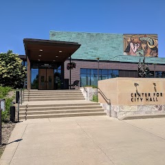
Minneapolis City Hall
City of Bloomington
Mall of America®
Transit and Meeting Points
Useful pickup, handoff, or rendezvous points close to Saint Louis Park.
Saint Paul Union Depot
Red Wing station
St. Cloud
Menomonie, WI
Flight Path Map
This map shows the direct air route between Robbinsdale and Edina. Straight-line distance: 9.86 mi (15.87 km).

#1 Robbinsdale
City in Hennepin County, Minnesota
| Population | 14,190 |
| Coordinates | 45.0321900, -93.3385600 |
| Altitude | 266 |
| Country | United States |

#2 Edina
The most populous city in Hennepin County, Minnesota.
| Population | 52,477 |
| Coordinates | 44.8896900, -93.3499500 |
| Altitude | 281 |
| Country | United States |
End: MN 100 North (-93.349969, 44.88969)
Estimated Travel Time
Distance: 18 km by road
| Speed | Time |
|---|---|
| 30 mph (48.3 km/h) | 00h 22m |
| 40 mph (64.37 km/h) | 00h 16m |
| 50 mph (80.47 km/h) | 00h 13m |
| 60 mph (96.56 km/h) | 00h 11m |
| 70 mph (112.65 km/h) | 00h 09m |
| 80 mph (129 km/h) | 00h 08m |
Fuel, Round Trip and CO2
Estimated fuel cost and emissions for this route.
| Fuel | $/gal | One way | Round trip |
|---|---|---|---|
| Regular gas | $3.57 | $1.39 | $2.78 |
| Mid-grade | $3.92 | $1.53 | $3.06 |
| Premium | $4.39 | $1.71 | $3.43 |
| Diesel | $4.86 | $1.90 | $3.79 |
Assumes 8.3 L/100 km (about 28.3 MPG). CO2 is an estimate and varies by vehicle, fuel blend, traffic, and terrain.
Prices in Minnesota · Jul 01, 2026
Distance to Other Cities
Planning a road trip? See the full trip guide on Trip.ovh — stops, fuel costs, weather, and departure timing.