How far is Roanoke, VA from Ferrum, VA?
The driving distance from Roanoke, VA to Ferrum, VA is about 33.5 miles (53.9 km), with a travel time of about 00h 52m by car.
- The straight-line flight distance is about 24.4 miles (39.2 km).
- For a round trip, plan for roughly 01h 44m of driving time before adding stops, traffic, or weather delays.
- A comfortable departure window is usually 8:00 AM to 10:00 AM EDT.
Reverse, save, or send this route
This route works well as a day trip with time at the destination. Copy the route link, send it to another device, or print a clean version before you head out.
This route works well as a day trip with time at the destination.
Flight Distance
Driving Distance
Gas Cost Calculator
Leave and Arrive Planner
Pick a departure time to see your estimated arrival and same-day return window.
Drive time stays fixed at 00h 52m.
A morning start gives you useful time at the destination and keeps the return out of the late evening.
You are leaving earlier than the recommended window, which gives you extra margin for breaks and traffic.
Halfway Point
A useful midpoint for breaks, coffee, or meeting in the middle.
Town of the United States
Route Weather Snapshot
Check the forecast at both ends before you head out.
Patchy Smoke
Driving Route Map
The map below follows the saved road route between Roanoke and Ferrum.
Turn-by-Turn Driving Directions
Step-by-step road directions between Roanoke and Ferrum.
-
1
Start on the route
87 m · 26 sec
-
2
Turn left onto 1st Street Southwest
602 ft · 34 sec · 1st Street Southwest
-
3
Turn sharp left onto Franklin Road Southwest
566 ft · 14 sec · Franklin Road Southwest
-
4
Turn right onto South Jefferson Street
870 ft · 39 sec · South Jefferson Street
-
5
Turn left onto Elm Avenue Southeast
941 ft · 21 sec · Elm Avenue Southeast
-
6
Take the ramp right
654 ft · 16 sec
-
7
Merge slight left onto Roy L. Webber Expressway
3.2 mi · 4 min · Roy L. Webber Expressway
-
8
Take the exit slight right toward VA 419, US 220 Business: Salem
875 ft · 21 sec
-
9
Keep slight right
52 m · 6 sec
-
10
Turn straight onto Electric Road
1.3 km · 2 min · Electric Road
-
11
Turn left onto Starkey Road
1.5 mi · 3 min · Starkey Road
-
12
Enter the roundabout and take exit 1 toward Starkey Road
20 m · 2 sec · Starkey Road
-
13
Exit the roundabout onto Starkey Road
2367 ft · 1 min · Starkey Road
-
14
Turn left onto Merriman Road
2672 ft · 52 sec · Merriman Road
-
15
Continue on Merriman Road
1.8 mi · 3 min · Merriman Road
-
16
Continue on Token Road
726 ft · 11 sec · Token Road
-
17
Continue on Naff Road
1.3 mi · 2 min · Naff Road
-
18
Keep slight left to continue on Naff Road
2542 ft · 43 sec · Naff Road
-
19
Turn right onto Wades Gap Road
5.6 mi · 8 min · Wades Gap Road
-
20
Turn straight onto Dillons Mill Road
2.1 mi · 3 min · Dillons Mill Road
-
21
Turn right onto Dugspur Road
1.3 km · 1 min · Dugspur Road
-
22
Turn left onto London Ridge Road
2084 ft · 33 sec · London Ridge Road
-
23
Turn right onto Dugspur Road
1.4 km · 1 min · Dugspur Road
-
24
Continue on Bethany Road
3.7 mi · 5 min · Bethany Road
-
25
Turn right onto Callaway Road
725 ft · 16 sec · Callaway Road
-
26
Turn left onto Ferrum Mountain Road
3.4 mi · 5 min · Ferrum Mountain Road
-
27
At the end of the road, turn left onto Ferrum Mountain Road
5 mi · 8 min · Ferrum Mountain Road
-
28
At the end of the road, turn left onto Franklin Street
1586 ft · 34 sec · Franklin Street
-
29
Arrive at your destination
0 m · 1 sec · Franklin Street
Car Route Details
A richer read on the saved driving route between Roanoke and Ferrum.
Turn-heavy local drive
The route has frequent decision points for its length, so lane choice and turn timing will matter more than cruising speed.
Wades Gap Road
Turn right onto Wades Gap Road
5.65 mi · 00h 08m
Route Summary
A quick read on whether this route feels easy, ambitious, or worth planning around.
A comfortable day-trip route
This route works well as a day trip. You can leave in the morning, spend meaningful time at the destination, and still return the same day.
Patchy Smoke leaving Roanoke and Areas Of Smoke near Ferrum.
Trip Questions
Direct answers travelers usually want before committing to the drive.
How long does it take to drive from Roanoke to Ferrum?
The road trip is about 33.5 miles (53.9 km) and usually takes 00h 52m in normal driving conditions.
Is this a same-day trip or an overnight route?
This route works well as a day trip. You can leave in the morning, spend meaningful time at the destination, and still return the same day.
What is the halfway point on this route?
Boones Mill is a useful midpoint, sitting about 16.7 miles from Roanoke and 16.7 miles from Ferrum.
How much longer is the road route than the straight-line distance?
The direct path is about 24.4 miles (39.2 km), while the road route adds roughly 9.1 extra miles because roads do not follow the straight air line.
When is the best time to leave for this route?
A good departure window is usually 8:00 AM to 10:00 AM EDT. If you want a more comfortable same-day return, try to leave by 4:46 PM EDT.
How much will gas cost for this route?
Using about 28.3 MPG, regular gas is estimated at $4.67 one way or $9.35 round trip. Estimated CO2 is about 10.5 kg one way.
What should you check before leaving?
Before you leave, expect Patchy Smoke around Roanoke and Areas Of Smoke near Ferrum.
Stop Ideas Near Boones Mill
Useful break, food, and waypoint ideas within about 15 miles of the route midpoint.

The City Market Building
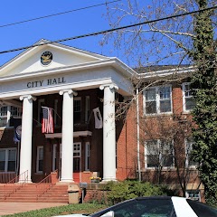
Salem City Hall

Charter Hall at the City Market Building
Transit and Meeting Points
Useful pickup, handoff, or rendezvous points close to Boones Mill.
Roanoke
Blacksburg, VA
Danville
Clifton Forge
Flight Path Map
This map shows the direct air route between Roanoke and Ferrum. Straight-line distance: 24.37 mi (39.22 km).

#1 Roanoke
The most populous city in Roanoke County, Virginia.
| Population | 99,058 |
| Coordinates | 37.2709700, -79.9414300 |
| Altitude | 285 |
| Country | United States |

#2 Ferrum
Census designated place
| Population | 2,043 |
| Coordinates | 36.9229200, -80.0133700 |
| Altitude | 395 |
| Country | United States |
End: Ferrum (-80.01337, 36.92292)
Estimated Travel Time
Distance: 54 km by road
| Speed | Time |
|---|---|
| 30 mph (48.3 km/h) | 01h 06m |
| 40 mph (64.37 km/h) | 00h 50m |
| 50 mph (80.47 km/h) | 00h 40m |
| 60 mph (96.56 km/h) | 00h 33m |
| 70 mph (112.65 km/h) | 00h 28m |
| 80 mph (129 km/h) | 00h 25m |
Fuel, Round Trip and CO2
Estimated fuel cost and emissions for this route.
| Fuel | $/gal | One way | Round trip |
|---|---|---|---|
| Regular gas | $3.96 | $4.67 | $9.35 |
| Mid-grade | $4.43 | $5.23 | $10.45 |
| Premium | $4.78 | $5.64 | $11.28 |
| Diesel | $5.62 | $6.64 | $13.27 |
Assumes 8.3 L/100 km (about 28.3 MPG). CO2 is an estimate and varies by vehicle, fuel blend, traffic, and terrain.
Prices in Virginia · Jul 17, 2026
Distance to Other Cities
Planning a road trip? See the full trip guide on Trip.ovh — stops, fuel costs, weather, and departure timing.