How far is Rhode Island, TX from Briar, TX?
The driving distance from Rhode Island, TX to Briar, TX is about 138.4 miles (222.7 km), with a travel time of about 02h 34m by car.
- The straight-line flight distance is about 111.8 miles (179.9 km).
- For a round trip, plan for roughly 05h 09m of driving time before adding stops, traffic, or weather delays.
- A comfortable departure window is usually 8:00 AM to 10:00 AM CDT.
Reverse, save, or send this route
This route works well as a day trip with time at the destination. Copy the route link, send it to another device, or print a clean version before you head out.
This route works well as a day trip with time at the destination.
Flight Distance
Driving Distance
Gas Cost Calculator
Leave and Arrive Planner
Pick a departure time to see your estimated arrival and same-day return window.
Drive time stays fixed at 02h 34m.
A morning start gives you useful time at the destination and keeps the return out of the late evening.
You are leaving earlier than the recommended window, which gives you extra margin for breaks and traffic.
Halfway Point
A useful midpoint for breaks, coffee, or meeting in the middle.
Route Weather Snapshot
Check the forecast at both ends before you head out.
Driving Route Map
The map below follows the saved road route between Rhode Island and Briar.
Turn-by-Turn Driving Directions
Step-by-step road directions between Rhode Island and Briar.
-
1
Start on County Road 161
3 m · 7 sec · County Road 161
-
2
Turn left onto East FM 833
1.5 km · 1 min · East FM 833
-
3
Turn right onto North State Highway 75
16 m · 3 sec · North State Highway 75
-
4
Turn left onto West FM 833
1.1 km · 2 min · West FM 833
-
5
Continue on Farm-to-Market Road 833
1990 ft · 56 sec · Farm-to-Market Road 833
-
6
Take the ramp right
2067 ft · 50 sec
-
7
Merge slight left
79.5 mi · 1 hr 22 min
-
8
Take the exit slight right toward Waco, Denton
3139 ft · 1 min
-
9
Continue on Woodall Rodgers Freeway
1.4 km · 1 min · Woodall Rodgers Freeway
-
10
Take the exit slight right toward I 35E North: Denton
1980 ft · 48 sec
-
11
Merge slight left onto North Stemmons Freeway
4.1 mi · 5 min · North Stemmons Freeway
-
12
Keep slight left to continue on John W Carpenter Freeway
1.2 km · 49 sec · John W Carpenter Freeway
-
13
Keep slight left to continue on SH 183 TEXpress
1.5 mi · 2 min · SH 183 TEXpress
-
14
Keep slight right to continue on SH 183 TEXpress
14.9 mi · 15 min · SH 183 TEXpress
-
15
Continue on SH 121/183 TEXpress
2 mi · 2 min · SH 121/183 TEXpress
-
16
Continue on SH 183 TEXpress
644 ft · 7 sec · SH 183 TEXpress
-
17
Continue on SH 121/183 TEXpress
1.1 km · 43 sec · SH 121/183 TEXpress
-
18
Continue on I 820 TEXpress
6.9 mi · 7 min · I 820 TEXpress
-
19
Merge slight right onto Northeast Loop
1864 ft · 24 sec · Northeast Loop
-
20
Continue on Jim Wright Freeway
5.7 mi · 7 min · Jim Wright Freeway
-
21
Take the exit slight right toward TX 199: Jacksboro Highway, Quebec Street
2351 ft · 50 sec
-
22
Keep slight right to continue on TX 199 West: Jacksboro Highway
885 ft · 19 sec
-
23
Turn slight left onto Northwest Loop 820
103 m · 7 sec · Northwest Loop 820
-
24
Turn right onto Lake Worth Boulevard
1.3 mi · 2 min · Lake Worth Boulevard
-
25
Take the exit straight toward Jacksboro Highway
8.8 mi · 10 min · Jacksboro Highway
-
26
Take the exit slight right toward FM 730: Boyd
560 ft · 14 sec
-
27
Turn straight onto Northwest Parkway
148 m · 13 sec · Northwest Parkway
-
28
Turn right onto Boyd Road
6.5 mi · 12 min · Boyd Road
-
29
Continue on Farm-to-Market Road 730
117 m · 8 sec · Farm-to-Market Road 730
-
30
Arrive at your destination
0 m · 1 sec · Farm-to-Market Road 730
Car Route Details
A richer read on the saved driving route between Rhode Island and Briar.
Interchange-aware route
The drive includes several ramps, exits, or merges, so checking the next few maneuvers before busy interchanges is useful.
Farm-to-Market Road 833
Merge slight left
79.5 mi · 01h 22m
Route Summary
A quick read on whether this route feels easy, ambitious, or worth planning around.
A comfortable day-trip route
This route works well as a day trip. You can leave in the morning, spend meaningful time at the destination, and still return the same day.
Sunny leaving Rhode Island and Sunny near Briar.
Trip Questions
Direct answers travelers usually want before committing to the drive.
How long does it take to drive from Rhode Island to Briar?
The road trip is about 138.4 miles (222.7 km) and usually takes 02h 34m in normal driving conditions.
Is this a same-day trip or an overnight route?
This route works well as a day trip. You can leave in the morning, spend meaningful time at the destination, and still return the same day.
What is the halfway point on this route?
Hutchins is a useful midpoint, sitting about 69.2 miles from Rhode Island and 69.2 miles from Briar.
How much longer is the road route than the straight-line distance?
The direct path is about 111.8 miles (179.9 km), while the road route adds roughly 26.6 extra miles because roads do not follow the straight air line.
When is the best time to leave for this route?
A good departure window is usually 8:00 AM to 10:00 AM CDT. If you want a more comfortable same-day return, try to leave by 1:20 PM CDT.
How much will gas cost for this route?
Using about 28.3 MPG, regular gas is estimated at $18.44 one way or $36.88 round trip. Estimated CO2 is about 43.4 kg one way.
What should you check before leaving?
Before you leave, expect Sunny around Rhode Island and Sunny near Briar.
Stop Ideas Near Hutchins
Useful break, food, and waypoint ideas within about 15 miles of the route midpoint.

Anju
Dallas Environmental Quality

Dallas City Hall
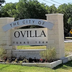
Ovilla City Hall
Transit and Meeting Points
Useful pickup, handoff, or rendezvous points close to Hutchins.
Union Station
Dallas, TX
Mesquite, TX
Fort Worth Central Station
Flight Path Map
This map shows the direct air route between Rhode Island and Briar. Straight-line distance: 111.78 mi (179.9 km).
#1 Rhode Island
Rhode Island is a place in Texas, United States.
| Population | 0 |
| Coordinates | 31.8154400, -96.2313600 |
| Altitude | 119 |
| Country | United States |

#2 Briar
Census designated place
| Population | 5,665 |
| Coordinates | 32.9951200, -97.5428000 |
| Altitude | 227 |
| Country | United States |
End: Briar (-97.5428, 32.99512)
Estimated Travel Time
Distance: 223 km by road
| Speed | Time |
|---|---|
| 30 mph (48.3 km/h) | 04h 36m |
| 40 mph (64.37 km/h) | 03h 27m |
| 50 mph (80.47 km/h) | 02h 46m |
| 60 mph (96.56 km/h) | 02h 18m |
| 70 mph (112.65 km/h) | 01h 58m |
| 80 mph (129 km/h) | 01h 43m |
Fuel, Round Trip and CO2
Estimated fuel cost and emissions for this route.
| Fuel | $/gal | One way | Round trip |
|---|---|---|---|
| Regular gas | $3.78 | $18.44 | $36.88 |
| Mid-grade | $4.25 | $20.75 | $41.50 |
| Premium | $4.59 | $22.40 | $44.81 |
| Diesel | $3.99 | $19.49 | $38.97 |
Assumes 8.3 L/100 km (about 28.3 MPG). CO2 is an estimate and varies by vehicle, fuel blend, traffic, and terrain.
Prices in Texas · Jul 27, 2026
Distance to Other Cities
Planning a road trip? See the full trip guide on Trip.ovh — stops, fuel costs, weather, and departure timing.