How far is Raoul, GA from Macon, GA?
The driving distance from Raoul, GA to Macon, GA is about 137.5 miles (221.3 km), with a travel time of about 02h 38m by car.
- The straight-line flight distance is about 111.2 miles (178.9 km).
- For a round trip, plan for roughly 05h 16m of driving time before adding stops, traffic, or weather delays.
- A comfortable departure window is usually 8:00 AM to 10:00 AM EDT.
Reverse, save, or send this route
This route works well as a day trip with time at the destination. Copy the route link, send it to another device, or print a clean version before you head out.
This route works well as a day trip with time at the destination.
Flight Distance
Driving Distance
Gas Cost Calculator
Leave and Arrive Planner
Pick a departure time to see your estimated arrival and same-day return window.
Drive time stays fixed at 02h 38m.
A morning start gives you useful time at the destination and keeps the return out of the late evening.
You are leaving earlier than the recommended window, which gives you extra margin for breaks and traffic.
Halfway Point
A useful midpoint for breaks, coffee, or meeting in the middle.
Census-designated place in DeKalb County, Georgia
Route Weather Snapshot
Check the forecast at both ends before you head out.
Mostly Cloudy then Slight Chance Showers And Thunderstorms
Showers And Thunderstorms Likely
Driving Route Map
The map below follows the saved road route between Raoul and Macon.
Turn-by-Turn Driving Directions
Step-by-step road directions between Raoul and Macon.
-
1
Start on County Road 221
24 m · 11 sec · County Road 221
-
2
Turn left onto Gainesville Highway
1378 ft · 28 sec · Gainesville Highway
-
3
Turn right onto Mount Zion Road
1.5 km · 4 min · Mount Zion Road
-
4
Turn left onto Tommy Irwin Parkway
1.4 mi · 2 min · Tommy Irwin Parkway
-
5
Continue on Cornelia Highway
13 mi · 15 min · Cornelia Highway
-
6
Continue on Lanier Parkway
24.2 mi · 26 min · Lanier Parkway
-
7
Merge slight left
6.6 mi · 7 min
-
8
Keep slight right
10.1 mi · 11 min
-
9
Take the exit slight right toward I 285 Bypass East: Augusta, Macon
1.2 km · 1 min
-
10
Keep slight left to continue on I 285 South: Augusta, Macon
2069 ft · 27 sec
-
11
Merge slight left onto Atlanta Bypass / The Perimeter
17.5 mi · 20 min · Atlanta Bypass / The Perimeter
-
12
Take the exit slight right toward I 675 South: Macon
1.1 mi · 2 min
-
13
Continue on Terrell Starr Parkway
10.2 mi · 12 min · Terrell Starr Parkway
-
14
Merge slight left
49.3 mi · 53 min
-
15
Keep slight left to continue on Macon, Savannah
10.5 mi · 11 min
-
16
Take the exit slight right toward US 23, GA 87: Riverside Drive
2101 ft · 55 sec
-
17
Turn left onto Riverside Drive
3.1 mi · 5 min · Riverside Drive
-
18
Turn right onto Spring Street
1122 ft · 30 sec · Spring Street
-
19
Continue on Spring Street
43 m · 4 sec · Spring Street
-
20
Turn left onto Mulberry Street
585 ft · 23 sec · Mulberry Street
-
21
Continue on Mulberry Street
625 ft · 27 sec · Mulberry Street
-
22
Arrive at your destination
0 m · 1 sec · Mulberry Street
Car Route Details
A richer read on the saved driving route between Raoul and Macon.
Highway-focused drive
Most of the mileage stays on named highways, so the important moments are ramps, exits, merges, and the final local approach.
Terrell Starr Parkway
Merge slight left
49.3 mi · 00h 53m
Route Summary
A quick read on whether this route feels easy, ambitious, or worth planning around.
A comfortable day-trip route
This route works well as a day trip. You can leave in the morning, spend meaningful time at the destination, and still return the same day.
Mostly Cloudy then Slight Chance Showers And Thunderstorms leaving Raoul and Showers And Thunderstorms Likely near Macon.
Trip Questions
Direct answers travelers usually want before committing to the drive.
How long does it take to drive from Raoul to Macon?
The road trip is about 137.5 miles (221.3 km) and usually takes 02h 38m in normal driving conditions.
Is this a same-day trip or an overnight route?
This route works well as a day trip. You can leave in the morning, spend meaningful time at the destination, and still return the same day.
What is the halfway point on this route?
Gresham Park is a useful midpoint, sitting about 75.2 miles from Raoul and 62.3 miles from Macon.
How much longer is the road route than the straight-line distance?
The direct path is about 111.2 miles (178.9 km), while the road route adds roughly 26.3 extra miles because roads do not follow the straight air line.
When is the best time to leave for this route?
A good departure window is usually 8:00 AM to 10:00 AM EDT. If you want a more comfortable same-day return, try to leave by 1:14 PM EDT.
How much will gas cost for this route?
Using about 28.3 MPG, regular gas is estimated at $19.21 one way or $38.42 round trip. Estimated CO2 is about 43.1 kg one way.
What should you check before leaving?
Before you leave, expect Mostly Cloudy then Slight Chance Showers And Thunderstorms around Raoul and Showers And Thunderstorms Likely near Macon.
Stop Ideas Near Gresham Park
Useful break, food, and waypoint ideas within about 15 miles of the route midpoint.

Cafe 55

Atlanta City Hall
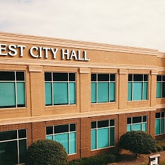
City of Stonecrest
Transit and Meeting Points
Useful pickup, handoff, or rendezvous points close to Gresham Park.
Peachtree Station
Gainesville
Flight Path Map
This map shows the direct air route between Raoul and Macon. Straight-line distance: 111.18 mi (178.93 km).
#1 Raoul
Census-designated place in Habersham County, Georgia
| Population | 2,558 |
| Coordinates | 34.4495400, -83.5943400 |
| Altitude | 433 |
| Country | United States |

#2 Macon
The second most populous city in Georgia.
| Population | 152,663 |
| Coordinates | 32.8406900, -83.6324000 |
| Altitude | 112 |
| Country | United States |
End: Mulberry Street (-83.632388, 32.840703)
Estimated Travel Time
Distance: 221 km by road
| Speed | Time |
|---|---|
| 30 mph (48.3 km/h) | 04h 34m |
| 40 mph (64.37 km/h) | 03h 26m |
| 50 mph (80.47 km/h) | 02h 45m |
| 60 mph (96.56 km/h) | 02h 17m |
| 70 mph (112.65 km/h) | 01h 57m |
| 80 mph (129 km/h) | 01h 42m |
Fuel, Round Trip and CO2
Estimated fuel cost and emissions for this route.
| Fuel | $/gal | One way | Round trip |
|---|---|---|---|
| Regular gas | $3.96 | $19.21 | $38.42 |
| Mid-grade | $4.43 | $21.48 | $42.96 |
| Premium | $4.78 | $23.17 | $46.35 |
| Diesel | $5.62 | $27.28 | $54.55 |
Assumes 8.3 L/100 km (about 28.3 MPG). CO2 is an estimate and varies by vehicle, fuel blend, traffic, and terrain.
Prices in Georgia · Aug 02, 2026
Distance to Other Cities
Planning a road trip? See the full trip guide on Trip.ovh — stops, fuel costs, weather, and departure timing.