How far is Randleman, NC from Raleigh, NC?
The driving distance from Randleman, NC to Raleigh, NC is about 74.9 miles (120.6 km), with a travel time of about 01h 24m by car.
- The straight-line flight distance is about 65.3 miles (105.1 km).
- For a round trip, plan for roughly 02h 49m of driving time before adding stops, traffic, or weather delays.
- A comfortable departure window is usually 8:00 AM to 10:00 AM EDT.
Reverse, save, or send this route
This route works well as a day trip with time at the destination. Copy the route link, send it to another device, or print a clean version before you head out.
This route works well as a day trip with time at the destination.
Flight Distance
Driving Distance
Gas Cost Calculator
Leave and Arrive Planner
Pick a departure time to see your estimated arrival and same-day return window.
Drive time stays fixed at 01h 24m.
A morning start gives you useful time at the destination and keeps the return out of the late evening.
You are leaving earlier than the recommended window, which gives you extra margin for breaks and traffic.
Halfway Point
A useful midpoint for breaks, coffee, or meeting in the middle.
Town in North Carolina, United States
Route Weather Snapshot
Check the forecast at both ends before you head out.
Slight Chance Rain Showers then Chance Showers And Thunderstorms
Partly Sunny then Chance Showers And Thunderstorms
Driving Route Map
The map below follows the saved road route between Randleman and Raleigh.
Turn-by-Turn Driving Directions
Step-by-step road directions between Randleman and Raleigh.
-
1
Start on North Main Street
1.3 mi · 3 min · North Main Street
-
2
Turn right onto New Salem Road
7.1 mi · 17 min · New Salem Road
-
3
Turn left onto NC Highway 22 North
1347 ft · 23 sec · NC Highway 22 North
-
4
Turn right onto Old Red Cross Road
2 mi · 5 min · Old Red Cross Road
-
5
At the end of the road, turn left onto Shiloh Road
35 m · 2 sec · Shiloh Road
-
6
Take the ramp straight
48 m · 8 sec
-
7
Turn right
17.2 mi · 20 min
-
8
Take the exit slight right toward US 64: Siler City, Pittsboro
1413 ft · 42 sec
-
9
Turn left
10.9 mi · 15 min
-
10
Keep slight left
26.9 mi · 35 min
-
11
Take the exit straight toward US 1 North, US 64 East: Raleigh
2623 ft · 1 min
-
12
Merge slight left onto Claude E. Pope Memorial Highway
5.4 mi · 6 min · Claude E. Pope Memorial Highway
-
13
Take the exit slight right toward Western Boulevard: NC State Univ, Cary
1683 ft · 41 sec
-
14
Keep slight right to continue on Western Boulevard: NC State Univ, Cary
136 m · 10 sec
-
15
Turn straight onto Western Boulevard
3.1 mi · 6 min · Western Boulevard
-
16
Continue on Martin Luther King Jr Boulevard
2789 ft · 1 min · Martin Luther King Jr Boulevard
-
17
Turn left onto South Wilmington Street
1048 ft · 43 sec · South Wilmington Street
-
18
Turn left onto East South Street
7 m · 1 sec · East South Street
-
19
Arrive at your destination
0 m · 1 sec · East South Street
Car Route Details
A richer read on the saved driving route between Randleman and Raleigh.
Interchange-aware route
The drive includes several ramps, exits, or merges, so checking the next few maneuvers before busy interchanges is useful.
US 64
Keep slight left
26.9 mi · 00h 35m
Route Summary
A quick read on whether this route feels easy, ambitious, or worth planning around.
A comfortable day-trip route
This route works well as a day trip. You can leave in the morning, spend meaningful time at the destination, and still return the same day.
Slight Chance Rain Showers then Chance Showers And Thunderstorms leaving Randleman and Partly Sunny then Chance Showers And Thunderstorms near Raleigh.
Trip Questions
Direct answers travelers usually want before committing to the drive.
How long does it take to drive from Randleman to Raleigh?
The road trip is about 74.9 miles (120.6 km) and usually takes 01h 24m in normal driving conditions.
Is this a same-day trip or an overnight route?
This route works well as a day trip. You can leave in the morning, spend meaningful time at the destination, and still return the same day.
What is the halfway point on this route?
Pittsboro is a useful midpoint, sitting about 38 miles from Randleman and 36.9 miles from Raleigh.
How much longer is the road route than the straight-line distance?
The direct path is about 65.3 miles (105.1 km), while the road route adds roughly 9.6 extra miles because roads do not follow the straight air line.
When is the best time to leave for this route?
A good departure window is usually 8:00 AM to 10:00 AM EDT. If you want a more comfortable same-day return, try to leave by 3:40 PM EDT.
How much will gas cost for this route?
Using about 28.3 MPG, regular gas is estimated at $10.46 one way or $20.91 round trip. Estimated CO2 is about 23.5 kg one way.
What should you check before leaving?
Before you leave, expect Slight Chance Rain Showers then Chance Showers And Thunderstorms around Randleman and Partly Sunny then Chance Showers And Thunderstorms near Raleigh.
Stop Ideas Near Pittsboro
Useful break, food, and waypoint ideas within about 15 miles of the route midpoint.
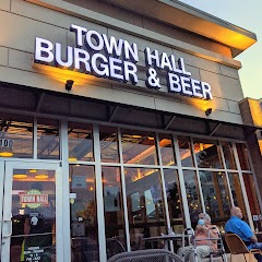
Town Hall Burger and Beer
Pittsboro Town Hall
Transit and Meeting Points
Useful pickup, handoff, or rendezvous points close to Pittsboro.
Cary
Durham
North Carolina State Fair station
Burlington
Flight Path Map
This map shows the direct air route between Randleman and Raleigh. Straight-line distance: 65.34 mi (105.15 km).

#1 Randleman
City in Randolph County, North Carolina, United States of America
| Population | 4,137 |
| Coordinates | 35.8179100, -79.8030900 |
| Altitude | 210 |
| Country | United States |

#2 Raleigh
The capital of North Carolina, Raleigh is a major center for business, government, and education.
| Population | 474,414 |
| Coordinates | 35.7721000, -78.6386100 |
| Altitude | 96 |
| Country | United States |
End: East South Street (-78.638606, 35.772148)
Estimated Travel Time
Distance: 121 km by road
| Speed | Time |
|---|---|
| 30 mph (48.3 km/h) | 02h 29m |
| 40 mph (64.37 km/h) | 01h 52m |
| 50 mph (80.47 km/h) | 01h 29m |
| 60 mph (96.56 km/h) | 01h 14m |
| 70 mph (112.65 km/h) | 01h 04m |
| 80 mph (129 km/h) | 00h 56m |
Fuel, Round Trip and CO2
Estimated fuel cost and emissions for this route.
| Fuel | $/gal | One way | Round trip |
|---|---|---|---|
| Regular gas | $3.96 | $10.46 | $20.91 |
| Mid-grade | $4.43 | $11.69 | $23.39 |
| Premium | $4.78 | $12.61 | $25.23 |
| Diesel | $5.62 | $14.85 | $29.69 |
Assumes 8.3 L/100 km (about 28.3 MPG). CO2 is an estimate and varies by vehicle, fuel blend, traffic, and terrain.
Prices in North Carolina · Jun 10, 2026
Distance to Other Cities
Planning a road trip? See the full trip guide on Trip.ovh — stops, fuel costs, weather, and departure timing.