How far is Raleigh, NC from Apex, NC?
Fastest route
The distance from Raleigh, North Carolina, to Apex, North Carolina, is approximately 13.8 miles (22.2 kilometers). The estimated travel time is 24 minutes. The route includes taking I-440 W and US-1 S via Western Blvd.
Directions
- Head north on S Wilmington St toward New Bern Pl.
- Turn left onto E Edenton St.
- Use any lane to turn slightly right onto Hillsborough St.
- At the traffic circle, take the 1st exit and stay on Hillsborough St.
- Turn right onto Western Blvd. Pass by Subway (on the right in 1.8 mi).
- Take the ramp on the left onto I-440 W.
- Take US-1 S to Center St. Take exit 96 from US-1 S.
- Take exit 96 for Ten Ten Rd.
- Follow Center St to N Salem St in Apex.
- Use the left 2 lanes to turn left onto Center St.
- Turn right onto N Salem St.
Tips & Suggestions
- 🚗 Plan your trip during off-peak hours to avoid heavy traffic.
- 📍 Keep your GPS or navigation app handy for real-time updates on the route.
- ⛽ Ensure your vehicle has enough fuel for the journey.
- 📱 Charge your phone before the trip in case you need to make calls or use maps.
- 🍴 Consider packing snacks and water for the ride, especially for longer journeys.
- 🚓 Obey traffic rules and speed limits for a safe and smooth trip.
- 🛣️ Stay alert for road signs and follow the directions to avoid missing turns.
Reverse, save, or send this route
This is an easy same-day return drive. Copy the route link, send it to another device, or print a clean version before you head out.
This is an easy same-day return drive.
Flight Distance
Driving Distance
Gas Cost Calculator
Leave and Arrive Planner
Pick a departure time to see your estimated arrival and same-day return window.
Drive time stays fixed at 00h 18m.
This is a short drive, so your comfort window is wide. Traffic and current weather matter more than the clock.
You are leaving earlier than the recommended window, which gives you extra margin for breaks and traffic.
Halfway Point
A useful midpoint for breaks, coffee, or meeting in the middle.
Town in North Carolina, United States
Route Weather Snapshot
Check the forecast at both ends before you head out.
Mostly Sunny then Chance Showers And Thunderstorms
Mostly Sunny then Chance Showers And Thunderstorms
Driving Route Map
The map below follows the saved road route between Raleigh and Apex.
Turn-by-Turn Driving Directions
Step-by-step road directions between Raleigh and Apex.
-
1
Start on East South Street
571 ft · 29 sec · East South Street
-
2
Turn left onto South Salisbury Street
955 ft · 33 sec · South Salisbury Street
-
3
Turn sharp right onto Martin Luther King Jr Boulevard
2691 ft · 57 sec · Martin Luther King Jr Boulevard
-
4
Continue on Western Boulevard
3.3 mi · 6 min · Western Boulevard
-
5
Take the ramp slight left
1727 ft · 42 sec
-
6
Merge slight left
7.9 mi · 10 min
-
7
Take the exit slight right toward Ten Ten Road
781 ft · 25 sec
-
8
Turn left onto Center Street
1.5 mi · 4 min · Center Street
-
9
At the end of the road, turn right onto North Salem Street
16 m · 2 sec · North Salem Street
-
10
Arrive at your destination
0 m · 1 sec · North Salem Street
Car Route Details
A richer read on the saved driving route between Raleigh and Apex.
Turn-heavy local drive
The route has frequent decision points for its length, so lane choice and turn timing will matter more than cruising speed.
Western Boulevard
Merge slight left
7.88 mi · 00h 10m
Route Summary
A quick read on whether this route feels easy, ambitious, or worth planning around.
A short regional drive
This route is short enough to handle as a quick errand, commute, or easy same-day return without much planning overhead.
Mostly Sunny then Chance Showers And Thunderstorms leaving Raleigh and Mostly Sunny then Chance Showers And Thunderstorms near Apex.
Trip Questions
Direct answers travelers usually want before committing to the drive.
How long does it take to drive from Raleigh to Apex?
The road trip is about 15.2 miles (24.5 km) and usually takes 00h 18m in normal driving conditions.
Is this a same-day trip or an overnight route?
This route is short enough to handle as a quick errand, commute, or easy same-day return without much planning overhead.
What is the halfway point on this route?
Cary is a useful midpoint, sitting about 7 miles from Raleigh and 8.3 miles from Apex.
How much longer is the road route than the straight-line distance?
The direct path is about 12.2 miles (19.6 km), while the road route adds roughly 3 extra miles because roads do not follow the straight air line.
When is the best time to leave for this route?
A good departure window is usually 7:00 AM to 7:00 PM EDT. If you want a more comfortable same-day return, try to leave by 7:52 PM EDT.
How much will gas cost for this route?
Using about 28.3 MPG, regular gas is estimated at $2.14 one way or $4.28 round trip. Estimated CO2 is about 4.8 kg one way.
What should you check before leaving?
Before you leave, expect Mostly Sunny then Chance Showers And Thunderstorms around Raleigh and Mostly Sunny then Chance Showers And Thunderstorms near Apex.
Stop Ideas Near Cary
Useful break, food, and waypoint ideas within about 15 miles of the route midpoint.
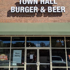
Town Hall Burger and Beer

Garner Town Hall

Kumon Math and Reading Center of Morrisville - Town Hall

Town of Cary
Transit and Meeting Points
Useful pickup, handoff, or rendezvous points close to Cary.
Cary
North Carolina State Fair station
Raleigh Union Station
Durham
Flight Path Map
This map shows the direct air route between Raleigh and Apex. Straight-line distance: 12.18 mi (19.6 km).

#1 Raleigh
The capital of North Carolina, Raleigh is a major center for business, government, and education.
| Population | 474,414 |
| Coordinates | 35.7721000, -78.6386100 |
| Altitude | 96 |
| Country | United States |

#2 Apex
The most populous city in Wake County, North Carolina.
| Population | 64,388 |
| Coordinates | 35.7326500, -78.8502900 |
| Altitude | 152 |
| Country | United States |
End: North Salem Street (-78.850246, 35.73263)
Estimated Travel Time
Distance: 25 km by road
| Speed | Time |
|---|---|
| 30 mph (48.3 km/h) | 00h 30m |
| 40 mph (64.37 km/h) | 00h 22m |
| 50 mph (80.47 km/h) | 00h 18m |
| 60 mph (96.56 km/h) | 00h 15m |
| 70 mph (112.65 km/h) | 00h 13m |
| 80 mph (129 km/h) | 00h 11m |
Fuel, Round Trip and CO2
Estimated fuel cost and emissions for this route.
| Fuel | $/gal | One way | Round trip |
|---|---|---|---|
| Regular gas | $3.96 | $2.14 | $4.28 |
| Mid-grade | $4.43 | $2.39 | $4.78 |
| Premium | $4.78 | $2.58 | $5.16 |
| Diesel | $5.62 | $3.04 | $6.07 |
Assumes 8.3 L/100 km (about 28.3 MPG). CO2 is an estimate and varies by vehicle, fuel blend, traffic, and terrain.
Prices in North Carolina · Jun 27, 2026
Distance to Other Cities
Planning a road trip? See the full trip guide on Trip.ovh — stops, fuel costs, weather, and departure timing.