How far is Perkiomen, PA from Bensalem, PA?
The driving distance from Perkiomen, PA to Bensalem, PA is about 36.3 miles (58.4 km), with a travel time of about 00h 39m by car.
- The straight-line flight distance is about 27 miles (43.4 km).
- For a round trip, plan for roughly 01h 19m of driving time before adding stops, traffic, or weather delays.
- A comfortable departure window is usually 7:00 AM to 7:00 PM EDT.
Reverse, save, or send this route
This is an easy same-day return drive. Copy the route link, send it to another device, or print a clean version before you head out.
This is an easy same-day return drive.
Flight Distance
Driving Distance
Gas Cost Calculator
Leave and Arrive Planner
Pick a departure time to see your estimated arrival and same-day return window.
Drive time stays fixed at 00h 39m.
This is a short drive, so your comfort window is wide. Traffic and current weather matter more than the clock.
This departure sits inside the recommended comfort window for the route.
Halfway Point
A useful midpoint for breaks, coffee, or meeting in the middle.
Township in Montgomery County, Pennsylvania
Route Weather Snapshot
Check the forecast at both ends before you head out.
Chance Rain Showers then Chance Showers And Thunderstorms
Chance Rain Showers then Chance Showers And Thunderstorms
Driving Route Map
The map below follows the saved road route between Perkiomen and Bensalem.
Turn-by-Turn Driving Directions
Step-by-step road directions between Perkiomen and Bensalem.
-
1
Start on Montgomery Avenue
5 m · 6 sec · Montgomery Avenue
-
2
Turn left onto Pennsylvania Avenue
845 ft · 42 sec · Pennsylvania Avenue
-
3
At the end of the road, turn left onto Oakland Avenue
78 m · 13 sec · Oakland Avenue
-
4
Turn right onto Egypt Road
2551 ft · 1 min · Egypt Road
-
5
Take the ramp right toward US 422 East
2157 ft · 53 sec
-
6
Merge slight left onto Pottstown Expressway
3 mi · 4 min · Pottstown Expressway
-
7
Continue on County Line Expressway
2.2 mi · 3 min · County Line Expressway
-
8
Keep slight left to continue on US 202 North, I 76 West, I 76 East: Turnpike, King of Prussia, Philadelphia
1156 ft · 28 sec
-
9
Keep slight left to continue on US 202 North: King of Prussia
2230 ft · 54 sec
-
10
Merge slight left
2395 ft · 37 sec
-
11
Take the exit slight right toward I 76 West: New Jersey, Harrisburg
1814 ft · 41 sec
-
12
Keep slight left to continue on Mall Boulevard
1331 ft · 21 sec
-
13
Keep slight left to continue on I 76 West: New Jersey, Harrisburg
533 ft · 8 sec
-
14
Merge slight left onto Schuylkill Expressway
2317 ft · 53 sec · Schuylkill Expressway
-
15
Keep slight right to continue on I 276 East: Allentown, New York City
1255 ft · 43 sec
-
16
Merge slight left onto Pennsylvania Turnpike
25.2 mi · 27 min · Pennsylvania Turnpike
-
17
Take the exit slight right toward PA 132: Street Road
2148 ft · 55 sec
-
18
Turn left onto Street Road
1.7 mi · 3 min · Street Road
-
19
Turn right onto Knights Road
80 m · 9 sec · Knights Road
-
20
Turn right
41 m · 10 sec
-
21
Arrive at your destination
0 m · 1 sec
Car Route Details
A richer read on the saved driving route between Perkiomen and Bensalem.
Highway-focused drive
Most of the mileage stays on named highways, so the important moments are ramps, exits, merges, and the final local approach.
Pennsylvania Turnpike
Merge slight left onto Pennsylvania Turnpike
25.2 mi · 00h 27m
Route Summary
A quick read on whether this route feels easy, ambitious, or worth planning around.
A short regional drive
This route is short enough to handle as a quick errand, commute, or easy same-day return without much planning overhead.
Chance Rain Showers then Chance Showers And Thunderstorms leaving Perkiomen and Chance Rain Showers then Chance Showers And Thunderstorms near Bensalem.
Trip Questions
Direct answers travelers usually want before committing to the drive.
How long does it take to drive from Perkiomen to Bensalem?
The road trip is about 36.3 miles (58.4 km) and usually takes 00h 39m in normal driving conditions.
Is this a same-day trip or an overnight route?
This route is short enough to handle as a quick errand, commute, or easy same-day return without much planning overhead.
What is the halfway point on this route?
Whitemarsh is a useful midpoint, sitting about 18.1 miles from Perkiomen and 18.3 miles from Bensalem.
How much longer is the road route than the straight-line distance?
The direct path is about 27 miles (43.4 km), while the road route adds roughly 9.3 extra miles because roads do not follow the straight air line.
When is the best time to leave for this route?
A good departure window is usually 7:00 AM to 7:00 PM EDT. If you want a more comfortable same-day return, try to leave by 7:10 PM EDT.
How much will gas cost for this route?
Using about 28.3 MPG, regular gas is estimated at $5.23 one way or $10.46 round trip. Estimated CO2 is about 11.4 kg one way.
What should you check before leaving?
Before you leave, expect Chance Rain Showers then Chance Showers And Thunderstorms around Perkiomen and Chance Rain Showers then Chance Showers And Thunderstorms near Bensalem.
Stop Ideas Near Whitemarsh
Useful break, food, and waypoint ideas within about 15 miles of the route midpoint.

Bluestone Lane City Hall Coffee Shop

Dilworth Park
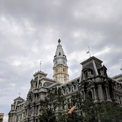
Philadelphia Marriage License

City Hall
Transit and Meeting Points
Useful pickup, handoff, or rendezvous points close to Whitemarsh.
Ardmore
North Philadelphia station
30th Street Station
Pennsauken, NJ
Flight Path Map
This map shows the direct air route between Perkiomen and Bensalem. Straight-line distance: 26.98 mi (43.42 km).

#1 Perkiomen
Township in Montgomery County, Pennsylvania
| Population | 9,134 |
| Coordinates | 40.1309400, -75.4607400 |
| Altitude | 35 |
| Country | United States |

#2 Bensalem
Township in Bucks County, Pennsylvania, United States
| Population | 60,491 |
| Coordinates | 40.1045500, -74.9512800 |
| Altitude | 30 |
| Country | United States |
End: (-74.951388, 40.104613)
Estimated Travel Time
Distance: 58 km by road
| Speed | Time |
|---|---|
| 30 mph (48.3 km/h) | 01h 12m |
| 40 mph (64.37 km/h) | 00h 54m |
| 50 mph (80.47 km/h) | 00h 43m |
| 60 mph (96.56 km/h) | 00h 36m |
| 70 mph (112.65 km/h) | 00h 31m |
| 80 mph (129 km/h) | 00h 27m |
Fuel, Round Trip and CO2
Estimated fuel cost and emissions for this route.
| Fuel | $/gal | One way | Round trip |
|---|---|---|---|
| Regular gas | $4.09 | $5.23 | $10.46 |
| Mid-grade | $4.60 | $5.89 | $11.77 |
| Premium | $4.95 | $6.34 | $12.68 |
| Diesel | $5.98 | $7.65 | $15.31 |
Assumes 8.3 L/100 km (about 28.3 MPG). CO2 is an estimate and varies by vehicle, fuel blend, traffic, and terrain.
Prices in Pennsylvania · Jun 10, 2026
Distance to Other Cities
Planning a road trip? See the full trip guide on Trip.ovh — stops, fuel costs, weather, and departure timing.