How far is Peoria, IL from Rushville, IL?
The driving distance from Peoria, IL to Rushville, IL is about 72.8 miles (117.1 km), with a travel time of about 01h 44m by car.
- The straight-line flight distance is about 64.7 miles (104.2 km).
- For a round trip, plan for roughly 03h 29m of driving time before adding stops, traffic, or weather delays.
- A comfortable departure window is usually 8:00 AM to 10:00 AM CDT.
Reverse, save, or send this route
This route works well as a day trip with time at the destination. Copy the route link, send it to another device, or print a clean version before you head out.
This route works well as a day trip with time at the destination.
Flight Distance
Driving Distance
Gas Cost Calculator
Leave and Arrive Planner
Pick a departure time to see your estimated arrival and same-day return window.
Drive time stays fixed at 01h 44m.
A morning start gives you useful time at the destination and keeps the return out of the late evening.
You are leaving earlier than the recommended window, which gives you extra margin for breaks and traffic.
Halfway Point
A useful midpoint for breaks, coffee, or meeting in the middle.
High school in Lewistown, Fulton County, Illinois
Route Weather Snapshot
Check the forecast at both ends before you head out.
Mostly Sunny then Chance Showers And Thunderstorms
Sunny then Chance Showers And Thunderstorms
Driving Route Map
The map below follows the saved road route between Peoria and Rushville.
Turn-by-Turn Driving Directions
Step-by-step road directions between Peoria and Rushville.
-
1
Start on Northeast Jefferson Avenue
535 ft · 15 sec · Northeast Jefferson Avenue
-
2
Continue on Southwest Jefferson Avenue
2.3 mi · 4 min · Southwest Jefferson Avenue
-
3
Turn left onto South Western Avenue
531 ft · 13 sec · South Western Avenue
-
4
Turn right onto Southwest Adams Street
1.2 mi · 2 min · Southwest Adams Street
-
5
Continue on Southwest Adams Street
566 ft · 7 sec · Southwest Adams Street
-
6
Continue straight
19.1 mi · 24 min
-
7
Turn left
39 m · 5 sec
-
8
Continue on West Valley View Drive
1061 ft · 18 sec · West Valley View Drive
-
9
Continue on United States Highway 24
16.9 mi · 25 min · United States Highway 24
-
10
Turn left onto South Main Street
4.6 mi · 7 min · South Main Street
-
11
Continue straight
28.1 mi · 42 min
-
12
Turn left onto West Washington Street
37 m · 5 sec · West Washington Street
-
13
Arrive at your destination
0 m · 1 sec · West Washington Street
Car Route Details
A richer read on the saved driving route between Peoria and Rushville.
Straightforward drive
The saved road route has a manageable number of maneuvers and should be easy to follow with normal attention to signs.
South Main Street
Continue straight
28.1 mi · 00h 42m
Route Summary
A quick read on whether this route feels easy, ambitious, or worth planning around.
A comfortable day-trip route
This route works well as a day trip. You can leave in the morning, spend meaningful time at the destination, and still return the same day.
Mostly Sunny then Chance Showers And Thunderstorms leaving Peoria and Sunny then Chance Showers And Thunderstorms near Rushville.
Trip Questions
Direct answers travelers usually want before committing to the drive.
How long does it take to drive from Peoria to Rushville?
The road trip is about 72.8 miles (117.1 km) and usually takes 01h 44m in normal driving conditions.
Is this a same-day trip or an overnight route?
This route works well as a day trip. You can leave in the morning, spend meaningful time at the destination, and still return the same day.
What is the halfway point on this route?
Lewistown is a useful midpoint, sitting about 36.4 miles from Peoria and 36.4 miles from Rushville.
How much longer is the road route than the straight-line distance?
The direct path is about 64.7 miles (104.2 km), while the road route adds roughly 8.1 extra miles because roads do not follow the straight air line.
When is the best time to leave for this route?
A good departure window is usually 8:00 AM to 10:00 AM CDT. If you want a more comfortable same-day return, try to leave by 3:00 PM CDT.
How much will gas cost for this route?
Using about 28.3 MPG, regular gas is estimated at $9.69 one way or $19.38 round trip. Estimated CO2 is about 22.8 kg one way.
What should you check before leaving?
Before you leave, expect Mostly Sunny then Chance Showers And Thunderstorms around Peoria and Sunny then Chance Showers And Thunderstorms near Rushville.
Stop Ideas Near Lewistown
Useful break, food, and waypoint ideas within about 15 miles of the route midpoint.
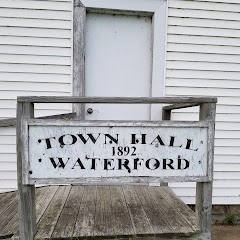
Waterford Town Hall

Lewistown City Hall
Havana Water Works Clerk
Transit and Meeting Points
Useful pickup, handoff, or rendezvous points close to Lewistown.
Macomb
Peoria, Illinois
Galesburg station
Lincoln
Flight Path Map
This map shows the direct air route between Peoria and Rushville. Straight-line distance: 64.74 mi (104.19 km).

#1 Peoria
The third most populous city in Illinois.
| Population | 109,428 |
| Coordinates | 40.6936500, -89.5889900 |
| Altitude | 153 |
| Country | United States |

#2 Rushville
Township in Schuyler County, Illinois
| Population | 2,822 |
| Coordinates | 40.1211600, -90.5631800 |
| Altitude | 205 |
| Country | United States |
End: Rushville (-90.56318, 40.12116)
Estimated Travel Time
Distance: 117 km by road
| Speed | Time |
|---|---|
| 30 mph (48.3 km/h) | 02h 25m |
| 40 mph (64.37 km/h) | 01h 49m |
| 50 mph (80.47 km/h) | 01h 27m |
| 60 mph (96.56 km/h) | 01h 12m |
| 70 mph (112.65 km/h) | 01h 02m |
| 80 mph (129 km/h) | 00h 54m |
Fuel, Round Trip and CO2
Estimated fuel cost and emissions for this route.
| Fuel | $/gal | One way | Round trip |
|---|---|---|---|
| Regular gas | $3.77 | $9.69 | $19.38 |
| Mid-grade | $4.25 | $10.93 | $21.86 |
| Premium | $4.65 | $11.96 | $23.92 |
| Diesel | $5.30 | $13.63 | $27.26 |
Assumes 8.3 L/100 km (about 28.3 MPG). CO2 is an estimate and varies by vehicle, fuel blend, traffic, and terrain.
Prices in Illinois · Jul 28, 2026
Distance to Other Cities
Planning a road trip? See the full trip guide on Trip.ovh — stops, fuel costs, weather, and departure timing.