How far is Pearson, GA from Savannah, GA?
The driving distance from Pearson, GA to Savannah, GA is about 154.5 miles (248.7 km), with a travel time of about 02h 36m by car.
- The straight-line flight distance is about 116.4 miles (187.4 km).
- For a round trip, plan for roughly 05h 12m of driving time before adding stops, traffic, or weather delays.
- A comfortable departure window is usually 8:00 AM to 10:00 AM EDT.
Reverse, save, or send this route
This route works well as a day trip with time at the destination. Copy the route link, send it to another device, or print a clean version before you head out.
This route works well as a day trip with time at the destination.
Flight Distance
Driving Distance
Gas Cost Calculator
Leave and Arrive Planner
Pick a departure time to see your estimated arrival and same-day return window.
Drive time stays fixed at 02h 36m.
A morning start gives you useful time at the destination and keeps the return out of the late evening.
You are leaving earlier than the recommended window, which gives you extra margin for breaks and traffic.
Halfway Point
A useful midpoint for breaks, coffee, or meeting in the middle.
Census-designated place in Glynn County, Georgia
Route Weather Snapshot
Check the forecast at both ends before you head out.
Partly Sunny then Chance Showers And Thunderstorms
Mostly Sunny then Showers And Thunderstorms Likely
Driving Route Map
The map below follows the saved road route between Pearson and Savannah.
Turn-by-Turn Driving Directions
Step-by-step road directions between Pearson and Savannah.
-
1
Start on West Albany Avenue
2.6 mi · 3 min · West Albany Avenue
-
2
Continue straight
25.3 mi · 30 min
-
3
Turn left onto Carswell Avenue
3.7 mi · 7 min · Carswell Avenue
-
4
Continue on Memorial Drive
1.1 mi · 2 min · Memorial Drive
-
5
Turn straight
140 m · 21 sec
-
6
Merge slight right onto Reynolds Street
664 ft · 13 sec · Reynolds Street
-
7
Continue on Brunswick Highway
23.5 mi · 31 min · Brunswick Highway
-
8
Continue straight
4.8 mi · 6 min
-
9
Continue straight
8.4 mi · 12 min
-
10
Continue straight
3 mi · 4 min
-
11
Turn left
13 mi · 18 min
-
12
Enter the roundabout and take exit 2 toward the route
37 m · 2 sec
-
13
Exit the roundabout
2.4 mi · 3 min
-
14
Enter the roundabout and take exit 2 toward the route
46 m · 5 sec
-
15
Exit the roundabout
1665 ft · 27 sec
-
16
Enter the roundabout and take exit 2 toward I 95 North: Savannah
55 m · 3 sec
-
17
Exit the roundabout onto I 95 North: Savannah
2402 ft · 59 sec
-
18
Merge slight left
55.2 mi · 59 min
-
19
Keep slight right
839 ft · 13 sec
-
20
Take the exit slight right toward I 16 East: Savannah
3145 ft · 41 sec
-
21
Merge slight left onto Jim Gillis Historic Savannah Parkway
7.7 mi · 9 min · Jim Gillis Historic Savannah Parkway
-
22
Keep slight left to continue on Jim Gillis Historic Savannah Parkway
3222 ft · 53 sec · Jim Gillis Historic Savannah Parkway
-
23
Keep slight right to continue on Martin Luther King Junior Boulevard
680 ft · 24 sec
-
24
Turn left onto Martin Luther King Junior Boulevard
1.3 km · 2 min · Martin Luther King Junior Boulevard
-
25
Turn left onto West Bay Street
1124 ft · 22 sec · West Bay Street
-
26
Turn uturn
36 m · 12 sec
-
27
Arrive at your destination
0 m · 1 sec
Car Route Details
A richer read on the saved driving route between Pearson and Savannah.
Highway-focused drive
Most of the mileage stays on named highways, so the important moments are ramps, exits, merges, and the final local approach.
I 95 North
Merge slight left
55.2 mi · 00h 59m
Route Summary
A quick read on whether this route feels easy, ambitious, or worth planning around.
A comfortable day-trip route
This route works well as a day trip. You can leave in the morning, spend meaningful time at the destination, and still return the same day.
Partly Sunny then Chance Showers And Thunderstorms leaving Pearson and Mostly Sunny then Showers And Thunderstorms Likely near Savannah.
Trip Questions
Direct answers travelers usually want before committing to the drive.
How long does it take to drive from Pearson to Savannah?
The road trip is about 154.5 miles (248.7 km) and usually takes 02h 36m in normal driving conditions.
Is this a same-day trip or an overnight route?
This route works well as a day trip. You can leave in the morning, spend meaningful time at the destination, and still return the same day.
What is the halfway point on this route?
Dock Junction is a useful midpoint, sitting about 77.1 miles from Pearson and 77.5 miles from Savannah.
How much longer is the road route than the straight-line distance?
The direct path is about 116.4 miles (187.4 km), while the road route adds roughly 38.1 extra miles because roads do not follow the straight air line.
When is the best time to leave for this route?
A good departure window is usually 8:00 AM to 10:00 AM EDT. If you want a more comfortable same-day return, try to leave by 1:18 PM EDT.
How much will gas cost for this route?
Using about 28.3 MPG, regular gas is estimated at $21.59 one way or $43.17 round trip. Estimated CO2 is about 48.4 kg one way.
What should you check before leaving?
Before you leave, expect Partly Sunny then Chance Showers And Thunderstorms around Pearson and Mostly Sunny then Showers And Thunderstorms Likely near Savannah.
Stop Ideas Near Dock Junction
Useful break, food, and waypoint ideas within about 15 miles of the route midpoint.

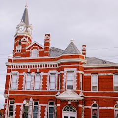
Historic Brunswick Courthouse
Brunswick Old City Hall

Brunswick Housing Authority
Transit and Meeting Points
Useful pickup, handoff, or rendezvous points close to Dock Junction.
Jesup
Jacksonville
Savannah
Flight Path Map
This map shows the direct air route between Pearson and Savannah. Straight-line distance: 116.46 mi (187.43 km).

#1 Pearson
City in Atkinson County, Georgia, USA
| Population | 2,089 |
| Coordinates | 31.2977000, -82.8523700 |
| Altitude | 62 |
| Country | United States |

#2 Savannah
The second most populous city in Georgia.
| Population | 143,632 |
| Coordinates | 32.0835400, -81.0998300 |
| Altitude | 6 |
| Country | United States |
End: (-81.099864, 32.083447)
Estimated Travel Time
Distance: 249 km by road
| Speed | Time |
|---|---|
| 30 mph (48.3 km/h) | 05h 08m |
| 40 mph (64.37 km/h) | 03h 51m |
| 50 mph (80.47 km/h) | 03h 05m |
| 60 mph (96.56 km/h) | 02h 34m |
| 70 mph (112.65 km/h) | 02h 12m |
| 80 mph (129 km/h) | 01h 55m |
Fuel, Round Trip and CO2
Estimated fuel cost and emissions for this route.
| Fuel | $/gal | One way | Round trip |
|---|---|---|---|
| Regular gas | $3.96 | $21.59 | $43.17 |
| Mid-grade | $4.43 | $24.14 | $48.28 |
| Premium | $4.78 | $26.04 | $52.08 |
| Diesel | $5.62 | $30.65 | $61.30 |
Assumes 8.3 L/100 km (about 28.3 MPG). CO2 is an estimate and varies by vehicle, fuel blend, traffic, and terrain.
Prices in Georgia · Jul 14, 2026
Distance to Other Cities
Planning a road trip? See the full trip guide on Trip.ovh — stops, fuel costs, weather, and departure timing.