How far is Parkersburg, WV from Brush Fork, WV?
The driving distance from Parkersburg, WV to Brush Fork, WV is about 184.4 miles (296.7 km), with a travel time of about 03h 34m by car.
- The straight-line flight distance is about 138.2 miles (222.4 km).
- For a round trip, plan for roughly 07h 08m of driving time before adding stops, traffic, or weather delays.
- A comfortable departure window is usually 6:00 AM to 8:00 AM EDT.
Reverse, save, or send this route
This drive is better planned with a longer stop or an overnight stay. Copy the route link, send it to another device, or print a clean version before you head out.
This drive is better planned with a longer stop or an overnight stay.
Flight Distance
Driving Distance
Gas Cost Calculator
Leave and Arrive Planner
Pick a departure time to see your estimated arrival and same-day return window.
Drive time stays fixed at 03h 34m.
An early departure helps you fit a real stop into the day without turning the return into a late-night drive.
You are leaving earlier than the recommended window, which gives you extra margin for breaks and traffic.
Halfway Point
A useful midpoint for breaks, coffee, or meeting in the middle.
Town in Kanawha County, West Virginia, United States
Route Weather Snapshot
Check the forecast at both ends before you head out.
Slight Chance Rain Showers then Partly Cloudy
Slight Chance Rain Showers
Driving Route Map
The map below follows the saved road route between Parkersburg and Brush Fork.
Turn-by-Turn Driving Directions
Step-by-step road directions between Parkersburg and Brush Fork.
-
1
Start on Juliana Street
137 m · 22 sec · Juliana Street
-
2
Turn right onto 6th Street
1268 ft · 51 sec · 6th Street
-
3
At the end of the road, turn right onto Green Street
111 m · 20 sec · Green Street
-
4
Turn left onto 5th Street
1.1 km · 2 min · 5th Street
-
5
Turn left onto Camden Avenue
1.3 km · 1 min · Camden Avenue
-
6
Continue on West Virginia Route 95
1.9 mi · 3 min · West Virginia Route 95
-
7
Take the ramp straight toward I 77, WV 2: Charleston
1165 ft · 29 sec
-
8
Merge slight left
163.6 mi · 3 hr 2 min
-
9
Take the exit slight right toward US 460: Princeton, Pearisburg VA
2374 ft · 1 min
-
10
Turn right onto Big Laurel Highway
9.9 mi · 12 min · Big Laurel Highway
-
11
Turn right onto Chicory Road
3.5 mi · 6 min · Chicory Road
-
12
Continue on Bluefield Avenue
3054 ft · 59 sec · Bluefield Avenue
-
13
Turn left onto Spruce Street
112 m · 8 sec · Spruce Street
-
14
Turn right onto Highland Avenue
782 ft · 16 sec · Highland Avenue
-
15
Turn right
1.6 mi · 2 min
-
16
Turn left onto Brushfork Road
1094 ft · 28 sec · Brushfork Road
-
17
Turn left onto Charcoal Street
637 ft · 35 sec · Charcoal Street
-
18
At the end of the road, turn left onto Old Bramwell Road
1048 ft · 29 sec · Old Bramwell Road
-
19
Arrive at your destination
0 m · 1 sec · Old Bramwell Road
Car Route Details
A richer read on the saved driving route between Parkersburg and Brush Fork.
Highway-focused drive
Most of the mileage stays on named highways, so the important moments are ramps, exits, merges, and the final local approach.
I 77
Merge slight left
164 mi · 03h 02m
Route Summary
A quick read on whether this route feels easy, ambitious, or worth planning around.
A longer out-and-back drive
This is still possible in one day, but it becomes a long driving day. Leaving early and planning your stop window matters more here.
Slight Chance Rain Showers then Partly Cloudy leaving Parkersburg and Slight Chance Rain Showers near Brush Fork.
Trip Questions
Direct answers travelers usually want before committing to the drive.
How long does it take to drive from Parkersburg to Brush Fork?
The road trip is about 184.4 miles (296.7 km) and usually takes 03h 34m in normal driving conditions.
Is this a same-day trip or an overnight route?
This is still possible in one day, but it becomes a long driving day. Leaving early and planning your stop window matters more here.
What is the halfway point on this route?
Chesapeake is a useful midpoint, sitting about 92.2 miles from Parkersburg and 92.1 miles from Brush Fork.
How much longer is the road route than the straight-line distance?
The direct path is about 138.2 miles (222.4 km), while the road route adds roughly 46.2 extra miles because roads do not follow the straight air line.
When is the best time to leave for this route?
A good departure window is usually 6:00 AM to 8:00 AM EDT. If you want a more comfortable same-day return, try to leave by 9:52 AM EDT.
How much will gas cost for this route?
Using about 28.3 MPG, regular gas is estimated at $25.75 one way or $51.49 round trip. Estimated CO2 is about 57.8 kg one way.
What should you check before leaving?
Before you leave, expect Slight Chance Rain Showers then Partly Cloudy around Parkersburg and Slight Chance Rain Showers near Brush Fork.
Stop Ideas Near Chesapeake
Useful break, food, and waypoint ideas within about 15 miles of the route midpoint.

Parks and Recreation

Kanawha County Magistrate Court
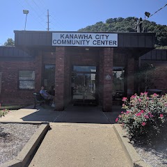
Kanawha City Community Center

Belle City Offices
Transit and Meeting Points
Useful pickup, handoff, or rendezvous points close to Chesapeake.
Charleston
Montgomery
Thurmond
Prince
Flight Path Map
This map shows the direct air route between Parkersburg and Brush Fork. Straight-line distance: 138.2 mi (222.41 km).

#1 Parkersburg
City in and county seat of Wood County, West Virginia
| Population | 29,009 |
| Coordinates | 39.2667400, -81.5615100 |
| Altitude | 187 |
| Country | United States |
#2 Brush Fork
Brush Fork is a place in West Virginia, United States.
| Population | 0 |
| Coordinates | 37.2809500, -81.2559300 |
| Altitude | 733 |
| Country | United States |
End: Brush Fork (-81.25593, 37.28095)
Estimated Travel Time
Distance: 297 km by road
| Speed | Time |
|---|---|
| 30 mph (48.3 km/h) | 06h 08m |
| 40 mph (64.37 km/h) | 04h 36m |
| 50 mph (80.47 km/h) | 03h 41m |
| 60 mph (96.56 km/h) | 03h 04m |
| 70 mph (112.65 km/h) | 02h 38m |
| 80 mph (129 km/h) | 02h 17m |
Fuel, Round Trip and CO2
Estimated fuel cost and emissions for this route.
| Fuel | $/gal | One way | Round trip |
|---|---|---|---|
| Regular gas | $3.96 | $25.75 | $51.49 |
| Mid-grade | $4.43 | $28.79 | $57.58 |
| Premium | $4.78 | $31.06 | $62.11 |
| Diesel | $5.62 | $36.56 | $73.11 |
Assumes 8.3 L/100 km (about 28.3 MPG). CO2 is an estimate and varies by vehicle, fuel blend, traffic, and terrain.
Prices in West Virginia · Apr 14, 2026
Distance to Other Cities
Planning a road trip? See the full trip guide on Trip.ovh — stops, fuel costs, weather, and departure timing.