How far is Monroeville, OH from Youngstown, OH?
The driving distance from Monroeville, OH to Youngstown, OH is about 124.6 miles (200.5 km), with a travel time of about 02h 02m by car.
- The straight-line flight distance is about 106.9 miles (172.1 km).
- For a round trip, plan for roughly 04h 05m of driving time before adding stops, traffic, or weather delays.
- A comfortable departure window is usually 8:00 AM to 10:00 AM EDT.
Reverse, save, or send this route
This route works well as a day trip with time at the destination. Copy the route link, send it to another device, or print a clean version before you head out.
This route works well as a day trip with time at the destination.
Flight Distance
Driving Distance
Gas Cost Calculator
Leave and Arrive Planner
Pick a departure time to see your estimated arrival and same-day return window.
Drive time stays fixed at 02h 02m.
A morning start gives you useful time at the destination and keeps the return out of the late evening.
This departure sits inside the recommended comfort window for the route.
Halfway Point
A useful midpoint for breaks, coffee, or meeting in the middle.
City in the state of Ohio, United States
Route Weather Snapshot
Check the forecast at both ends before you head out.
Slight Chance Showers And Thunderstorms then Chance Showers And Thunderstorms
Chance Showers And Thunderstorms
Driving Route Map
The map below follows the saved road route between Monroeville and Youngstown.
Turn-by-Turn Driving Directions
Step-by-step road directions between Monroeville and Youngstown.
-
1
Start on Hollister Street
99 m · 17 sec · Hollister Street
-
2
Turn right onto Main Street
88 m · 17 sec · Main Street
-
3
Turn left onto Milan Street
1103 ft · 32 sec · Milan Street
-
4
Continue on River Road
2588 ft · 1 min · River Road
-
5
Turn right onto Washington Road
2.7 mi · 6 min · Washington Road
-
6
Continue on West Washington Street
1 km · 2 min · West Washington Street
-
7
Turn left onto Whittlesey Avenue
2.9 mi · 5 min · Whittlesey Avenue
-
8
Continue on Shaw Mill Road
1 mi · 2 min · Shaw Mill Road
-
9
Turn left
2.1 mi · 3 min
-
10
Take the exit slight right
1049 ft · 26 sec
-
11
Continue straight
1100 ft · 27 sec
-
12
Keep slight left
2656 ft · 1 min
-
13
Merge slight left onto Ohio Turnpike
23.3 mi · 25 min · Ohio Turnpike
-
14
Keep slight left to continue on Ohio Turnpike
9.2 mi · 10 min · Ohio Turnpike
-
15
Keep slight left to continue on Ohio Turnpike
67.1 mi · 1 hr 12 min · Ohio Turnpike
-
16
Take the exit slight right toward I 80 East
1.4 km · 2 min
-
17
Keep slight left to continue on I 80 East, CR 18: Youngstown, Mahoning Avenue
1328 ft · 32 sec
-
18
Keep slight left to continue on I 80 East: Youngstown
4.5 mi · 6 min
-
19
Keep slight right to continue on I 680: Youngstown
5.9 mi · 8 min
-
20
Take the exit slight right
1304 ft · 39 sec
-
21
Turn sharp left onto Market Street
3144 ft · 59 sec · Market Street
-
22
Keep slight right to continue on Central Square
38 m · 2 sec · Central Square
-
23
Arrive at your destination
0 m · 1 sec · Central Square
Car Route Details
A richer read on the saved driving route between Monroeville and Youngstown.
Highway-focused drive
Most of the mileage stays on named highways, so the important moments are ramps, exits, merges, and the final local approach.
Ohio Turnpike
Keep slight left to continue on Ohio Turnpike
67.1 mi · 01h 12m
Route Summary
A quick read on whether this route feels easy, ambitious, or worth planning around.
A comfortable day-trip route
This route works well as a day trip. You can leave in the morning, spend meaningful time at the destination, and still return the same day.
Slight Chance Showers And Thunderstorms then Chance Showers And Thunderstorms leaving Monroeville and Chance Showers And Thunderstorms near Youngstown.
Trip Questions
Direct answers travelers usually want before committing to the drive.
How long does it take to drive from Monroeville to Youngstown?
The road trip is about 124.6 miles (200.5 km) and usually takes 02h 02m in normal driving conditions.
Is this a same-day trip or an overnight route?
This route works well as a day trip. You can leave in the morning, spend meaningful time at the destination, and still return the same day.
What is the halfway point on this route?
Broadview Heights is a useful midpoint, sitting about 61.4 miles from Monroeville and 63.2 miles from Youngstown.
How much longer is the road route than the straight-line distance?
The direct path is about 106.9 miles (172.1 km), while the road route adds roughly 17.7 extra miles because roads do not follow the straight air line.
When is the best time to leave for this route?
A good departure window is usually 8:00 AM to 10:00 AM EDT. If you want a more comfortable same-day return, try to leave by 2:24 PM EDT.
How much will gas cost for this route?
Using about 28.3 MPG, regular gas is estimated at $16.30 one way or $32.60 round trip. Estimated CO2 is about 39.1 kg one way.
What should you check before leaving?
Before you leave, expect Slight Chance Showers And Thunderstorms then Chance Showers And Thunderstorms around Monroeville and Chance Showers And Thunderstorms near Youngstown.
Stop Ideas Near Broadview Heights
Useful break, food, and waypoint ideas within about 15 miles of the route midpoint.

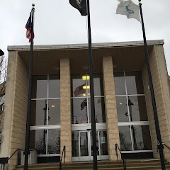
Cleveland City Hall
Parma City Hall
Brunswick City Hall Recreation
Transit and Meeting Points
Useful pickup, handoff, or rendezvous points close to Broadview Heights.
Cleveland Lakefront station
Elyria
Alliance
Sandusky
Flight Path Map
This map shows the direct air route between Monroeville and Youngstown. Straight-line distance: 106.91 mi (172.06 km).
#1 Monroeville
Human settlement in Huron County, Ohio, United States of America
| Population | 1,339 |
| Coordinates | 41.2442200, -82.6962900 |
| Altitude | 216 |
| Country | United States |

#2 Youngstown
The most populous city in Mahoning County, Ohio.
| Population | 63,828 |
| Coordinates | 41.0997800, -80.6495200 |
| Altitude | 259 |
| Country | United States |
End: Central Square (-80.649441, 41.09972)
Estimated Travel Time
Distance: 201 km by road
| Speed | Time |
|---|---|
| 30 mph (48.3 km/h) | 04h 09m |
| 40 mph (64.37 km/h) | 03h 06m |
| 50 mph (80.47 km/h) | 02h 29m |
| 60 mph (96.56 km/h) | 02h 04m |
| 70 mph (112.65 km/h) | 01h 46m |
| 80 mph (129 km/h) | 01h 33m |
Fuel, Round Trip and CO2
Estimated fuel cost and emissions for this route.
| Fuel | $/gal | One way | Round trip |
|---|---|---|---|
| Regular gas | $3.71 | $16.30 | $32.60 |
| Mid-grade | $4.24 | $18.66 | $37.33 |
| Premium | $4.79 | $21.08 | $42.15 |
| Diesel | $4.30 | $18.94 | $37.88 |
Assumes 8.3 L/100 km (about 28.3 MPG). CO2 is an estimate and varies by vehicle, fuel blend, traffic, and terrain.
Prices in Ohio · Jun 10, 2026
Distance to Other Cities
Planning a road trip? See the full trip guide on Trip.ovh — stops, fuel costs, weather, and departure timing.