How far is Mission Canyon, CA from Los Angeles, CA?
The driving distance from Mission Canyon, CA to Los Angeles, CA is about 100.7 miles (162 km), with a travel time of about 02h 05m by car.
- The straight-line flight distance is about 88.3 miles (142.1 km).
- For a round trip, plan for roughly 04h 10m of driving time before adding stops, traffic, or weather delays.
- A comfortable departure window is usually 8:00 AM to 10:00 AM PDT.
Reverse, save, or send this route
This route works well as a day trip with time at the destination. Copy the route link, send it to another device, or print a clean version before you head out.
This route works well as a day trip with time at the destination.
Flight Distance
Driving Distance
Gas Cost Calculator
Leave and Arrive Planner
Pick a departure time to see your estimated arrival and same-day return window.
Drive time stays fixed at 02h 05m.
A morning start gives you useful time at the destination and keeps the return out of the late evening.
You are leaving earlier than the recommended window, which gives you extra margin for breaks and traffic.
Halfway Point
A useful midpoint for breaks, coffee, or meeting in the middle.
The most populous city in Ventura County, California.
Route Weather Snapshot
Check the forecast at both ends before you head out.
Patchy Fog
Mostly Sunny
Driving Route Map
The map below follows the saved road route between Mission Canyon and Los Angeles.
Turn-by-Turn Driving Directions
Step-by-step road directions between Mission Canyon and Los Angeles.
-
1
Start on Dorking Place
80 m · 18 sec · Dorking Place
-
2
Turn right onto Cheltenham Road
94 m · 14 sec · Cheltenham Road
-
3
Turn right onto Williams Way
888 ft · 40 sec · Williams Way
-
4
At the end of the road, turn right onto Montrose Place
82 m · 14 sec · Montrose Place
-
5
Turn straight onto Tunnel Road
1343 ft · 1 min · Tunnel Road
-
6
Turn straight onto Mission Canyon Road
1285 ft · 58 sec · Mission Canyon Road
-
7
Turn slight right onto Foothill Road
845 ft · 28 sec · Foothill Road
-
8
Turn left onto Mission Canyon Road
2366 ft · 58 sec · Mission Canyon Road
-
9
Continue on East Los Olivos Street
1819 ft · 1 min · East Los Olivos Street
-
10
Turn left onto Garden Street
1.9 mi · 6 min · Garden Street
-
11
Take the ramp left toward US 101 South
1014 ft · 25 sec
-
12
Merge slight left onto El Camino Real
12.2 mi · 14 min · El Camino Real
-
13
Continue on Ventura Freeway
70.5 mi · 1 hr 21 min · Ventura Freeway
-
14
Keep slight right to continue on Route 101
1 km · 44 sec · Route 101
-
15
Merge slight left onto Hollywood Freeway
10.3 mi · 14 min · Hollywood Freeway
-
16
Take the exit slight right toward Broadway
636 ft · 17 sec
-
17
Continue on West Aliso Street
125 m · 18 sec · West Aliso Street
-
18
Turn right onto North Spring Street
1455 ft · 36 sec · North Spring Street
-
19
Turn left onto West 1st Street
108 m · 12 sec · West 1st Street
-
20
Arrive at your destination
0 m · 1 sec · West 1st Street
Car Route Details
A richer read on the saved driving route between Mission Canyon and Los Angeles.
Highway-focused drive
Most of the mileage stays on named highways, so the important moments are ramps, exits, merges, and the final local approach.
Ventura Freeway
Continue on Ventura Freeway
70.5 mi · 01h 21m
Route Summary
A quick read on whether this route feels easy, ambitious, or worth planning around.
A comfortable day-trip route
This route works well as a day trip. You can leave in the morning, spend meaningful time at the destination, and still return the same day.
Patchy Fog leaving Mission Canyon and Mostly Sunny near Los Angeles.
Trip Questions
Direct answers travelers usually want before committing to the drive.
How long does it take to drive from Mission Canyon to Los Angeles?
The road trip is about 100.7 miles (162 km) and usually takes 02h 05m in normal driving conditions.
Is this a same-day trip or an overnight route?
This route works well as a day trip. You can leave in the morning, spend meaningful time at the destination, and still return the same day.
What is the halfway point on this route?
Camarillo is a useful midpoint, sitting about 48.9 miles from Mission Canyon and 51.8 miles from Los Angeles.
How much longer is the road route than the straight-line distance?
The direct path is about 88.3 miles (142.1 km), while the road route adds roughly 12.4 extra miles because roads do not follow the straight air line.
When is the best time to leave for this route?
A good departure window is usually 8:00 AM to 10:00 AM PDT. If you want a more comfortable same-day return, try to leave by 2:20 PM PDT.
How much will gas cost for this route?
Using about 28.3 MPG, regular gas is estimated at $20.48 one way or $40.96 round trip. Estimated CO2 is about 31.5 kg one way.
What should you check before leaving?
Before you leave, expect Patchy Fog around Mission Canyon and Mostly Sunny near Los Angeles.
Stop Ideas Near Camarillo
Useful break, food, and waypoint ideas within about 15 miles of the route midpoint.
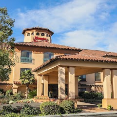
Hampton Inn & Suites Camarillo

Permanent Household Hazardous Waste Facility - City of Thousand Oaks

Santa Paula City Hall
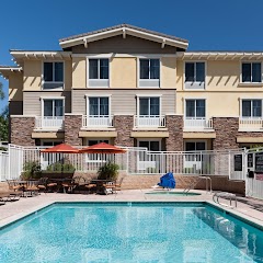
Homewood Suites by Hilton Agoura Hills
Transit and Meeting Points
Useful pickup, handoff, or rendezvous points close to Camarillo.
Camarillo station
Oxnard Transportation Center
Santa Paula, California
Moorpark
Flight Path Map
This map shows the direct air route between Mission Canyon and Los Angeles. Straight-line distance: 88.31 mi (142.12 km).

#1 Mission Canyon
Census-designated place in Santa Barbara County, California
| Population | 2,381 |
| Coordinates | 34.4508300, -119.7129100 |
| Altitude | 193 |
| Country | United States |

#2 Los Angeles
The second most populous city in the United States and the center of the Los Angeles metropolitan area.
| Population | 3,970,219 |
| Coordinates | 34.0522300, -118.2436800 |
| Altitude | 89 |
| Country | United States |
End: West 1st Street (-118.24357, 34.05234)
Estimated Travel Time
Distance: 162 km by road
| Speed | Time |
|---|---|
| 30 mph (48.3 km/h) | 03h 21m |
| 40 mph (64.37 km/h) | 02h 31m |
| 50 mph (80.47 km/h) | 02h 00m |
| 60 mph (96.56 km/h) | 01h 40m |
| 70 mph (112.65 km/h) | 01h 26m |
| 80 mph (129 km/h) | 01h 15m |
Fuel, Round Trip and CO2
Estimated fuel cost and emissions for this route.
| Fuel | $/gal | One way | Round trip |
|---|---|---|---|
| Regular gas | $5.77 | $20.48 | $40.96 |
| Mid-grade | $6.07 | $21.53 | $43.07 |
| Premium | $6.24 | $22.16 | $44.33 |
| Diesel | $7.57 | $26.86 | $53.73 |
Assumes 8.3 L/100 km (about 28.3 MPG). CO2 is an estimate and varies by vehicle, fuel blend, traffic, and terrain.
Prices in California · Jul 17, 2026
Distance to Other Cities
Planning a road trip? See the full trip guide on Trip.ovh — stops, fuel costs, weather, and departure timing.