How far is Middlebury, IN from Hammond, IN?
The driving distance from Middlebury, IN to Hammond, IN is about 184.1 miles (296.2 km), with a travel time of about 03h 30m by car.
- The straight-line flight distance is about 161.5 miles (259.9 km).
- For a round trip, plan for roughly 07h 00m of driving time before adding stops, traffic, or weather delays.
- A comfortable departure window is usually 6:00 AM to 8:00 AM EDT.
Reverse, save, or send this route
This drive is better planned with a longer stop or an overnight stay. Copy the route link, send it to another device, or print a clean version before you head out.
This drive is better planned with a longer stop or an overnight stay.
Flight Distance
Driving Distance
Gas Cost Calculator
Leave and Arrive Planner
Pick a departure time to see your estimated arrival and same-day return window.
Drive time stays fixed at 03h 30m.
An early departure helps you fit a real stop into the day without turning the return into a late-night drive.
You are leaving earlier than the recommended window, which gives you extra margin for breaks and traffic.
Halfway Point
A useful midpoint for breaks, coffee, or meeting in the middle.
Town in Indiana, United States
Route Weather Snapshot
Check the forecast at both ends before you head out.
Partly Sunny
Driving Route Map
The map below follows the saved road route between Middlebury and Hammond.
Turn-by-Turn Driving Directions
Step-by-step road directions between Middlebury and Hammond.
-
1
Start on West Martz Market Street
563 ft · 27 sec · West Martz Market Street
-
2
Turn right
1 km · 1 min
-
3
Turn left
2199 ft · 45 sec
-
4
Turn right onto West 8th Street
693 ft · 19 sec · West 8th Street
-
5
Turn left onto Main Street
16.4 mi · 23 min · Main Street
-
6
Continue on South Forest Avenue
24.1 mi · 37 min · South Forest Avenue
-
7
At the end of the road, turn right
2.6 mi · 4 min
-
8
Turn left
2.7 mi · 4 min
-
9
Turn left onto Cross Street
1853 ft · 33 sec · Cross Street
-
10
Turn right
13.2 mi · 20 min
-
11
Turn left onto South Washington Street
11.7 mi · 18 min · South Washington Street
-
12
Continue on Holden Street
137 m · 8 sec · Holden Street
-
13
Turn slight left onto North Main Street
104 m · 6 sec · North Main Street
-
14
Continue on Base Line Road
1.6 mi · 2 min · Base Line Road
-
15
Continue on Base Line Rd
4 mi · 6 min · Base Line Rd
-
16
Continue on Base Line Road
9.6 mi · 14 min · Base Line Road
-
17
Turn right onto South River Road
1 mi · 2 min · South River Road
-
18
Enter the roundabout and take exit 2 toward South River Road
57 m · 8 sec · South River Road
-
19
Exit the roundabout onto South River Road
5.5 mi · 10 min · South River Road
-
20
Continue on N River Road
2146 ft · 43 sec · N River Road
-
21
Take the ramp slight right
1644 ft · 40 sec
-
22
Merge slight left
80.4 mi · 1 hr 27 min
-
23
Take the exit slight right toward I 80 West, I 94 West, US 6 West: Chicago
1.4 mi · 3 min
-
24
Merge slight left onto Borman Expressway
8 mi · 11 min · Borman Expressway
-
25
Take the exit slight right toward SR 152 North, US 41 South: Indianapolis Boulevard
1208 ft · 30 sec
-
26
Keep slight left to continue on SR 152 North: Indianapolis Boulevard
1061 ft · 26 sec
-
27
Turn straight onto Indianapolis Boulevard
1457 ft · 34 sec · Indianapolis Boulevard
-
28
Turn left onto 173rd Street
1.6 km · 3 min · 173rd Street
-
29
Turn right onto Columbia Avenue
830 ft · 23 sec · Columbia Avenue
-
30
Arrive at your destination
0 m · 1 sec · Columbia Avenue
Car Route Details
A richer read on the saved driving route between Middlebury and Hammond.
Interchange-aware route
The drive includes several ramps, exits, or merges, so checking the next few maneuvers before busy interchanges is useful.
N River Road
Merge slight left
80.4 mi · 01h 27m
Route Summary
A quick read on whether this route feels easy, ambitious, or worth planning around.
A longer out-and-back drive
This is still possible in one day, but it becomes a long driving day. Leaving early and planning your stop window matters more here.
Partly Sunny leaving Middlebury and Partly Sunny near Hammond.
Trip Questions
Direct answers travelers usually want before committing to the drive.
How long does it take to drive from Middlebury to Hammond?
The road trip is about 184.1 miles (296.2 km) and usually takes 03h 30m in normal driving conditions.
Is this a same-day trip or an overnight route?
This is still possible in one day, but it becomes a long driving day. Leaving early and planning your stop window matters more here.
What is the halfway point on this route?
Battle Ground is a useful midpoint, sitting about 93.3 miles from Middlebury and 90.8 miles from Hammond.
How much longer is the road route than the straight-line distance?
The direct path is about 161.5 miles (259.9 km), while the road route adds roughly 22.6 extra miles because roads do not follow the straight air line.
When is the best time to leave for this route?
A good departure window is usually 6:00 AM to 8:00 AM EDT. If you want a more comfortable same-day return, try to leave by 10:00 AM EDT.
How much will gas cost for this route?
Using about 28.3 MPG, regular gas is estimated at $24.47 one way or $48.95 round trip. Estimated CO2 is about 57.7 kg one way.
Do you cross a time zone on this route?
Yes. There is about a 1 hour time difference between Middlebury and Hammond, so arrival and return times should be read in local time.
What should you check before leaving?
Before you leave, expect Partly Sunny around Middlebury and Partly Sunny near Hammond.
Stop Ideas Near Battle Ground
Useful break, food, and waypoint ideas within about 15 miles of the route midpoint.

Town of Mulberry - Town Hall & Municipal Utilities
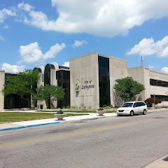
Lafayette City Hall
Morton Community Center
Transit and Meeting Points
Useful pickup, handoff, or rendezvous points close to Battle Ground.
Lafayette station
Crawfordsville (Bus), Indiana
Crawfordsville
Rensselaer
Flight Path Map
This map shows the direct air route between Middlebury and Hammond. Straight-line distance: 161.49 mi (259.89 km).

#1 Middlebury
Human settlement in Elkhart County, Indiana, United States of America
| Population | 3,608 |
| Coordinates | 39.2642100, -87.1189000 |
| Altitude | 204 |
| Country | United States |

#2 Hammond
The most populous city in Lake County, Indiana.
| Population | 75,342 |
| Coordinates | 41.5833700, -87.5000400 |
| Altitude | 183 |
| Country | United States |
End: Columbia Avenue (-87.500185, 41.58337)
Estimated Travel Time
Distance: 296 km by road
| Speed | Time |
|---|---|
| 30 mph (48.3 km/h) | 06h 07m |
| 40 mph (64.37 km/h) | 04h 36m |
| 50 mph (80.47 km/h) | 03h 40m |
| 60 mph (96.56 km/h) | 03h 04m |
| 70 mph (112.65 km/h) | 02h 37m |
| 80 mph (129 km/h) | 02h 17m |
Fuel, Round Trip and CO2
Estimated fuel cost and emissions for this route.
| Fuel | $/gal | One way | Round trip |
|---|---|---|---|
| Regular gas | $3.77 | $24.47 | $48.95 |
| Mid-grade | $4.25 | $27.60 | $55.20 |
| Premium | $4.65 | $30.20 | $60.41 |
| Diesel | $5.30 | $34.42 | $68.85 |
Assumes 8.3 L/100 km (about 28.3 MPG). CO2 is an estimate and varies by vehicle, fuel blend, traffic, and terrain.
Prices in Indiana · Jul 24, 2026
Distance to Other Cities
Planning a road trip? See the full trip guide on Trip.ovh — stops, fuel costs, weather, and departure timing.