How far is Merrimack, NH from Effingham, NH?
The driving distance from Merrimack, NH to Effingham, NH is about 89.1 miles (143.4 km), with a travel time of about 02h 17m by car.
- The straight-line flight distance is about 66.7 miles (107.4 km).
- For a round trip, plan for roughly 04h 34m of driving time before adding stops, traffic, or weather delays.
- A comfortable departure window is usually 8:00 AM to 10:00 AM EDT.
Reverse, save, or send this route
This route works well as a day trip with time at the destination. Copy the route link, send it to another device, or print a clean version before you head out.
This route works well as a day trip with time at the destination.
Flight Distance
Driving Distance
Gas Cost Calculator
Leave and Arrive Planner
Pick a departure time to see your estimated arrival and same-day return window.
Drive time stays fixed at 02h 17m.
A morning start gives you useful time at the destination and keeps the return out of the late evening.
You are leaving earlier than the recommended window, which gives you extra margin for breaks and traffic.
Halfway Point
A useful midpoint for breaks, coffee, or meeting in the middle.
Town in Strafford County, New Hampshire, United States
Route Weather Snapshot
Check the forecast at both ends before you head out.
Sunny
Driving Route Map
The map below follows the saved road route between Merrimack and Effingham.
Turn-by-Turn Driving Directions
Step-by-step road directions between Merrimack and Effingham.
-
1
Start on Loop Road
25 m · 6 sec · Loop Road
-
2
Turn straight onto Daniel Webster Highway
3.8 mi · 8 min · Daniel Webster Highway
-
3
Continue on South River Road
2135 ft · 46 sec · South River Road
-
4
Take the ramp right toward Concord, Nashua
2141 ft · 52 sec
-
5
Merge slight left onto Raymond Wieczorek Drive
653 ft · 11 sec · Raymond Wieczorek Drive
-
6
Keep slight right to continue on Bedford, Manchester
1.3 km · 2 min
-
7
Merge slight left onto Everett Turnpike
1.3 mi · 2 min · Everett Turnpike
-
8
Take the exit slight right toward I 293 South, NH 101 East: Exeter, Portsmouth
2925 ft · 1 min
-
9
Merge slight left
4.6 mi · 6 min
-
10
Keep slight right to continue on NH 101 East: Portsmouth, Seacoast
19.1 mi · 22 min
-
11
Take the exit slight right toward NH 125: Epping, Kingston
1211 ft · 37 sec
-
12
Turn left onto Calef Highway
9.7 mi · 15 min · Calef Highway
-
13
Enter the roundabout and take exit 2 toward Lee Circle
52 m · 5 sec · Calef Highway
-
14
Exit the rotary onto Calef Highway
7.7 mi · 13 min · Calef Highway
-
15
Continue on Gonic Road
1.8 mi · 3 min · Gonic Road
-
16
Take the exit slight right toward NH 16 Onramp North
3142 ft · 57 sec · NH 16 Onramp North
-
17
Merge slight left onto Spaulding Turnpike
14.4 mi · 19 min · Spaulding Turnpike
-
18
Continue on White Mountain Highway
7 mi · 11 min · White Mountain Highway
-
19
Turn right onto Wakefield Road
3088 ft · 2 min · Wakefield Road
-
20
Turn sharp left onto Province Lake Road
15.9 mi · 30 min · Province Lake Road
-
21
Turn right onto Plantation Road
18 m · 3 sec · Plantation Road
-
22
Arrive at your destination
0 m · 1 sec · Plantation Road
Car Route Details
A richer read on the saved driving route between Merrimack and Effingham.
Highway-focused drive
Most of the mileage stays on named highways, so the important moments are ramps, exits, merges, and the final local approach.
NH 101 East
Keep slight right to continue on NH 101 East: Portsmouth, Seacoast
19.1 mi · 00h 22m
Route Summary
A quick read on whether this route feels easy, ambitious, or worth planning around.
A comfortable day-trip route
This route works well as a day trip. You can leave in the morning, spend meaningful time at the destination, and still return the same day.
Sunny leaving Merrimack and Sunny near Effingham.
Trip Questions
Direct answers travelers usually want before committing to the drive.
How long does it take to drive from Merrimack to Effingham?
The road trip is about 89.1 miles (143.4 km) and usually takes 02h 17m in normal driving conditions.
Is this a same-day trip or an overnight route?
This route works well as a day trip. You can leave in the morning, spend meaningful time at the destination, and still return the same day.
What is the halfway point on this route?
Barrington is a useful midpoint, sitting about 44.6 miles from Merrimack and 44.6 miles from Effingham.
How much longer is the road route than the straight-line distance?
The direct path is about 66.7 miles (107.4 km), while the road route adds roughly 22.4 extra miles because roads do not follow the straight air line.
When is the best time to leave for this route?
A good departure window is usually 8:00 AM to 10:00 AM EDT. If you want a more comfortable same-day return, try to leave by 1:56 PM EDT.
How much will gas cost for this route?
Using about 28.3 MPG, regular gas is estimated at $12.39 one way or $24.77 round trip. Estimated CO2 is about 27.9 kg one way.
What should you check before leaving?
Before you leave, expect Sunny around Merrimack and Sunny near Effingham.
Stop Ideas Near Barrington
Useful break, food, and waypoint ideas within about 15 miles of the route midpoint.

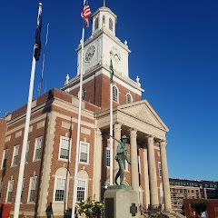
Old City Hall
Dover City Hall
Transit and Meeting Points
Useful pickup, handoff, or rendezvous points close to Barrington.
Durham–UNH station
Dover Transportation Center
Portsmouth, New Hampshire
Exeter station
Flight Path Map
This map shows the direct air route between Merrimack and Effingham. Straight-line distance: 66.77 mi (107.45 km).

#1 Merrimack
River in New Hampshire and Massachusetts, United States
| Population | 27,452 |
| Coordinates | 42.8650900, -71.4934000 |
| Altitude | 47 |
| Country | United States |

#2 Effingham
Town in New Hampshire
| Population | 1,481 |
| Coordinates | 43.7611900, -70.9964500 |
| Altitude | 183 |
| Country | United States |
End: Effingham (-70.99645, 43.76119)
Estimated Travel Time
Distance: 143 km by road
| Speed | Time |
|---|---|
| 30 mph (48.3 km/h) | 02h 58m |
| 40 mph (64.37 km/h) | 02h 13m |
| 50 mph (80.47 km/h) | 01h 46m |
| 60 mph (96.56 km/h) | 01h 29m |
| 70 mph (112.65 km/h) | 01h 16m |
| 80 mph (129 km/h) | 01h 06m |
Fuel, Round Trip and CO2
Estimated fuel cost and emissions for this route.
| Fuel | $/gal | One way | Round trip |
|---|---|---|---|
| Regular gas | $3.95 | $12.39 | $24.77 |
| Mid-grade | $4.46 | $13.99 | $27.99 |
| Premium | $4.86 | $15.25 | $30.51 |
| Diesel | $6.00 | $18.83 | $37.66 |
Assumes 8.3 L/100 km (about 28.3 MPG). CO2 is an estimate and varies by vehicle, fuel blend, traffic, and terrain.
Prices in New Hampshire · Jul 26, 2026
Distance to Other Cities
Planning a road trip? See the full trip guide on Trip.ovh — stops, fuel costs, weather, and departure timing.