How far is La Vernia, TX from Austin, TX?
The driving distance from La Vernia, TX to Austin, TX is about 87.4 miles (140.6 km), with a travel time of about 01h 24m by car.
- The straight-line flight distance is about 66.8 miles (107.5 km).
- For a round trip, plan for roughly 02h 49m of driving time before adding stops, traffic, or weather delays.
- A comfortable departure window is usually 8:00 AM to 10:00 AM CDT.
Reverse, save, or send this route
This route works well as a day trip with time at the destination. Copy the route link, send it to another device, or print a clean version before you head out.
This route works well as a day trip with time at the destination.
Flight Distance
Driving Distance
Gas Cost Calculator
Leave and Arrive Planner
Pick a departure time to see your estimated arrival and same-day return window.
Drive time stays fixed at 01h 24m.
A morning start gives you useful time at the destination and keeps the return out of the late evening.
This departure sits inside the recommended comfort window for the route.
Halfway Point
A useful midpoint for breaks, coffee, or meeting in the middle.
Census designated place
Route Weather Snapshot
Check the forecast at both ends before you head out.
Driving Route Map
The map below follows the saved road route between La Vernia and Austin.
Turn-by-Turn Driving Directions
Step-by-step road directions between La Vernia and Austin.
-
1
Start on Dry Hollow
43 m · 10 sec · Dry Hollow
-
2
Turn left onto Chihuahua East
110 m · 10 sec · Chihuahua East
-
3
Turn left onto Seguin Road
3078 ft · 1 min · Seguin Road
-
4
Continue on Farm to Market Road 775
14.9 mi · 20 min · Farm to Market Road 775
-
5
Turn right onto West Interstate 10
140 m · 13 sec · West Interstate 10
-
6
Take the ramp slight left toward I 10 East, US 90 East, TX 130 North
527 ft · 13 sec
-
7
Merge slight left
1.5 mi · 2 min
-
8
Continue on I 10 East: Houston, Austin, Waco
4.7 mi · 5 min
-
9
Take the exit slight right toward TX 123 Business: Austin Street
1409 ft · 34 sec
-
10
Turn straight onto West Interstate 10
1 mi · 2 min · West Interstate 10
-
11
Turn left onto North Austin Street
1.2 mi · 2 min · North Austin Street
-
12
At the end of the road, turn left onto North State Highway 123
15.5 mi · 20 min · North State Highway 123
-
13
Continue on South Guadalupe Street
2.1 mi · 4 min · South Guadalupe Street
-
14
Turn right onto North Interstate 35
1.4 km · 2 min · North Interstate 35
-
15
Take the ramp slight left
954 ft · 23 sec
-
16
Merge slight left onto Purple Heart Trail
29.3 mi · 32 min · Purple Heart Trail
-
17
Take the exit slight right toward 6th - 12th Streets
665 ft · 24 sec
-
18
Turn left onto East 6th Street
2863 ft · 1 min · East 6th Street
-
19
Turn left onto Congress Avenue
109 m · 18 sec · Congress Avenue
-
20
Turn left onto East 5th Street
8 m · 1 sec · East 5th Street
-
21
Arrive at your destination
0 m · 1 sec · East 5th Street
Car Route Details
A richer read on the saved driving route between La Vernia and Austin.
Interchange-aware route
The drive includes several ramps, exits, or merges, so checking the next few maneuvers before busy interchanges is useful.
Purple Heart Trail
Merge slight left onto Purple Heart Trail
29.3 mi · 00h 32m
Route Summary
A quick read on whether this route feels easy, ambitious, or worth planning around.
A comfortable day-trip route
This route works well as a day trip. You can leave in the morning, spend meaningful time at the destination, and still return the same day.
Sunny leaving La Vernia and Sunny near Austin.
Trip Questions
Direct answers travelers usually want before committing to the drive.
How long does it take to drive from La Vernia to Austin?
The road trip is about 87.4 miles (140.6 km) and usually takes 01h 24m in normal driving conditions.
Is this a same-day trip or an overnight route?
This route works well as a day trip. You can leave in the morning, spend meaningful time at the destination, and still return the same day.
What is the halfway point on this route?
Redwood is a useful midpoint, sitting about 36.7 miles from La Vernia and 50.6 miles from Austin.
How much longer is the road route than the straight-line distance?
The direct path is about 66.8 miles (107.5 km), while the road route adds roughly 20.6 extra miles because roads do not follow the straight air line.
When is the best time to leave for this route?
A good departure window is usually 8:00 AM to 10:00 AM CDT. If you want a more comfortable same-day return, try to leave by 3:40 PM CDT.
How much will gas cost for this route?
Using about 28.3 MPG, regular gas is estimated at $11.64 one way or $23.28 round trip. Estimated CO2 is about 27.4 kg one way.
What should you check before leaving?
Before you leave, expect Sunny around La Vernia and Sunny near Austin.
Stop Ideas Near Redwood
Useful break, food, and waypoint ideas within about 15 miles of the route midpoint.

New Braunfels Parks and Recreation
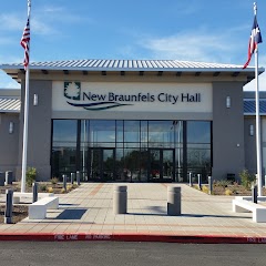
New Braunfels City Hall

Comal County Courthouse(Gerichtsgebäude)
Transit and Meeting Points
Useful pickup, handoff, or rendezvous points close to Redwood.
San Marcos Station
Austin
San Antonio Station
Taylor
Flight Path Map
This map shows the direct air route between La Vernia and Austin. Straight-line distance: 66.77 mi (107.46 km).

#1 La Vernia
City in Wilson County, Texas, United States
| Population | 1,449 |
| Coordinates | 29.3563500, -98.1155600 |
| Altitude | 149 |
| Country | United States |

#2 Austin
The eleventh most populous city in the United States and the center of the Austin metropolitan area.
| Population | 995,484 |
| Coordinates | 30.2671500, -97.7430600 |
| Altitude | 149 |
| Country | United States |
End: East 5th Street (-97.743073, 30.267115)
Estimated Travel Time
Distance: 141 km by road
| Speed | Time |
|---|---|
| 30 mph (48.3 km/h) | 02h 54m |
| 40 mph (64.37 km/h) | 02h 11m |
| 50 mph (80.47 km/h) | 01h 44m |
| 60 mph (96.56 km/h) | 01h 27m |
| 70 mph (112.65 km/h) | 01h 14m |
| 80 mph (129 km/h) | 01h 05m |
Fuel, Round Trip and CO2
Estimated fuel cost and emissions for this route.
| Fuel | $/gal | One way | Round trip |
|---|---|---|---|
| Regular gas | $3.78 | $11.64 | $23.28 |
| Mid-grade | $4.25 | $13.10 | $26.19 |
| Premium | $4.59 | $14.14 | $28.28 |
| Diesel | $3.99 | $12.30 | $24.60 |
Assumes 8.3 L/100 km (about 28.3 MPG). CO2 is an estimate and varies by vehicle, fuel blend, traffic, and terrain.
Prices in Texas · Jul 20, 2026
Distance to Other Cities
Planning a road trip? See the full trip guide on Trip.ovh — stops, fuel costs, weather, and departure timing.