How far is Kilgore, TX from Corpus Christi, TX?
The driving distance from Kilgore, TX to Corpus Christi, TX is about 409.9 miles (659.6 km), with a travel time of about 07h 09m by car.
- The straight-line flight distance is about 350.8 miles (564.6 km).
- For a round trip, plan for roughly 14h 19m of driving time before adding stops, traffic, or weather delays.
- A comfortable departure window is usually 6:00 AM to 7:30 AM CDT.
Reverse, save, or send this route
This drive is better planned with a longer stop or an overnight stay. Copy the route link, send it to another device, or print a clean version before you head out.
This drive is better planned with a longer stop or an overnight stay.
Flight Distance
Driving Distance
Gas Cost Calculator
Leave and Arrive Planner
Pick a departure time to see your estimated arrival and same-day return window.
Drive time stays fixed at 07h 09m.
Starting early still helps, but most travelers will want a longer stop or an overnight stay on a route this long.
You are leaving earlier than the recommended window, which gives you extra margin for breaks and traffic.
Halfway Point
A useful midpoint for breaks, coffee, or meeting in the middle.
City in Harris County, Texas, U.
Route Weather Snapshot
Check the forecast at both ends before you head out.
Slight Chance Showers And Thunderstorms
Mostly Sunny
Driving Route Map
The map below follows the saved road route between Kilgore and Corpus Christi.
Turn-by-Turn Driving Directions
Step-by-step road directions between Kilgore and Corpus Christi.
-
1
Start on East Main Street
1 km · 2 min · East Main Street
-
2
At the end of the road, turn right onto North Henderson Boulevard
16.3 mi · 19 min · North Henderson Boulevard
-
3
Continue on Highway 79
1.7 mi · 2 min · Highway 79
-
4
Turn left onto US Route 259
16.2 mi · 18 min · US Route 259
-
5
Continue on North Railroad Avenue
2.9 mi · 4 min · North Railroad Avenue
-
6
Continue on US Route 259
3 mi · 3 min · US Route 259
-
7
Continue on US Highway 259
11.2 mi · 13 min · US Highway 259
-
8
Take the exit slight right toward US 59 South: Lufkin
68 m · 6 sec
-
9
Continue straight
128 m · 12 sec
-
10
Continue straight
556 ft · 16 sec
-
11
Turn left
32 m · 4 sec
-
12
Turn right onto North US Highway 59
1.1 km · 48 sec · North US Highway 59
-
13
Continue on Northwest Stallings Drive
6.4 mi · 7 min · Northwest Stallings Drive
-
14
Continue on Stallings Drive
2015 ft · 26 sec · Stallings Drive
-
15
Take the exit slight right
919 ft · 25 sec
-
16
Turn straight
68 m · 6 sec
-
17
Merge slight left onto South Street
1.3 mi · 2 min · South Street
-
18
Continue on South US Highway 59
19.4 mi · 22 min · South US Highway 59
-
19
Take the exit slight right toward South First Street
121 m · 10 sec
-
20
Turn straight onto South Medford Drive
1041 ft · 23 sec · South Medford Drive
-
21
Turn left onto South First Street
4.1 mi · 5 min · South First Street
-
22
Continue on US 59
1.3 mi · 2 min · US 59
-
23
Continue on Diboll Relief Route
113.5 mi · 2 hr 5 min · Diboll Relief Route
-
24
Continue on Southwest Freeway
34.7 mi · 40 min · Southwest Freeway
-
25
Take the exit slight right toward Spur 10: Cottonwood, Church Road, Hartledge Road
1158 ft · 28 sec
-
26
Turn straight onto Southwest Freeway Frontage Road
1.5 km · 2 min · Southwest Freeway Frontage Road
-
27
Continue on Southwest Freeway Frontage Road
2217 ft · 1 min · Southwest Freeway Frontage Road
-
28
Continue on US 59 Southbound Frontage Road
1.4 km · 2 min · US 59 Southbound Frontage Road
-
29
Take the ramp straight
1027 ft · 25 sec
-
30
Merge slight left
9.2 mi · 11 min
-
31
Keep slight left
6.6 mi · 8 min
-
32
Take the exit slight right
1.5 mi · 2 min
-
33
Continue on US Highway 59
74.7 mi · 1 hr 22 min · US Highway 59
-
34
Keep slight left to continue on Spur 91
1.6 km · 1 min · Spur 91
-
35
Merge slight right onto US Highway 77 South
33.2 mi · 38 min · US Highway 77 South
-
36
Turn straight onto Alamo Street
1.9 mi · 3 min · Alamo Street
-
37
Turn left onto East Empresario Street
1.5 mi · 2 min · East Empresario Street
-
38
Turn right
9.6 mi · 10 min
-
39
Continue on Farm to Market Road 136
17.7 mi · 23 min · Farm to Market Road 136
-
40
Take the ramp right
2045 ft · 50 sec
-
41
Merge slight left
12.1 mi · 13 min
-
42
Take the exit slight right
1912 ft · 44 sec
-
43
Turn slight right
1793 ft · 56 sec
-
44
Take the ramp slight left
2474 ft · 1 min
-
45
Merge slight left
1548 ft · 29 sec
-
46
Continue on Interstate Highway 37
118 m · 10 sec · Interstate Highway 37
-
47
Continue on Interstate Highway 37
135 m · 15 sec · Interstate Highway 37
-
48
Continue straight
147 m · 9 sec
-
49
Arrive at your destination
0 m · 1 sec
Car Route Details
A richer read on the saved driving route between Kilgore and Corpus Christi.
Long-distance drive
This route is long enough that fuel, rest stops, weather, and timing matter more than any single maneuver.
Diboll Relief Route
Continue on Diboll Relief Route
114 mi · 02h 05m
Route Summary
A quick read on whether this route feels easy, ambitious, or worth planning around.
Better with a longer stop
This route is long enough that most travelers will be better off planning an overnight stay or a more deliberate stop window.
Slight Chance Showers And Thunderstorms leaving Kilgore and Mostly Sunny near Corpus Christi.
Trip Questions
Direct answers travelers usually want before committing to the drive.
How long does it take to drive from Kilgore to Corpus Christi?
The road trip is about 409.9 miles (659.6 km) and usually takes 07h 09m in normal driving conditions.
Is this a same-day trip or an overnight route?
This route is long enough that most travelers will be better off planning an overnight stay or a more deliberate stop window.
What is the halfway point on this route?
West University Place is a useful midpoint, sitting about 204.4 miles from Kilgore and 205.5 miles from Corpus Christi.
How much longer is the road route than the straight-line distance?
The direct path is about 350.8 miles (564.6 km), while the road route adds roughly 59.1 extra miles because roads do not follow the straight air line.
When is the best time to leave for this route?
A good departure window is usually 6:00 AM to 7:30 AM CDT. Starting early still helps, but most travelers will want a longer stop or an overnight stay on a route this long.
How much will gas cost for this route?
Using about 28.3 MPG, regular gas is estimated at $54.64 one way or $109.29 round trip. Estimated CO2 is about 128.5 kg one way.
What should you check before leaving?
Before you leave, expect Slight Chance Showers And Thunderstorms around Kilgore and Mostly Sunny near Corpus Christi.
Stop Ideas Near West University Place
Useful break, food, and waypoint ideas within about 15 miles of the route midpoint.
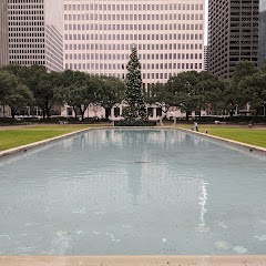
Hermann Square

Houston BCycle: City Hall

Houston City Hall
Houston Police Department Westside
Transit and Meeting Points
Useful pickup, handoff, or rendezvous points close to West University Place.
Houston, TX
Houston
Prairie View, TX
Galveston (Texas Eagle Bus), Texas
Flight Path Map
This map shows the direct air route between Kilgore and Corpus Christi. Straight-line distance: 350.81 mi (564.57 km).

#1 Kilgore
Small city in Gregg County, Texas
| Population | 14,857 |
| Coordinates | 32.3862600, -94.8757700 |
| Altitude | 109 |
| Country | United States |

#2 Corpus Christi
The second most populous city in Texas and the center of the Corpus Christi metropolitan area.
| Population | 327,248 |
| Coordinates | 27.8005800, -97.3963800 |
| Altitude | 2 |
| Country | United States |
End: I 37 (-97.396427, 27.800658)
Estimated Travel Time
Distance: 660 km by road
| Speed | Time |
|---|---|
| 30 mph (48.3 km/h) | 13h 39m |
| 40 mph (64.37 km/h) | 10h 14m |
| 50 mph (80.47 km/h) | 08h 11m |
| 60 mph (96.56 km/h) | 06h 49m |
| 70 mph (112.65 km/h) | 05h 51m |
| 80 mph (129 km/h) | 05h 06m |
Fuel, Round Trip and CO2
Estimated fuel cost and emissions for this route.
| Fuel | $/gal | One way | Round trip |
|---|---|---|---|
| Regular gas | $3.78 | $54.64 | $109.29 |
| Mid-grade | $4.25 | $61.48 | $122.97 |
| Premium | $4.59 | $66.39 | $132.77 |
| Diesel | $3.99 | $57.74 | $115.48 |
Assumes 8.3 L/100 km (about 28.3 MPG). CO2 is an estimate and varies by vehicle, fuel blend, traffic, and terrain.
Prices in Texas · Jun 10, 2026
Distance to Other Cities
Planning a road trip? See the full trip guide on Trip.ovh — stops, fuel costs, weather, and departure timing.