How far is Jordan, MN from Blaine, MN?
The distance between Jordan, MN and Blaine, MN is 49 miles (78.86 kilometers) by car, following the US-169 route. The fastest route from Jordan, MN to Blaine, MN is via US-169 N. The drive time is approximately 52 minutes, without stopping. The halfway point is Edina, MN.
Here are some tips for driving from Jordan to Blaine:
- Use a traffic app to avoid congestion.
- Plan your trip for off-peak hours.
- Take a scenic route if you have the time.
- Be aware of the speed limit and obey all traffic laws.
Reverse, save, or send this route
This route works well as a day trip with time at the destination. Copy the route link, send it to another device, or print a clean version before you head out.
This route works well as a day trip with time at the destination.
Flight Distance
Driving Distance
Gas Cost Calculator
Leave and Arrive Planner
Pick a departure time to see your estimated arrival and same-day return window.
Drive time stays fixed at 00h 53m.
A morning start gives you useful time at the destination and keeps the return out of the late evening.
You are leaving earlier than the recommended window, which gives you extra margin for breaks and traffic.
Halfway Point
A useful midpoint for breaks, coffee, or meeting in the middle.
The most populous city in Hennepin County, Minnesota.
Route Weather Snapshot
Check the forecast at both ends before you head out.
Rain Showers Likely
Rain Showers Likely
Driving Route Map
The map below follows the saved road route between Jordan and Blaine.
Turn-by-Turn Driving Directions
Step-by-step road directions between Jordan and Blaine.
-
1
Start on the route
67 m · 22 sec
-
2
Turn left onto Broadway Street South
1926 ft · 53 sec · Broadway Street South
-
3
Take the ramp slight right
1388 ft · 38 sec
-
4
Merge slight left
6.5 mi · 8 min
-
5
Take the exit slight right toward MN 41, CR 78: Chaska
1682 ft · 41 sec
-
6
Keep slight right to continue on MN 41, CR 78: Chaska
81 m · 8 sec
-
7
Turn straight onto County Road 78
2231 ft · 35 sec · County Road 78
-
8
Continue on Chestnut Boulevard
2499 ft · 41 sec · Chestnut Boulevard
-
9
Enter the roundabout and take exit 2 toward 130th Street West
35 m · 3 sec · 130th Street West
-
10
Exit the roundabout onto 130th Street West
1.6 km · 1 min · 130th Street West
-
11
Turn left onto Marystown Road
1.4 km · 1 min · Marystown Road
-
12
Take the ramp right toward US 169 North
2122 ft · 52 sec
-
13
Merge slight left
5.1 mi · 6 min
-
14
Keep slight left
6.1 mi · 7 min
-
15
Take the exit slight right toward I 494 East, MN 5 East
1.1 km · 1 min
-
16
Merge slight left
1.6 mi · 2 min
-
17
Take the exit slight right toward MN 100
1099 ft · 27 sec
-
18
Merge slight left
15.3 mi · 19 min
-
19
Keep slight left to continue on I 694 East
1.1 km · 1 min
-
20
Merge slight left
1.9 mi · 2 min
-
21
Take the exit slight right toward MN 65: Central Avenue
1933 ft · 47 sec
-
22
Continue on Central Avenue Northeast
1858 ft · 26 sec · Central Avenue Northeast
-
23
Continue on Highway 65 Northeast
6.3 mi · 9 min · Highway 65 Northeast
-
24
Arrive at your destination
0 m · 1 sec · Central Avenue Northeast
Car Route Details
A richer read on the saved driving route between Jordan and Blaine.
Turn-heavy local drive
The route has frequent decision points for its length, so lane choice and turn timing will matter more than cruising speed.
MN 100
Merge slight left
15.3 mi · 00h 19m
Route Summary
A quick read on whether this route feels easy, ambitious, or worth planning around.
A comfortable day-trip route
This route works well as a day trip. You can leave in the morning, spend meaningful time at the destination, and still return the same day.
Rain Showers Likely leaving Jordan and Rain Showers Likely near Blaine.
Trip Questions
Direct answers travelers usually want before committing to the drive.
How long does it take to drive from Jordan to Blaine?
The road trip is about 51 miles (82 km) and usually takes 00h 53m in normal driving conditions.
Is this a same-day trip or an overnight route?
This route works well as a day trip. You can leave in the morning, spend meaningful time at the destination, and still return the same day.
What is the halfway point on this route?
Edina is a useful midpoint, sitting about 24.7 miles from Jordan and 26.3 miles from Blaine.
How much longer is the road route than the straight-line distance?
The direct path is about 39.1 miles (63 km), while the road route adds roughly 11.9 extra miles because roads do not follow the straight air line.
When is the best time to leave for this route?
A good departure window is usually 8:00 AM to 10:00 AM CDT. If you want a more comfortable same-day return, try to leave by 4:42 PM CDT.
How much will gas cost for this route?
Using about 28.3 MPG, regular gas is estimated at $6.42 one way or $12.85 round trip. Estimated CO2 is about 16 kg one way.
What should you check before leaving?
Before you leave, expect Rain Showers Likely around Jordan and Rain Showers Likely near Blaine.
Stop Ideas Near Edina
Useful break, food, and waypoint ideas within about 15 miles of the route midpoint.

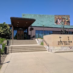
Minneapolis City Hall
City of Bloomington

Mall of America®
Transit and Meeting Points
Useful pickup, handoff, or rendezvous points close to Edina.
Saint Paul Union Depot
Red Wing station
St. Cloud
Menomonie, WI
Flight Path Map
This map shows the direct air route between Jordan and Blaine. Straight-line distance: 39.15 mi (63 km).
#1 Jordan
City in Scott County, Minnesota, United States
| Population | 6,076 |
| Coordinates | 44.6669100, -93.6269000 |
| Altitude | 235 |
| Country | United States |

#2 Blaine
A city in Anoka County, Minnesota.
| Population | 66,697 |
| Coordinates | 45.1608000, -93.2349500 |
| Altitude | 276 |
| Country | United States |
End: MN 65 (-93.234938, 45.160786)
Estimated Travel Time
Distance: 82 km by road
| Speed | Time |
|---|---|
| 30 mph (48.3 km/h) | 01h 41m |
| 40 mph (64.37 km/h) | 01h 16m |
| 50 mph (80.47 km/h) | 01h 01m |
| 60 mph (96.56 km/h) | 00h 50m |
| 70 mph (112.65 km/h) | 00h 43m |
| 80 mph (129 km/h) | 00h 38m |
Fuel, Round Trip and CO2
Estimated fuel cost and emissions for this route.
| Fuel | $/gal | One way | Round trip |
|---|---|---|---|
| Regular gas | $3.57 | $6.42 | $12.85 |
| Mid-grade | $3.92 | $7.06 | $14.12 |
| Premium | $4.39 | $7.91 | $15.81 |
| Diesel | $4.86 | $8.76 | $17.51 |
Assumes 8.3 L/100 km (about 28.3 MPG). CO2 is an estimate and varies by vehicle, fuel blend, traffic, and terrain.
Prices in Minnesota · Jun 11, 2026
Distance to Other Cities
Planning a road trip? See the full trip guide on Trip.ovh — stops, fuel costs, weather, and departure timing.