How far is Heber, CA from Santa Ana, CA?
The driving distance from Heber, CA to Santa Ana, CA is about 196.7 miles (316.5 km), with a travel time of about 03h 17m by car.
- The straight-line flight distance is about 152.2 miles (245 km).
- For a round trip, plan for roughly 06h 35m of driving time before adding stops, traffic, or weather delays.
- A comfortable departure window is usually 6:00 AM to 8:00 AM PDT.
Reverse, save, or send this route
This drive is better planned with a longer stop or an overnight stay. Copy the route link, send it to another device, or print a clean version before you head out.
This drive is better planned with a longer stop or an overnight stay.
Flight Distance
Driving Distance
Gas Cost Calculator
Leave and Arrive Planner
Pick a departure time to see your estimated arrival and same-day return window.
Drive time stays fixed at 03h 17m.
An early departure helps you fit a real stop into the day without turning the return into a late-night drive.
You are leaving earlier than the recommended window, which gives you extra margin for breaks and traffic.
Halfway Point
A useful midpoint for breaks, coffee, or meeting in the middle.
Census-designated place in San Diego County, California
Route Weather Snapshot
Check the forecast at both ends before you head out.
Sunny then Patchy Blowing Dust
Partly Sunny
Driving Route Map
The map below follows the saved road route between Heber and Santa Ana.
Turn-by-Turn Driving Directions
Step-by-step road directions between Heber and Santa Ana.
-
1
Start on East Heber Road
1456 ft · 31 sec · East Heber Road
-
2
Turn right onto South Dogwood Road
3 mi · 6 min · South Dogwood Road
-
3
Take the ramp sharp right
979 ft · 24 sec
-
4
Merge slight left onto Kumeyaay Highway
92.2 mi · 1 hr 40 min · Kumeyaay Highway
-
5
Take the exit slight right toward Lake Jennings Park Road
1450 ft · 39 sec
-
6
Turn right onto Lake Jennings Park Road
2.3 mi · 4 min · Lake Jennings Park Road
-
7
Continue on Mapleview Street
1.2 km · 1 min · Mapleview Street
-
8
Turn left onto San Vicente Freeway
3.2 mi · 4 min · San Vicente Freeway
-
9
Take the exit slight right toward CA 52 West
2800 ft · 48 sec
-
10
Continue on San Clemente Canyon Freeway
12.9 mi · 15 min · San Clemente Canyon Freeway
-
11
Take the exit slight right toward I 805 South, I 805 North
1746 ft · 23 sec
-
12
Keep slight right to continue on I 805 North: Los Angeles
1534 ft · 20 sec
-
13
Merge slight left onto Jacob Dekema Freeway
4.3 mi · 5 min · Jacob Dekema Freeway
-
14
Keep slight left
1.3 km · 56 sec
-
15
Merge slight right onto San Diego Freeway
35.4 mi · 42 min · San Diego Freeway
-
16
Keep slight right to continue on San Diego Freeway
18.1 mi · 21 min · San Diego Freeway
-
17
Keep slight left to continue on San Diego Freeway
7.4 mi · 9 min · San Diego Freeway
-
18
Keep slight right to continue on Bake Parkway
1.6 mi · 2 min
-
19
Keep slight right
6 mi · 7 min
-
20
Take the exit slight right toward Jamboree Road
1266 ft · 17 sec
-
21
Continue straight
527 ft · 11 sec
-
22
Turn right onto Jamboree Road
760 ft · 18 sec · Jamboree Road
-
23
Turn left onto El Camino Real
2.2 mi · 5 min · El Camino Real
-
24
Turn left onto Newport Avenue
109 m · 14 sec · Newport Avenue
-
25
Take the ramp right toward I 5 North: Los Angeles
1127 ft · 17 sec
-
26
Merge slight left onto Santa Ana Freeway
1 mi · 1 min · Santa Ana Freeway
-
27
Take the exit slight right toward First Street, Fourth Street
768 ft · 10 sec
-
28
Keep slight left to continue on First Street
1147 ft · 15 sec
-
29
Turn straight onto Mabury Street
88 m · 10 sec · Mabury Street
-
30
Turn right onto East 1st Street
1.4 mi · 3 min · East 1st Street
-
31
Arrive at your destination
0 m · 1 sec · West 1st Street
Car Route Details
A richer read on the saved driving route between Heber and Santa Ana.
Highway-focused drive
Most of the mileage stays on named highways, so the important moments are ramps, exits, merges, and the final local approach.
Kumeyaay Highway
Merge slight left onto Kumeyaay Highway
92.2 mi · 01h 40m
Route Summary
A quick read on whether this route feels easy, ambitious, or worth planning around.
A longer out-and-back drive
This is still possible in one day, but it becomes a long driving day. Leaving early and planning your stop window matters more here.
Sunny then Patchy Blowing Dust leaving Heber and Partly Sunny near Santa Ana.
Trip Questions
Direct answers travelers usually want before committing to the drive.
How long does it take to drive from Heber to Santa Ana?
The road trip is about 196.7 miles (316.5 km) and usually takes 03h 17m in normal driving conditions.
Is this a same-day trip or an overnight route?
This is still possible in one day, but it becomes a long driving day. Leaving early and planning your stop window matters more here.
What is the halfway point on this route?
Winter Gardens is a useful midpoint, sitting about 97.8 miles from Heber and 98.9 miles from Santa Ana.
How much longer is the road route than the straight-line distance?
The direct path is about 152.2 miles (245 km), while the road route adds roughly 44.5 extra miles because roads do not follow the straight air line.
When is the best time to leave for this route?
A good departure window is usually 6:00 AM to 8:00 AM PDT. If you want a more comfortable same-day return, try to leave by 10:24 AM PDT.
How much will gas cost for this route?
Using about 28.3 MPG, regular gas is estimated at $40.04 one way or $80.07 round trip. Estimated CO2 is about 61.7 kg one way.
What should you check before leaving?
Before you leave, expect Sunny then Patchy Blowing Dust around Heber and Partly Sunny near Santa Ana.
Stop Ideas Near Winter Gardens
Useful break, food, and waypoint ideas within about 15 miles of the route midpoint.

Singing Hills Golf Resort at Sycuan
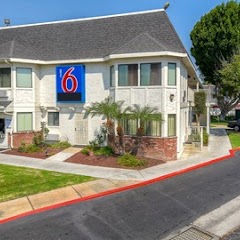
Motel 6 El Cajon, CA - San Diego
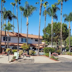
Vacationer RV Resort
City of San Diego - Engineering Field Office
Transit and Meeting Points
Useful pickup, handoff, or rendezvous points close to Winter Gardens.
Santa Fe Depot
Old Town Transit Center
Sorrento Valley station
Solana Beach
Flight Path Map
This map shows the direct air route between Heber and Santa Ana. Straight-line distance: 152.22 mi (244.97 km).

#1 Heber
Census-designated place in Imperial County, California
| Population | 4,275 |
| Coordinates | 32.7308900, -115.5297200 |
| Altitude | -3 |
| Country | United States |

#2 Santa Ana
The most populous city in Orange County, California and the center of the Santa Ana metropolitan area.
| Population | 331,301 |
| Coordinates | 33.7455700, -117.8678300 |
| Altitude | 35 |
| Country | United States |
End: West 1st Street (-117.86783, 33.745553)
Estimated Travel Time
Distance: 316 km by road
| Speed | Time |
|---|---|
| 30 mph (48.3 km/h) | 06h 33m |
| 40 mph (64.37 km/h) | 04h 54m |
| 50 mph (80.47 km/h) | 03h 55m |
| 60 mph (96.56 km/h) | 03h 16m |
| 70 mph (112.65 km/h) | 02h 48m |
| 80 mph (129 km/h) | 02h 27m |
Fuel, Round Trip and CO2
Estimated fuel cost and emissions for this route.
| Fuel | $/gal | One way | Round trip |
|---|---|---|---|
| Regular gas | $5.77 | $40.04 | $80.07 |
| Mid-grade | $6.07 | $42.10 | $84.20 |
| Premium | $6.24 | $43.33 | $86.65 |
| Diesel | $7.57 | $52.51 | $105.03 |
Assumes 8.3 L/100 km (about 28.3 MPG). CO2 is an estimate and varies by vehicle, fuel blend, traffic, and terrain.
Prices in California · Jun 27, 2026
Distance to Other Cities
Planning a road trip? See the full trip guide on Trip.ovh — stops, fuel costs, weather, and departure timing.