How far is Harrisonburg, VA from Abingdon, VA?
The driving distance from Harrisonburg, VA to Abingdon, VA is about 231.6 miles (372.8 km), with a travel time of about 04h 17m by car.
- The straight-line flight distance is about 208.3 miles (335.3 km).
- For a round trip, plan for roughly 08h 35m of driving time before adding stops, traffic, or weather delays.
- A comfortable departure window is usually 6:00 AM to 8:00 AM EDT.
Reverse, save, or send this route
This drive is better planned with a longer stop or an overnight stay. Copy the route link, send it to another device, or print a clean version before you head out.
This drive is better planned with a longer stop or an overnight stay.
Flight Distance
Driving Distance
Gas Cost Calculator
Leave and Arrive Planner
Pick a departure time to see your estimated arrival and same-day return window.
Drive time stays fixed at 04h 17m.
An early departure helps you fit a real stop into the day without turning the return into a late-night drive.
You are leaving earlier than the recommended window, which gives you extra margin for breaks and traffic.
Halfway Point
A useful midpoint for breaks, coffee, or meeting in the middle.
Census designated place
Route Weather Snapshot
Check the forecast at both ends before you head out.
Mostly Sunny
Driving Route Map
The map below follows the saved road route between Harrisonburg and Abingdon.
Turn-by-Turn Driving Directions
Step-by-step road directions between Harrisonburg and Abingdon.
-
1
Start on North Main Street
35 m · 9 sec · North Main Street
-
2
Turn left onto Court Square
79 m · 8 sec · Court Square
-
3
Continue on Court Square
51 m · 5 sec · Court Square
-
4
Turn right onto West Market Street
873 ft · 19 sec · West Market Street
-
5
Turn left onto South High Street
1.4 km · 2 min · South High Street
-
6
Turn left onto Maryland Avenue
2307 ft · 1 min · Maryland Avenue
-
7
Continue on Port Republic Road
2558 ft · 1 min · Port Republic Road
-
8
Take the ramp right
1009 ft · 25 sec
-
9
Merge slight left
54.3 mi · 59 min
-
10
Keep slight left
117.1 mi · 2 hr 10 min
-
11
Continue straight
1.3 mi · 1 min
-
12
Keep slight left
55.8 mi · 1 hr
-
13
Take the exit slight right toward US 58 Alternate, VA 75: Abingdon, South Holston Dam
890 ft · 25 sec
-
14
Turn right onto Cummings Street
1.1 km · 2 min · Cummings Street
-
15
Arrive at your destination
0 m · 1 sec · Cummings Street
Car Route Details
A richer read on the saved driving route between Harrisonburg and Abingdon.
Straightforward drive
The saved road route has a manageable number of maneuvers and should be easy to follow with normal attention to signs.
Port Republic Road
Keep slight left
117 mi · 02h 10m
Route Summary
A quick read on whether this route feels easy, ambitious, or worth planning around.
A longer out-and-back drive
This is still possible in one day, but it becomes a long driving day. Leaving early and planning your stop window matters more here.
Sunny leaving Harrisonburg and Mostly Sunny near Abingdon.
Trip Questions
Direct answers travelers usually want before committing to the drive.
How long does it take to drive from Harrisonburg to Abingdon?
The road trip is about 231.6 miles (372.8 km) and usually takes 04h 17m in normal driving conditions.
Is this a same-day trip or an overnight route?
This is still possible in one day, but it becomes a long driving day. Leaving early and planning your stop window matters more here.
What is the halfway point on this route?
Shawsville is a useful midpoint, sitting about 115.8 miles from Harrisonburg and 115.9 miles from Abingdon.
How much longer is the road route than the straight-line distance?
The direct path is about 208.3 miles (335.3 km), while the road route adds roughly 23.3 extra miles because roads do not follow the straight air line.
When is the best time to leave for this route?
A good departure window is usually 6:00 AM to 8:00 AM EDT. If you want a more comfortable same-day return, try to leave by 8:24 AM EDT.
How much will gas cost for this route?
Using about 28.3 MPG, regular gas is estimated at $32.36 one way or $64.72 round trip. Estimated CO2 is about 72.6 kg one way.
What should you check before leaving?
Before you leave, expect Sunny around Harrisonburg and Mostly Sunny near Abingdon.
Stop Ideas Near Shawsville
Useful break, food, and waypoint ideas within about 15 miles of the route midpoint.

The City Market Building
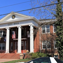
Salem City Hall

Charter Hall at the City Market Building
Transit and Meeting Points
Useful pickup, handoff, or rendezvous points close to Shawsville.
Blacksburg, VA
Roanoke
White Sulphur Springs
Alderson
Flight Path Map
This map shows the direct air route between Harrisonburg and Abingdon. Straight-line distance: 208.35 mi (335.31 km).

#1 Harrisonburg
The most populous city in Virginia.
| Population | 53,204 |
| Coordinates | 38.4495700, -78.8689200 |
| Altitude | 404 |
| Country | United States |

#2 Abingdon
City in Virginia, USA
| Population | 7,856 |
| Coordinates | 36.7098300, -81.9773500 |
| Altitude | 629 |
| Country | United States |
End: Abingdon (-81.97735, 36.70983)
Estimated Travel Time
Distance: 373 km by road
| Speed | Time |
|---|---|
| 30 mph (48.3 km/h) | 07h 43m |
| 40 mph (64.37 km/h) | 05h 47m |
| 50 mph (80.47 km/h) | 04h 37m |
| 60 mph (96.56 km/h) | 03h 51m |
| 70 mph (112.65 km/h) | 03h 18m |
| 80 mph (129 km/h) | 02h 53m |
Fuel, Round Trip and CO2
Estimated fuel cost and emissions for this route.
| Fuel | $/gal | One way | Round trip |
|---|---|---|---|
| Regular gas | $3.96 | $32.36 | $64.72 |
| Mid-grade | $4.43 | $36.18 | $72.37 |
| Premium | $4.78 | $39.04 | $78.07 |
| Diesel | $5.62 | $45.95 | $91.90 |
Assumes 8.3 L/100 km (about 28.3 MPG). CO2 is an estimate and varies by vehicle, fuel blend, traffic, and terrain.
Prices in Virginia · Jul 14, 2026
Distance to Other Cities
Planning a road trip? See the full trip guide on Trip.ovh — stops, fuel costs, weather, and departure timing.