How far is Goldsboro, NC from Durham, NC?
Fastest route
The route from Goldsboro, North Carolina to Durham, North Carolina is approximately 78.5 miles and takes around 1 hour and 19 minutes.
Directions
- Take US-70 BUS W to I-795 N.
- At the traffic circle, take the 2nd exit onto US-70 BUS W/W Ash St.
- Turn right onto US-70 BUS W (signs for Interstate 795/US 70).
- Continue on I-795 N. Take US-70 BYP W to US-70 W.
- Take exit 22 for NC-44 E toward US 117/Wayne Memorial Dr.
- Keep left at the fork and merge onto US-70 BYP W.
- Get on I-40 W in Garner from US-70 BUS W.
- Keep left to continue on US-70 BYP W.
- Take exit 326B to merge onto US-70 BUS W toward Clayton.
- Continue straight to stay on US-70 BUS W.
- Use the right 2 lanes to merge onto I-40 W via the ramp to Raleigh.
- Continue on I-40 W to Durham. Take exit 3B from NC-147 N.
- Use the right 2 lanes to take exit 279B for NC-147 N toward Durham/Downtown.
- Keep left at the fork to continue on NC-147 N.
- Take exit 3B toward US-15 BUS/US-501 BUS N/Mangum St/Roxboro St.
- Take US-15 BUS N/US-501 BUS N to your destination.
- Merge onto Jackie Robinson Dr/N Service Rd E W.
- Slight right toward US-15 BUS N/US-501 BUS N/S Roxboro St.
- Slight right onto US-15 BUS N/US-501 BUS N/S Roxboro St.
- Continue to follow US-15 BUS N/US-501 BUS N.
Tips & Suggestions
- 🚗 Make sure to follow the signs for Interstate 795/US 70 when turning onto US-70 BUS W/W Ash St.
- 🛣️ Stay on I-795 N and then merge onto US-70 BYP W to continue your journey.
- 🗺️ Use the left lanes to merge onto I-40 W via the ramp to Raleigh.
- ⚠️ Take the correct exit (3B) toward US-15 BUS/US-501 BUS N/Mangum St/Roxboro St to reach your destination.
- 📍 Keep in mind that you will need to make a slight right onto US-15 BUS N/US-501 BUS N/S Roxboro St to stay on track.
- ⛽ Plan your journey with appropriate rest stops and refueling locations along the way.
- 📱 Consider using a navigation app or GPS device for real-time directions during your trip.
Reverse, save, or send this route
This route works well as a day trip with time at the destination. Copy the route link, send it to another device, or print a clean version before you head out.
This route works well as a day trip with time at the destination.
Flight Distance
Driving Distance
Gas Cost Calculator
Leave and Arrive Planner
Pick a departure time to see your estimated arrival and same-day return window.
Drive time stays fixed at 01h 21m.
A morning start gives you useful time at the destination and keeps the return out of the late evening.
You are leaving earlier than the recommended window, which gives you extra margin for breaks and traffic.
Halfway Point
A useful midpoint for breaks, coffee, or meeting in the middle.
Town in North Carolina
Route Weather Snapshot
Check the forecast at both ends before you head out.
Mostly Sunny
Mostly Sunny
Driving Route Map
The map below follows the saved road route between Goldsboro and Durham.
Turn-by-Turn Driving Directions
Step-by-step road directions between Goldsboro and Durham.
-
1
Start on East Ash Street
953 ft · 45 sec · East Ash Street
-
2
Enter the roundabout and take exit 2 toward West Ash Street
52 m · 8 sec · West Ash Street
-
3
Exit the roundabout onto West Ash Street
926 ft · 46 sec · West Ash Street
-
4
Turn right onto North George Street
2478 ft · 49 sec · North George Street
-
5
Turn left onto Grantham Street
1.8 mi · 3 min · Grantham Street
-
6
Continue straight
5.1 mi · 7 min
-
7
Continue straight
10.4 mi · 14 min
-
8
Continue straight
2 mi · 3 min
-
9
Keep slight left
10.1 mi · 13 min
-
10
Continue on Clayton Bypass Scenic Byway
10 mi · 11 min · Clayton Bypass Scenic Byway
-
11
Merge slight left
29.5 mi · 34 min
-
12
Take the exit slight right toward I 885 North: Downtown Durham
1 km · 44 sec
-
13
Merge slight left onto Durham Freeway
4.1 mi · 5 min · Durham Freeway
-
14
Keep slight left to continue on Durham Freeway
2.6 mi · 3 min · Durham Freeway
-
15
Take the exit slight right toward Jackie Robinson Drive, Roxboro Street
769 ft · 19 sec
-
16
Continue on Jackie Robinson Drive
604 ft · 19 sec · Jackie Robinson Drive
-
17
Turn right onto South Roxboro Street
1625 ft · 49 sec · South Roxboro Street
-
18
Turn left onto East Main Street
30 m · 2 sec · East Main Street
-
19
Arrive at your destination
0 m · 1 sec · East Main Street
Car Route Details
A richer read on the saved driving route between Goldsboro and Durham.
Interchange-aware route
The drive includes several ramps, exits, or merges, so checking the next few maneuvers before busy interchanges is useful.
Clayton Bypass Scenic Byway
Merge slight left
29.5 mi · 00h 34m
Route Summary
A quick read on whether this route feels easy, ambitious, or worth planning around.
A comfortable day-trip route
This route works well as a day trip. You can leave in the morning, spend meaningful time at the destination, and still return the same day.
Mostly Sunny leaving Goldsboro and Mostly Sunny near Durham.
Trip Questions
Direct answers travelers usually want before committing to the drive.
How long does it take to drive from Goldsboro to Durham?
The road trip is about 77.8 miles (125.2 km) and usually takes 01h 21m in normal driving conditions.
Is this a same-day trip or an overnight route?
This route works well as a day trip. You can leave in the morning, spend meaningful time at the destination, and still return the same day.
What is the halfway point on this route?
Clayton is a useful midpoint, sitting about 38.8 miles from Goldsboro and 39 miles from Durham.
How much longer is the road route than the straight-line distance?
The direct path is about 66 miles (106.2 km), while the road route adds roughly 11.8 extra miles because roads do not follow the straight air line.
When is the best time to leave for this route?
A good departure window is usually 8:00 AM to 10:00 AM EDT. If you want a more comfortable same-day return, try to leave by 3:46 PM EDT.
How much will gas cost for this route?
Using about 28.3 MPG, regular gas is estimated at $10.85 one way or $21.71 round trip. Estimated CO2 is about 24.4 kg one way.
What should you check before leaving?
Before you leave, expect Mostly Sunny around Goldsboro and Mostly Sunny near Durham.
Stop Ideas Near Clayton
Useful break, food, and waypoint ideas within about 15 miles of the route midpoint.
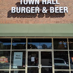
Town Hall Burger and Beer

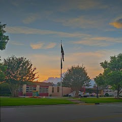
Garner Town Hall
Clayton Utilities
Angier Police Department And Town Hall
Transit and Meeting Points
Useful pickup, handoff, or rendezvous points close to Clayton.
Selma–Smithfield
Raleigh Union Station
North Carolina State Fair station
Cary
Flight Path Map
This map shows the direct air route between Goldsboro and Durham. Straight-line distance: 66 mi (106.21 km).

#1 Goldsboro
City in Wayne County, North Carolina, United States
| Population | 34,447 |
| Coordinates | 35.3848800, -77.9927700 |
| Altitude | 33 |
| Country | United States |

#2 Durham
The third most populous city in North Carolina and the center of the Durham metropolitan area.
| Population | 285,897 |
| Coordinates | 35.9940300, -78.8986200 |
| Altitude | 123 |
| Country | United States |
End: (-78.898591, 35.994064)
Estimated Travel Time
Distance: 125 km by road
| Speed | Time |
|---|---|
| 30 mph (48.3 km/h) | 02h 35m |
| 40 mph (64.37 km/h) | 01h 56m |
| 50 mph (80.47 km/h) | 01h 33m |
| 60 mph (96.56 km/h) | 01h 17m |
| 70 mph (112.65 km/h) | 01h 06m |
| 80 mph (129 km/h) | 00h 58m |
Fuel, Round Trip and CO2
Estimated fuel cost and emissions for this route.
| Fuel | $/gal | One way | Round trip |
|---|---|---|---|
| Regular gas | $3.96 | $10.85 | $21.71 |
| Mid-grade | $4.43 | $12.14 | $24.27 |
| Premium | $4.78 | $13.09 | $26.18 |
| Diesel | $5.62 | $15.41 | $30.82 |
Assumes 8.3 L/100 km (about 28.3 MPG). CO2 is an estimate and varies by vehicle, fuel blend, traffic, and terrain.
Prices in North Carolina · Aug 02, 2026
Distance to Other Cities
Planning a road trip? See the full trip guide on Trip.ovh — stops, fuel costs, weather, and departure timing.