How far is Glendale, AZ from Kaibito, AZ?
The driving distance from Glendale, AZ to Kaibito, AZ is about 259.7 miles (417.9 km), with a travel time of about 05h 21m by car.
- The straight-line flight distance is about 220.5 miles (354.8 km).
- For a round trip, plan for roughly 10h 43m of driving time before adding stops, traffic, or weather delays.
- A comfortable departure window is usually 6:00 AM to 8:00 AM MST.
Reverse, save, or send this route
This drive is better planned with a longer stop or an overnight stay. Copy the route link, send it to another device, or print a clean version before you head out.
This drive is better planned with a longer stop or an overnight stay.
Flight Distance
Driving Distance
Gas Cost Calculator
Leave and Arrive Planner
Pick a departure time to see your estimated arrival and same-day return window.
Drive time stays fixed at 05h 21m.
An early departure helps you fit a real stop into the day without turning the return into a late-night drive.
You are leaving earlier than the recommended window, which gives you extra margin for breaks and traffic.
Halfway Point
A useful midpoint for breaks, coffee, or meeting in the middle.
Census-designated place in Coconino County, Arizona, United States
Route Weather Snapshot
Check the forecast at both ends before you head out.
Slight Chance Showers And Thunderstorms
Driving Route Map
The map below follows the saved road route between Glendale and Kaibito.
Turn-by-Turn Driving Directions
Step-by-step road directions between Glendale and Kaibito.
-
1
Start on Grand Avenue
1633 ft · 31 sec · Grand Avenue
-
2
Turn sharp right onto West Myrtle Avenue
1191 ft · 48 sec · West Myrtle Avenue
-
3
Turn left onto North 59th Avenue
1.2 km · 2 min · North 59th Avenue
-
4
Turn right onto West Northern Avenue
4.2 mi · 8 min · West Northern Avenue
-
5
Turn slight left
134 m · 18 sec
-
6
Turn straight onto North Black Canyon Highway
679 ft · 14 sec · North Black Canyon Highway
-
7
Take the ramp slight left toward I 17 North: Flagstaff
702 ft · 19 sec
-
8
Merge slight left onto Black Canyon Freeway
32 mi · 35 min · Black Canyon Freeway
-
9
Continue on Phoenix–Cordes Junction Highway
8.9 mi · 10 min · Phoenix–Cordes Junction Highway
-
10
Continue on Arizona Veterans Highway
13.4 mi · 14 min · Arizona Veterans Highway
-
11
Keep slight left to continue on Arizona Veterans Highway
77.3 mi · 1 hr 18 min · Arizona Veterans Highway
-
12
Continue on Prescott–Flagstaff Highway
1 km · 44 sec · Prescott–Flagstaff Highway
-
13
Take the exit slight right toward I 40 East, Albuquerque
2458 ft · 1 min
-
14
Merge slight left onto Purple Heart Trail
5.1 mi · 6 min · Purple Heart Trail
-
15
Take the exit slight right toward US 89 North: Page
1412 ft · 36 sec
-
16
Turn left onto Country Club Drive
2753 ft · 51 sec · Country Club Drive
-
17
Turn right onto Flagstaff-Cameron Highway
2.3 mi · 3 min · Flagstaff-Cameron Highway
-
18
Continue on US Highway 89
6.4 mi · 9 min · US Highway 89
-
19
Continue on Flagstaff-Cameron Highway
37.8 mi · 45 min · Flagstaff-Cameron Highway
-
20
Enter the roundabout and take exit 1 toward Cameron–Bitter Springs Highway
47 m · 3 sec · Cameron-Bitter Springs Highway
-
21
Exit the rotary onto Cameron-Bitter Springs Highway
1.4 mi · 2 min · Cameron-Bitter Springs Highway
-
22
Continue on US 89
1419 ft · 27 sec · US 89
-
23
Continue on Cameron-Bitter Springs Highway
13.9 mi · 16 min · Cameron-Bitter Springs Highway
-
24
Turn right onto Navajo Trail
30.7 mi · 35 min · Navajo Trail
-
25
Turn left onto Navajo Route 6262
2.1 mi · 5 min · Navajo Route 6262
-
26
Turn left onto Navajo Route 21
19.1 mi · 46 min · Navajo Route 21
-
27
Continue on Navajo Route 6331
1.2 mi · 3 min · Navajo Route 6331
-
28
Arrive at your destination
0 m · 1 sec · Navajo Route 6331
Car Route Details
A richer read on the saved driving route between Glendale and Kaibito.
Highway-focused drive
Most of the mileage stays on named highways, so the important moments are ramps, exits, merges, and the final local approach.
Arizona Veterans Highway
Keep slight left to continue on Arizona Veterans Highway
77.3 mi · 01h 18m
Route Summary
A quick read on whether this route feels easy, ambitious, or worth planning around.
A longer out-and-back drive
This is still possible in one day, but it becomes a long driving day. Leaving early and planning your stop window matters more here.
Sunny leaving Glendale and Slight Chance Showers And Thunderstorms near Kaibito.
Trip Questions
Direct answers travelers usually want before committing to the drive.
How long does it take to drive from Glendale to Kaibito?
The road trip is about 259.7 miles (417.9 km) and usually takes 05h 21m in normal driving conditions.
Is this a same-day trip or an overnight route?
This is still possible in one day, but it becomes a long driving day. Leaving early and planning your stop window matters more here.
What is the halfway point on this route?
Mountainaire is a useful midpoint, sitting about 130 miles from Glendale and 129.7 miles from Kaibito.
How much longer is the road route than the straight-line distance?
The direct path is about 220.5 miles (354.8 km), while the road route adds roughly 39.2 extra miles because roads do not follow the straight air line.
When is the best time to leave for this route?
A good departure window is usually 6:00 AM to 8:00 AM MST. If you want a more comfortable same-day return, try to leave by 6:16 AM MST.
How much will gas cost for this route?
Using about 28.3 MPG, regular gas is estimated at $45.35 one way or $90.70 round trip. Estimated CO2 is about 81.4 kg one way.
Do you cross a time zone on this route?
Yes. There is about a 1 hour time difference between Glendale and Kaibito, so arrival and return times should be read in local time.
What should you check before leaving?
Before you leave, expect Sunny around Glendale and Slight Chance Showers And Thunderstorms near Kaibito.
Stop Ideas Near Mountainaire
Useful break, food, and waypoint ideas within about 15 miles of the route midpoint.
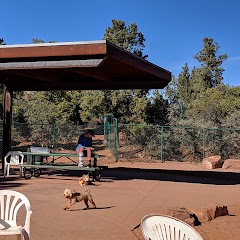
Sedona Dog Park

United States Postal Service

Flagstaff City Hall
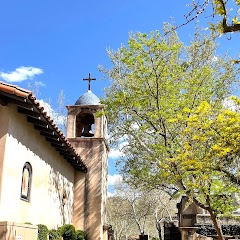
Sedona
Transit and Meeting Points
Useful pickup, handoff, or rendezvous points close to Mountainaire.
Flagstaff (Greyhound), Arizona
Flagstaff Station
Sedona (Center Bus Stop), Arizona
Williams, Arizona
Flight Path Map
This map shows the direct air route between Glendale and Kaibito. Straight-line distance: 220.47 mi (354.82 km).

#1 Glendale
The second most populous city in Arizona.
| Population | 255,307 |
| Coordinates | 33.5386500, -112.1859900 |
| Altitude | 351 |
| Country | United States |

#2 Kaibito
Census designated place
| Population | 1,522 |
| Coordinates | 36.5972200, -111.0743100 |
| Altitude | 1771 |
| Country | United States |
End: Kaibito (-111.07431, 36.59722)
Estimated Travel Time
Distance: 418 km by road
| Speed | Time |
|---|---|
| 30 mph (48.3 km/h) | 08h 39m |
| 40 mph (64.37 km/h) | 06h 29m |
| 50 mph (80.47 km/h) | 05h 11m |
| 60 mph (96.56 km/h) | 04h 19m |
| 70 mph (112.65 km/h) | 03h 42m |
| 80 mph (129 km/h) | 03h 14m |
Fuel, Round Trip and CO2
Estimated fuel cost and emissions for this route.
| Fuel | $/gal | One way | Round trip |
|---|---|---|---|
| Regular gas | $4.95 | $45.35 | $90.70 |
| Mid-grade | $5.34 | $48.90 | $97.79 |
| Premium | $5.57 | $50.98 | $101.97 |
| Diesel | $6.37 | $58.31 | $116.63 |
Assumes 8.3 L/100 km (about 28.3 MPG). CO2 is an estimate and varies by vehicle, fuel blend, traffic, and terrain.
Prices in Arizona · Jul 24, 2026
Distance to Other Cities
Planning a road trip? See the full trip guide on Trip.ovh — stops, fuel costs, weather, and departure timing.