How far is Freedom, NH from Salem, NH?
The driving distance from Freedom, NH to Salem, NH is about 97.1 miles (156.2 km), with a travel time of about 01h 50m by car.
- The straight-line flight distance is about 71.2 miles (114.6 km).
- For a round trip, plan for roughly 03h 40m of driving time before adding stops, traffic, or weather delays.
- A comfortable departure window is usually 8:00 AM to 10:00 AM EDT.
Reverse, save, or send this route
This route works well as a day trip with time at the destination. Copy the route link, send it to another device, or print a clean version before you head out.
This route works well as a day trip with time at the destination.
Flight Distance
Driving Distance
Gas Cost Calculator
Leave and Arrive Planner
Pick a departure time to see your estimated arrival and same-day return window.
Drive time stays fixed at 01h 50m.
A morning start gives you useful time at the destination and keeps the return out of the late evening.
You are leaving earlier than the recommended window, which gives you extra margin for breaks and traffic.
Halfway Point
A useful midpoint for breaks, coffee, or meeting in the middle.
City in Strafford County, New Hampshire, United States
Route Weather Snapshot
Check the forecast at both ends before you head out.
Patchy Fog then Mostly Sunny
Driving Route Map
The map below follows the saved road route between Freedom and Salem.
Turn-by-Turn Driving Directions
Step-by-step road directions between Freedom and Salem.
-
1
Start on Elm Street
1080 ft · 31 sec · Elm Street
-
2
Continue on Loon Lake Road
1.3 mi · 3 min · Loon Lake Road
-
3
At the end of the road, turn right onto Porter Road
2665 ft · 41 sec · Porter Road
-
4
Continue on Ossipee Trail
6.3 mi · 9 min · Ossipee Trail
-
5
Take the ramp left
1437 ft · 39 sec
-
6
Merge slight left onto White Mountain Highway
21.2 mi · 31 min · White Mountain Highway
-
7
Continue on Spaulding Turnpike
34 mi · 45 min · Spaulding Turnpike
-
8
Merge slight left onto Blue Star Turnpike
7.3 mi · 9 min · Blue Star Turnpike
-
9
Keep slight left to continue on Blue Star Turnpike
7.7 mi · 9 min · Blue Star Turnpike
-
10
Keep slight right to continue on I 495 South: Worcester
12.9 mi · 15 min
-
11
Take the exit slight right toward MA 97, MA 110, MA 113: Haverhill, Salem New Hampshire
830 ft · 20 sec
-
12
Keep slight right to continue on MA 97: Haverhill, Salem New Hampshire
816 ft · 23 sec
-
13
Turn right onto Broadway
1.2 mi · 2 min · Broadway
-
14
Continue on State Route 97
1.8 mi · 4 min · State Route 97
-
15
Continue on Ayers Village Road
1.2 km · 2 min · Ayers Village Road
-
16
Continue on Main Street
1 mi · 2 min · Main Street
-
17
Turn left
34 m · 8 sec
-
18
Arrive at your destination
0 m · 1 sec
Car Route Details
A richer read on the saved driving route between Freedom and Salem.
Highway-focused drive
Most of the mileage stays on named highways, so the important moments are ramps, exits, merges, and the final local approach.
Spaulding Turnpike
Continue on Spaulding Turnpike
34 mi · 00h 45m
Route Summary
A quick read on whether this route feels easy, ambitious, or worth planning around.
A comfortable day-trip route
This route works well as a day trip. You can leave in the morning, spend meaningful time at the destination, and still return the same day.
Patchy Fog then Mostly Sunny leaving Freedom and Patchy Fog near Salem.
Trip Questions
Direct answers travelers usually want before committing to the drive.
How long does it take to drive from Freedom to Salem?
The road trip is about 97.1 miles (156.2 km) and usually takes 01h 50m in normal driving conditions.
Is this a same-day trip or an overnight route?
This route works well as a day trip. You can leave in the morning, spend meaningful time at the destination, and still return the same day.
What is the halfway point on this route?
Somersworth is a useful midpoint, sitting about 48.3 miles from Freedom and 48.7 miles from Salem.
How much longer is the road route than the straight-line distance?
The direct path is about 71.2 miles (114.6 km), while the road route adds roughly 25.9 extra miles because roads do not follow the straight air line.
When is the best time to leave for this route?
A good departure window is usually 8:00 AM to 10:00 AM EDT. If you want a more comfortable same-day return, try to leave by 2:50 PM EDT.
How much will gas cost for this route?
Using about 28.3 MPG, regular gas is estimated at $13.49 one way or $26.98 round trip. Estimated CO2 is about 30.4 kg one way.
What should you check before leaving?
Before you leave, expect Patchy Fog then Mostly Sunny around Freedom and Patchy Fog near Salem.
Stop Ideas Near Somersworth
Useful break, food, and waypoint ideas within about 15 miles of the route midpoint.

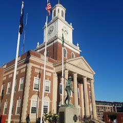
Old City Hall
Dover City Hall
Transit and Meeting Points
Useful pickup, handoff, or rendezvous points close to Somersworth.
Dover Transportation Center
Durham–UNH station
Wells Regional Transportation Center
Portsmouth, New Hampshire
Flight Path Map
This map shows the direct air route between Freedom and Salem. Straight-line distance: 71.23 mi (114.63 km).

#1 Freedom
Town located in Carroll County, New Hampshire
| Population | 1,593 |
| Coordinates | 43.8123000, -71.0356200 |
| Altitude | 135 |
| Country | United States |

#2 Salem
Town in New Hampshire, United States
| Population | 30,641 |
| Coordinates | 42.7884200, -71.2008900 |
| Altitude | 40 |
| Country | United States |
End: (-71.200866, 42.788382)
Estimated Travel Time
Distance: 156 km by road
| Speed | Time |
|---|---|
| 30 mph (48.3 km/h) | 03h 14m |
| 40 mph (64.37 km/h) | 02h 25m |
| 50 mph (80.47 km/h) | 01h 56m |
| 60 mph (96.56 km/h) | 01h 37m |
| 70 mph (112.65 km/h) | 01h 23m |
| 80 mph (129 km/h) | 01h 12m |
Fuel, Round Trip and CO2
Estimated fuel cost and emissions for this route.
| Fuel | $/gal | One way | Round trip |
|---|---|---|---|
| Regular gas | $3.95 | $13.49 | $26.98 |
| Mid-grade | $4.46 | $15.24 | $30.49 |
| Premium | $4.86 | $16.61 | $33.23 |
| Diesel | $6.00 | $20.51 | $41.02 |
Assumes 8.3 L/100 km (about 28.3 MPG). CO2 is an estimate and varies by vehicle, fuel blend, traffic, and terrain.
Prices in New Hampshire · Aug 01, 2026
Distance to Other Cities
Planning a road trip? See the full trip guide on Trip.ovh — stops, fuel costs, weather, and departure timing.