How far is Fredonia, AZ from Tucson, AZ?
The driving distance from Fredonia, AZ to Tucson, AZ is about 455.4 miles (732.9 km), with a travel time of about 07h 30m by car.
- The straight-line flight distance is about 338.8 miles (545.3 km).
- For a round trip, plan for roughly 15h 00m of driving time before adding stops, traffic, or weather delays.
- A comfortable departure window is usually 6:00 AM to 7:30 AM MST.
Reverse, save, or send this route
This drive is better planned with a longer stop or an overnight stay. Copy the route link, send it to another device, or print a clean version before you head out.
This drive is better planned with a longer stop or an overnight stay.
Flight Distance
Driving Distance
Gas Cost Calculator
Leave and Arrive Planner
Pick a departure time to see your estimated arrival and same-day return window.
Drive time stays fixed at 07h 30m.
Starting early still helps, but most travelers will want a longer stop or an overnight stay on a route this long.
You are leaving earlier than the recommended window, which gives you extra margin for breaks and traffic.
Halfway Point
A useful midpoint for breaks, coffee, or meeting in the middle.
Park in Uintah County, Utah, United States of America
Route Weather Snapshot
Check the forecast at both ends before you head out.
Mostly Sunny
Mostly Sunny then Slight Chance Showers And Thunderstorms
Driving Route Map
The map below follows the saved road route between Fredonia and Tucson.
Turn-by-Turn Driving Directions
Step-by-step road directions between Fredonia and Tucson.
-
1
Start on West Pratt Street
14 m · 3 sec · West Pratt Street
-
2
Turn right onto South Main Street
1.6 mi · 3 min · South Main Street
-
3
Continue on Bitter Springs–Fredonia Highway
83.6 mi · 1 hr 54 min · Bitter Springs–Fredonia Highway
-
4
At the end of the road, turn right onto Cameron-Bitter Springs Highway
56.6 mi · 1 hr 6 min · Cameron-Bitter Springs Highway
-
5
Continue on US 89
1421 ft · 27 sec · US 89
-
6
Continue on Cameron-Bitter Springs Highway
1.4 mi · 2 min · Cameron-Bitter Springs Highway
-
7
Enter the roundabout and take exit 2 toward Cameron–Bitter Springs Highway
47 m · 3 sec · Flagstaff-Cameron Highway
-
8
Exit the rotary onto Flagstaff-Cameron Highway
37.9 mi · 45 min · Flagstaff-Cameron Highway
-
9
Continue on US Highway 89
6.4 mi · 9 min · US Highway 89
-
10
Continue on Flagstaff-Cameron Highway
2.3 mi · 4 min · Flagstaff-Cameron Highway
-
11
Turn left onto Country Club Drive
1786 ft · 51 sec · Country Club Drive
-
12
Take the exit right
1952 ft · 48 sec
-
13
Merge slight left onto Purple Heart Trail
4.7 mi · 5 min · Purple Heart Trail
-
14
Take the exit slight right toward I 17 South, AZ 89A North: Phoenix, Flagstaff
907 ft · 17 sec
-
15
Keep slight left to continue on I 17, AZ 89A South: Sedona, Phoenix
1 mi · 2 min
-
16
Merge slight left onto Arizona Veterans Highway
93 mi · 1 hr 33 min · Arizona Veterans Highway
-
17
Continue on Phoenix–Cordes Junction Highway
5.8 mi · 6 min · Phoenix–Cordes Junction Highway
-
18
Continue on Black Canyon Freeway
10.5 mi · 10 min · Black Canyon Freeway
-
19
Continue on North Black Canyon Highway
3.2 mi · 3 min · North Black Canyon Highway
-
20
Continue on Black Canyon Freeway
27.9 mi · 32 min · Black Canyon Freeway
-
21
Continue on Maricopa Freeway
16.3 mi · 19 min · Maricopa Freeway
-
22
Continue on Phoenix-Casa Grande Highway
37.8 mi · 38 min · Phoenix-Casa Grande Highway
-
23
Continue on Casa Grande-Tucson Highway
54.6 mi · 56 min · Casa Grande-Tucson Highway
-
24
Continue on North Freeway
3.6 mi · 4 min · North Freeway
-
25
Take the exit slight right toward Congress Street, Broadway Boulevard
2278 ft · 44 sec
-
26
Turn straight onto North Freeway Road
49 m · 5 sec · North Freeway Road
-
27
Turn left onto West Congress Street
1776 ft · 56 sec · West Congress Street
-
28
Continue on West Broadway Boulevard
2.9 mi · 7 min · West Broadway Boulevard
-
29
Turn left onto North Country Club Road
40 m · 9 sec · North Country Club Road
-
30
Arrive at your destination
0 m · 1 sec · North Country Club Road
Car Route Details
A richer read on the saved driving route between Fredonia and Tucson.
Long-distance drive
This route is long enough that fuel, rest stops, weather, and timing matter more than any single maneuver.
Arizona Veterans Highway
Merge slight left onto Arizona Veterans Highway
93 mi · 01h 34m
Route Summary
A quick read on whether this route feels easy, ambitious, or worth planning around.
Better with a longer stop
This route is long enough that most travelers will be better off planning an overnight stay or a more deliberate stop window.
Mostly Sunny leaving Fredonia and Mostly Sunny then Slight Chance Showers And Thunderstorms near Tucson.
Trip Questions
Direct answers travelers usually want before committing to the drive.
How long does it take to drive from Fredonia to Tucson?
The road trip is about 455.4 miles (732.9 km) and usually takes 07h 30m in normal driving conditions.
Is this a same-day trip or an overnight route?
This route is long enough that most travelers will be better off planning an overnight stay or a more deliberate stop window.
What is the halfway point on this route?
Big Park is a useful midpoint, sitting about 226.7 miles from Fredonia and 228.7 miles from Tucson.
How much longer is the road route than the straight-line distance?
The direct path is about 338.8 miles (545.3 km), while the road route adds roughly 116.6 extra miles because roads do not follow the straight air line.
When is the best time to leave for this route?
A good departure window is usually 6:00 AM to 7:30 AM MST. Starting early still helps, but most travelers will want a longer stop or an overnight stay on a route this long.
How much will gas cost for this route?
Using about 28.3 MPG, regular gas is estimated at $79.56 one way or $159.13 round trip. Estimated CO2 is about 142.8 kg one way.
What should you check before leaving?
Before you leave, expect Mostly Sunny around Fredonia and Mostly Sunny then Slight Chance Showers And Thunderstorms near Tucson.
Stop Ideas Near Big Park
Useful break, food, and waypoint ideas within about 15 miles of the route midpoint.
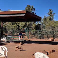
Sedona Dog Park

Worthwhile Wealth Council

Sedona City Hall
Sedona
Transit and Meeting Points
Useful pickup, handoff, or rendezvous points close to Big Park.
Sedona (Center Bus Stop), Arizona
Camp Verde, Arizona
Flagstaff (Greyhound), Arizona
Flagstaff Station
Flight Path Map
This map shows the direct air route between Fredonia and Tucson. Straight-line distance: 338.82 mi (545.28 km).

#1 Fredonia
Town in Coconino County, Arizona, United States
| Population | 1,272 |
| Coordinates | 36.9455400, -112.5265900 |
| Altitude | 1424 |
| Country | United States |

#2 Tucson
The second most populous city in Arizona and the center of the Tucson metropolitan area.
| Population | 553,571 |
| Coordinates | 32.2217400, -110.9264800 |
| Altitude | 759 |
| Country | United States |
End: North Country Club Road (-110.926548, 32.221738)
Estimated Travel Time
Distance: 733 km by road
| Speed | Time |
|---|---|
| 30 mph (48.3 km/h) | 15h 10m |
| 40 mph (64.37 km/h) | 11h 23m |
| 50 mph (80.47 km/h) | 09h 06m |
| 60 mph (96.56 km/h) | 07h 35m |
| 70 mph (112.65 km/h) | 06h 30m |
| 80 mph (129 km/h) | 05h 40m |
Fuel, Round Trip and CO2
Estimated fuel cost and emissions for this route.
| Fuel | $/gal | One way | Round trip |
|---|---|---|---|
| Regular gas | $4.95 | $79.56 | $159.13 |
| Mid-grade | $5.34 | $85.78 | $171.56 |
| Premium | $5.57 | $89.45 | $178.89 |
| Diesel | $6.37 | $102.30 | $204.60 |
Assumes 8.3 L/100 km (about 28.3 MPG). CO2 is an estimate and varies by vehicle, fuel blend, traffic, and terrain.
Prices in Arizona · Jul 26, 2026
Distance to Other Cities
Planning a road trip? See the full trip guide on Trip.ovh — stops, fuel costs, weather, and departure timing.