How far is Four Oaks, NC from High Point, NC?
The driving distance from Four Oaks, NC to High Point, NC is about 114.6 miles (184.4 km), with a travel time of about 02h 02m by car.
- The straight-line flight distance is about 95.3 miles (153.4 km).
- For a round trip, plan for roughly 04h 04m of driving time before adding stops, traffic, or weather delays.
- A comfortable departure window is usually 8:00 AM to 10:00 AM EDT.
Reverse, save, or send this route
This route works well as a day trip with time at the destination. Copy the route link, send it to another device, or print a clean version before you head out.
This route works well as a day trip with time at the destination.
Flight Distance
Driving Distance
Gas Cost Calculator
Leave and Arrive Planner
Pick a departure time to see your estimated arrival and same-day return window.
Drive time stays fixed at 02h 02m.
A morning start gives you useful time at the destination and keeps the return out of the late evening.
You are leaving earlier than the recommended window, which gives you extra margin for breaks and traffic.
Halfway Point
A useful midpoint for breaks, coffee, or meeting in the middle.
Town in North Carolina, United States
Route Weather Snapshot
Check the forecast at both ends before you head out.
Slight Chance Showers And Thunderstorms
Mostly Sunny
Driving Route Map
The map below follows the saved road route between Four Oaks and High Point.
Turn-by-Turn Driving Directions
Step-by-step road directions between Four Oaks and High Point.
-
1
Start on East Wellons Street
100 m · 12 sec · East Wellons Street
-
2
Turn right onto North Baker Street
2174 ft · 57 sec · North Baker Street
-
3
Turn left onto East Hatcher Street
2318 ft · 1 min · East Hatcher Street
-
4
Continue on Black Creek Road
2.3 mi · 3 min · Black Creek Road
-
5
Turn left onto Lassiter Road
4.6 mi · 6 min · Lassiter Road
-
6
Turn left
2.3 mi · 3 min
-
7
Take the ramp right
1277 ft · 31 sec
-
8
Merge slight left
5.4 mi · 6 min
-
9
Keep slight right to continue on NC 42: Fuquay-Varina
1960 ft · 24 sec
-
10
Take the exit slight right toward Cleveland Rd
1339 ft · 35 sec
-
11
Turn left onto Cleveland Road
1.6 mi · 3 min · Cleveland Road
-
12
Continue on Cleveland School Road
1.1 mi · 2 min · Cleveland School Road
-
13
Turn right onto Benson Road
2708 ft · 57 sec · Benson Road
-
14
Take the ramp left toward NC 540 Toll West: Apex
1972 ft · 49 sec
-
15
Merge slight left onto Triangle Expressway
19.5 mi · 21 min · Triangle Expressway
-
16
Take the exit slight right toward US 64: Apex, Pittsboro
1111 ft · 27 sec
-
17
Keep slight left
1902 ft · 46 sec
-
18
Keep slight right to continue on US 64 West: Pittsboro
1274 ft · 31 sec
-
19
Merge slight left
32 mi · 42 min
-
20
Take the exit right
1943 ft · 47 sec
-
21
Merge slight left onto Isaac Brooks Highway
25.5 mi · 31 min · Isaac Brooks Highway
-
22
Take the exit slight right toward I 85, US 421 North: Winston-Salem, Durham, Charlotte
1107 ft · 27 sec
-
23
Keep slight left to continue on I 85 South, US 421 North: Winston-Salem, Charlotte
1.3 km · 2 min
-
24
Merge slight left onto Greensboro Urban Loop
4.8 mi · 5 min · Greensboro Urban Loop
-
25
Keep slight left to continue on I 85 South: High Point, Charlotte
2.4 mi · 3 min
-
26
Keep slight right to continue on US 29 South
7.1 mi · 8 min
-
27
Take the exit slight right toward South Main Street, Downtown
1356 ft · 35 sec
-
28
Turn right onto South Main Street
1.6 mi · 3 min · South Main Street
-
29
Arrive at your destination
0 m · 1 sec · South Main Street
Car Route Details
A richer read on the saved driving route between Four Oaks and High Point.
Highway-focused drive
Most of the mileage stays on named highways, so the important moments are ramps, exits, merges, and the final local approach.
US 64 West
Merge slight left
32 mi · 00h 42m
Route Summary
A quick read on whether this route feels easy, ambitious, or worth planning around.
A comfortable day-trip route
This route works well as a day trip. You can leave in the morning, spend meaningful time at the destination, and still return the same day.
Slight Chance Showers And Thunderstorms leaving Four Oaks and Mostly Sunny near High Point.
Trip Questions
Direct answers travelers usually want before committing to the drive.
How long does it take to drive from Four Oaks to High Point?
The road trip is about 114.6 miles (184.4 km) and usually takes 02h 02m in normal driving conditions.
Is this a same-day trip or an overnight route?
This route works well as a day trip. You can leave in the morning, spend meaningful time at the destination, and still return the same day.
What is the halfway point on this route?
Pittsboro is a useful midpoint, sitting about 57.6 miles from Four Oaks and 57 miles from High Point.
How much longer is the road route than the straight-line distance?
The direct path is about 95.3 miles (153.4 km), while the road route adds roughly 19.3 extra miles because roads do not follow the straight air line.
When is the best time to leave for this route?
A good departure window is usually 8:00 AM to 10:00 AM EDT. If you want a more comfortable same-day return, try to leave by 2:26 PM EDT.
How much will gas cost for this route?
Using about 28.3 MPG, regular gas is estimated at $16.00 one way or $32.00 round trip. Estimated CO2 is about 35.9 kg one way.
What should you check before leaving?
Before you leave, expect Slight Chance Showers And Thunderstorms around Four Oaks and Mostly Sunny near High Point.
Stop Ideas Near Pittsboro
Useful break, food, and waypoint ideas within about 15 miles of the route midpoint.
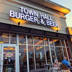
Town Hall Burger and Beer
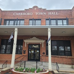
Carrboro Town Hall

The Town Hall Grill
Transit and Meeting Points
Useful pickup, handoff, or rendezvous points close to Pittsboro.
Cary
Durham
North Carolina State Fair station
Burlington
Flight Path Map
This map shows the direct air route between Four Oaks and High Point. Straight-line distance: 95.33 mi (153.42 km).

#1 Four Oaks
Town of the United States
| Population | 2,387 |
| Coordinates | 35.4448800, -78.4269500 |
| Altitude | 60 |
| Country | United States |

#2 High Point
The second most populous city in Guilford County, North Carolina.
| Population | 113,565 |
| Coordinates | 35.9556900, -80.0053200 |
| Altitude | 281 |
| Country | United States |
End: South Main Street (-80.005284, 35.955694)
Estimated Travel Time
Distance: 184 km by road
| Speed | Time |
|---|---|
| 30 mph (48.3 km/h) | 03h 49m |
| 40 mph (64.37 km/h) | 02h 51m |
| 50 mph (80.47 km/h) | 02h 17m |
| 60 mph (96.56 km/h) | 01h 54m |
| 70 mph (112.65 km/h) | 01h 38m |
| 80 mph (129 km/h) | 01h 25m |
Fuel, Round Trip and CO2
Estimated fuel cost and emissions for this route.
| Fuel | $/gal | One way | Round trip |
|---|---|---|---|
| Regular gas | $3.96 | $16.00 | $32.00 |
| Mid-grade | $4.43 | $17.89 | $35.79 |
| Premium | $4.78 | $19.30 | $38.61 |
| Diesel | $5.62 | $22.72 | $45.44 |
Assumes 8.3 L/100 km (about 28.3 MPG). CO2 is an estimate and varies by vehicle, fuel blend, traffic, and terrain.
Prices in North Carolina · Jul 27, 2026
Distance to Other Cities
Planning a road trip? See the full trip guide on Trip.ovh — stops, fuel costs, weather, and departure timing.