How far is Fontana, CA from El Centro, CA?
The driving distance from Fontana, CA to El Centro, CA is about 166.3 miles (267.7 km), with a travel time of about 03h 14m by car.
- The straight-line flight distance is about 140.4 miles (226 km).
- For a round trip, plan for roughly 06h 29m of driving time before adding stops, traffic, or weather delays.
- A comfortable departure window is usually 6:00 AM to 8:00 AM PDT.
Reverse, save, or send this route
This drive is better planned with a longer stop or an overnight stay. Copy the route link, send it to another device, or print a clean version before you head out.
This drive is better planned with a longer stop or an overnight stay.
Flight Distance
Driving Distance
Gas Cost Calculator
Leave and Arrive Planner
Pick a departure time to see your estimated arrival and same-day return window.
Drive time stays fixed at 03h 14m.
An early departure helps you fit a real stop into the day without turning the return into a late-night drive.
You are leaving earlier than the recommended window, which gives you extra margin for breaks and traffic.
Halfway Point
A useful midpoint for breaks, coffee, or meeting in the middle.
A city in Riverside County, California.
Route Weather Snapshot
Check the forecast at both ends before you head out.
Mostly Sunny
Driving Route Map
The map below follows the saved road route between Fontana and El Centro.
Turn-by-Turn Driving Directions
Step-by-step road directions between Fontana and El Centro.
-
1
Start on Merrill Avenue
63 m · 9 sec · Merrill Avenue
-
2
Turn left onto Sierra Avenue
1.7 mi · 3 min · Sierra Avenue
-
3
Take the ramp slight left toward I 10 East: San Bernardino
2075 ft · 53 sec
-
4
Merge slight left onto San Bernardino Freeway
7.2 mi · 8 min · San Bernardino Freeway
-
5
Continue on Pearl Harbor Memorial Highway
40.3 mi · 44 min · Pearl Harbor Memorial Highway
-
6
Keep slight left to continue on Sonny Bono Memorial Freeway
32.5 mi · 35 min · Sonny Bono Memorial Freeway
-
7
Keep slight right to continue on CA 86 South: CA 86 South, Brawley, El Centro
70 mi · 1 hr 22 min
-
8
Turn right onto South 1st Street
1999 ft · 28 sec · South 1st Street
-
9
Continue on South Brawley Avenue
1.5 km · 1 min · South Brawley Avenue
-
10
Turn left
99 m · 18 sec
-
11
Turn right
609 ft · 46 sec
-
12
At the end of the road, turn right
144 m · 24 sec
-
13
Turn left
12.2 mi · 17 min
-
14
Turn left onto West State Street
2101 ft · 1 min · West State Street
-
15
Arrive at your destination
0 m · 1 sec · West State Street
Car Route Details
A richer read on the saved driving route between Fontana and El Centro.
Straightforward drive
The saved road route has a manageable number of maneuvers and should be easy to follow with normal attention to signs.
CA 86 South
Keep slight right to continue on CA 86 South: CA 86 South, Brawley, El Centro
70 mi · 01h 22m
Route Summary
A quick read on whether this route feels easy, ambitious, or worth planning around.
A longer out-and-back drive
This is still possible in one day, but it becomes a long driving day. Leaving early and planning your stop window matters more here.
Sunny leaving Fontana and Mostly Sunny near El Centro.
Trip Questions
Direct answers travelers usually want before committing to the drive.
How long does it take to drive from Fontana to El Centro?
The road trip is about 166.3 miles (267.7 km) and usually takes 03h 14m in normal driving conditions.
Is this a same-day trip or an overnight route?
This is still possible in one day, but it becomes a long driving day. Leaving early and planning your stop window matters more here.
What is the halfway point on this route?
Coachella is a useful midpoint, sitting about 83.1 miles from Fontana and 83.2 miles from El Centro.
How much longer is the road route than the straight-line distance?
The direct path is about 140.4 miles (226 km), while the road route adds roughly 25.9 extra miles because roads do not follow the straight air line.
When is the best time to leave for this route?
A good departure window is usually 6:00 AM to 8:00 AM PDT. If you want a more comfortable same-day return, try to leave by 10:30 AM PDT.
How much will gas cost for this route?
Using about 28.3 MPG, regular gas is estimated at $33.86 one way or $67.73 round trip. Estimated CO2 is about 52.2 kg one way.
What should you check before leaving?
Before you leave, expect Sunny around Fontana and Mostly Sunny near El Centro.
Stop Ideas Near Coachella
Useful break, food, and waypoint ideas within about 15 miles of the route midpoint.

Turtle Back Mesa Bed & Breakfast

Hotel Indigo Coachella, an IHG Hotel

United States Postal Service
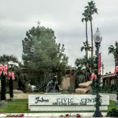
Indio City Hall
Transit and Meeting Points
Useful pickup, handoff, or rendezvous points close to Coachella.
Indio, California
La Quinta, CA
Palm Desert, CA
Palm Springs (Buses), California
Flight Path Map
This map shows the direct air route between Fontana and El Centro. Straight-line distance: 140.42 mi (225.99 km).

#1 Fontana
The second most populous city in San Bernardino County, California.
| Population | 216,173 |
| Coordinates | 34.0922300, -117.4350500 |
| Altitude | 377 |
| Country | United States |

#2 El Centro
A city in Imperial County, California.
| Population | 43,601 |
| Coordinates | 32.7920000, -115.5630500 |
| Altitude | -12 |
| Country | United States |
End: El Centro (-115.56305, 32.792)
Estimated Travel Time
Distance: 268 km by road
| Speed | Time |
|---|---|
| 30 mph (48.3 km/h) | 05h 32m |
| 40 mph (64.37 km/h) | 04h 09m |
| 50 mph (80.47 km/h) | 03h 19m |
| 60 mph (96.56 km/h) | 02h 46m |
| 70 mph (112.65 km/h) | 02h 22m |
| 80 mph (129 km/h) | 02h 04m |
Fuel, Round Trip and CO2
Estimated fuel cost and emissions for this route.
| Fuel | $/gal | One way | Round trip |
|---|---|---|---|
| Regular gas | $5.77 | $33.86 | $67.73 |
| Mid-grade | $6.07 | $35.61 | $71.21 |
| Premium | $6.24 | $36.65 | $73.29 |
| Diesel | $7.57 | $44.42 | $88.84 |
Assumes 8.3 L/100 km (about 28.3 MPG). CO2 is an estimate and varies by vehicle, fuel blend, traffic, and terrain.
Prices in California · Jul 17, 2026
Distance to Other Cities
Planning a road trip? See the full trip guide on Trip.ovh — stops, fuel costs, weather, and departure timing.