How far is Flagstaff, AZ from Kingman, AZ?
The driving distance from Flagstaff, AZ to Kingman, AZ is about 147.8 miles (237.8 km), with a travel time of about 02h 34m by car.
- The straight-line flight distance is about 135.6 miles (218.2 km).
- For a round trip, plan for roughly 05h 08m of driving time before adding stops, traffic, or weather delays.
- A comfortable departure window is usually 8:00 AM to 10:00 AM MST.
Reverse, save, or send this route
This route works well as a day trip with time at the destination. Copy the route link, send it to another device, or print a clean version before you head out.
This route works well as a day trip with time at the destination.
Flight Distance
Driving Distance
Gas Cost Calculator
Leave and Arrive Planner
Pick a departure time to see your estimated arrival and same-day return window.
Drive time stays fixed at 02h 34m.
A morning start gives you useful time at the destination and keeps the return out of the late evening.
You are leaving earlier than the recommended window, which gives you extra margin for breaks and traffic.
Halfway Point
A useful midpoint for breaks, coffee, or meeting in the middle.
Census-designated place in Yavapai County, Arizona
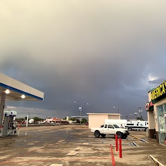
Route Weather Snapshot
Check the forecast at both ends before you head out.
Chance Showers And Thunderstorms
Sunny then Isolated Showers And Thunderstorms
Driving Route Map
The map below follows the saved road route between Flagstaff and Kingman.
Turn-by-Turn Driving Directions
Step-by-step road directions between Flagstaff and Kingman.
-
1
Start on West Historic Route 66
153 m · 15 sec · West Historic Route 66
-
2
Turn slight left onto South Milton Road
2868 ft · 1 min · South Milton Road
-
3
Turn right onto West Historic Route 66
4 mi · 7 min · West Historic Route 66
-
4
Take the ramp straight
2469 ft · 1 min
-
5
Merge slight left onto Purple Heart Trail
141.4 mi · 2 hr 21 min · Purple Heart Trail
-
6
Take the exit slight right toward US 93: Beale Street, Las Vegas
1909 ft · 47 sec
-
7
Turn straight onto West Beale Street
1.4 km · 2 min · West Beale Street
-
8
Turn right onto North 4th Street
21 m · 3 sec · North 4th Street
-
9
Arrive at your destination
0 m · 1 sec · North 4th Street
Car Route Details
A richer read on the saved driving route between Flagstaff and Kingman.
Straightforward drive
The saved road route has a manageable number of maneuvers and should be easy to follow with normal attention to signs.
Purple Heart Trail
Merge slight left onto Purple Heart Trail
141 mi · 02h 22m
Route Summary
A quick read on whether this route feels easy, ambitious, or worth planning around.
A comfortable day-trip route
This route works well as a day trip. You can leave in the morning, spend meaningful time at the destination, and still return the same day.
Chance Showers And Thunderstorms leaving Flagstaff and Sunny then Isolated Showers And Thunderstorms near Kingman.
Trip Questions
Direct answers travelers usually want before committing to the drive.
How long does it take to drive from Flagstaff to Kingman?
The road trip is about 147.8 miles (237.8 km) and usually takes 02h 34m in normal driving conditions.
Is this a same-day trip or an overnight route?
This route works well as a day trip. You can leave in the morning, spend meaningful time at the destination, and still return the same day.
What is the halfway point on this route?
Paulden is a useful midpoint, sitting about 73.8 miles from Flagstaff and 74 miles from Kingman.
How much longer is the road route than the straight-line distance?
The direct path is about 135.6 miles (218.2 km), while the road route adds roughly 12.2 extra miles because roads do not follow the straight air line.
When is the best time to leave for this route?
A good departure window is usually 8:00 AM to 10:00 AM MST. If you want a more comfortable same-day return, try to leave by 1:22 PM MST.
How much will gas cost for this route?
Using about 28.3 MPG, regular gas is estimated at $25.79 one way or $51.59 round trip. Estimated CO2 is about 46.3 kg one way.
What should you check before leaving?
Before you leave, expect Chance Showers And Thunderstorms around Flagstaff and Sunny then Isolated Showers And Thunderstorms near Kingman.
Stop Ideas Near Paulden
Useful break, food, and waypoint ideas within about 15 miles of the route midpoint.
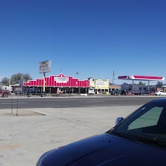
Chevron Seligman

Seligman Fire District
Chevron
Transit and Meeting Points
Useful pickup, handoff, or rendezvous points close to Paulden.
Williams, Arizona
Williams Junction, Arizona
Camp Verde, Arizona
Sedona (Center Bus Stop), Arizona
Flight Path Map
This map shows the direct air route between Flagstaff and Kingman. Straight-line distance: 135.61 mi (218.24 km).

#1 Flagstaff
The most populous city in Coconino County, Arizona.
| Population | 73,939 |
| Coordinates | 35.1980700, -111.6512700 |
| Altitude | 2104 |
| Country | United States |

#2 Kingman
City in Arizona, USA
| Population | 31,815 |
| Coordinates | 35.1894400, -114.0530100 |
| Altitude | 1021 |
| Country | United States |
End: Kingman (-114.05301, 35.18944)
Estimated Travel Time
Distance: 238 km by road
| Speed | Time |
|---|---|
| 30 mph (48.3 km/h) | 04h 55m |
| 40 mph (64.37 km/h) | 03h 41m |
| 50 mph (80.47 km/h) | 02h 57m |
| 60 mph (96.56 km/h) | 02h 27m |
| 70 mph (112.65 km/h) | 02h 06m |
| 80 mph (129 km/h) | 01h 50m |
Fuel, Round Trip and CO2
Estimated fuel cost and emissions for this route.
| Fuel | $/gal | One way | Round trip |
|---|---|---|---|
| Regular gas | $4.95 | $25.79 | $51.59 |
| Mid-grade | $5.34 | $27.81 | $55.62 |
| Premium | $5.57 | $29.00 | $58.00 |
| Diesel | $6.37 | $33.17 | $66.33 |
Assumes 8.3 L/100 km (about 28.3 MPG). CO2 is an estimate and varies by vehicle, fuel blend, traffic, and terrain.
Prices in Arizona · Jul 24, 2026
Distance to Other Cities
Planning a road trip? See the full trip guide on Trip.ovh — stops, fuel costs, weather, and departure timing.