How far is Fayetteville, NC from Spring Hope, NC?
The driving distance from Fayetteville, NC to Spring Hope, NC is about 92.3 miles (148.6 km), with a travel time of about 01h 47m by car.
- The straight-line flight distance is about 75.2 miles (121.1 km).
- For a round trip, plan for roughly 03h 35m of driving time before adding stops, traffic, or weather delays.
- A comfortable departure window is usually 8:00 AM to 10:00 AM EDT.
Reverse, save, or send this route
This route works well as a day trip with time at the destination. Copy the route link, send it to another device, or print a clean version before you head out.
This route works well as a day trip with time at the destination.
Flight Distance
Driving Distance
Gas Cost Calculator
Leave and Arrive Planner
Pick a departure time to see your estimated arrival and same-day return window.
Drive time stays fixed at 01h 47m.
A morning start gives you useful time at the destination and keeps the return out of the late evening.
You are leaving earlier than the recommended window, which gives you extra margin for breaks and traffic.
Halfway Point
A useful midpoint for breaks, coffee, or meeting in the middle.
Town in North Carolina
Route Weather Snapshot
Check the forecast at both ends before you head out.
Chance Showers And Thunderstorms
Chance Showers And Thunderstorms
Driving Route Map
The map below follows the saved road route between Fayetteville and Spring Hope.
Turn-by-Turn Driving Directions
Step-by-step road directions between Fayetteville and Spring Hope.
-
1
Start on Market Square
80 m · 6 sec · Market Square
-
2
Exit the rotary onto Person Street
1170 ft · 21 sec · Person Street
-
3
Exit the roundabout onto Person Street
1647 ft · 30 sec · Person Street
-
4
Enter the roundabout and take exit 3 toward B Street
37 m · 2 sec · B Street
-
5
Exit the roundabout onto B Street
1681 ft · 37 sec · B Street
-
6
Turn right onto Grove Street
938 ft · 25 sec · Grove Street
-
7
Turn left onto North Eastern Boulevard
30.8 mi · 36 min · North Eastern Boulevard
-
8
Take the exit slight right toward I 40: Raleigh, Wilmington
1480 ft · 36 sec
-
9
Keep slight left to continue on I 40 West: Raleigh
1.3 km · 2 min
-
10
Merge slight left
14.2 mi · 15 min
-
11
Keep slight left
11.5 mi · 13 min
-
12
Take the exit slight right toward I 87 North, I 440 East, US 64 East: Rocky Mount
2659 ft · 57 sec
-
13
Merge slight left
2.1 mi · 3 min
-
14
Keep slight right to continue on I 87 North, US 64 East, US 264 East: Rocky Mount, Wilson, Greenville
17.2 mi · 19 min
-
15
Keep slight left
9.8 mi · 11 min
-
16
Take the exit slight right
1261 ft · 35 sec
-
17
Turn left
1462 ft · 24 sec
-
18
At the end of the road, turn right
3.5 mi · 5 min
-
19
Arrive at your destination
0 m · 1 sec · East Nash Street
Car Route Details
A richer read on the saved driving route between Fayetteville and Spring Hope.
Highway-focused drive
Most of the mileage stays on named highways, so the important moments are ramps, exits, merges, and the final local approach.
North Eastern Boulevard
Turn left onto North Eastern Boulevard
30.8 mi · 00h 36m
Route Summary
A quick read on whether this route feels easy, ambitious, or worth planning around.
A comfortable day-trip route
This route works well as a day trip. You can leave in the morning, spend meaningful time at the destination, and still return the same day.
Chance Showers And Thunderstorms leaving Fayetteville and Chance Showers And Thunderstorms near Spring Hope.
Trip Questions
Direct answers travelers usually want before committing to the drive.
How long does it take to drive from Fayetteville to Spring Hope?
The road trip is about 92.3 miles (148.6 km) and usually takes 01h 47m in normal driving conditions.
Is this a same-day trip or an overnight route?
This route works well as a day trip. You can leave in the morning, spend meaningful time at the destination, and still return the same day.
What is the halfway point on this route?
Clayton is a useful midpoint, sitting about 46.2 miles from Fayetteville and 46.2 miles from Spring Hope.
How much longer is the road route than the straight-line distance?
The direct path is about 75.2 miles (121.1 km), while the road route adds roughly 17.1 extra miles because roads do not follow the straight air line.
When is the best time to leave for this route?
A good departure window is usually 8:00 AM to 10:00 AM EDT. If you want a more comfortable same-day return, try to leave by 2:54 PM EDT.
How much will gas cost for this route?
Using about 28.3 MPG, regular gas is estimated at $12.91 one way or $25.83 round trip. Estimated CO2 is about 29 kg one way.
What should you check before leaving?
Before you leave, expect Chance Showers And Thunderstorms around Fayetteville and Chance Showers And Thunderstorms near Spring Hope.
Stop Ideas Near Clayton
Useful break, food, and waypoint ideas within about 15 miles of the route midpoint.
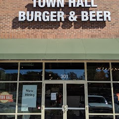
Town Hall Burger and Beer

Garner Town Hall
Clayton Utilities

Angier Police Department And Town Hall
Transit and Meeting Points
Useful pickup, handoff, or rendezvous points close to Clayton.
Selma–Smithfield
Raleigh Union Station
North Carolina State Fair station
Cary
Flight Path Map
This map shows the direct air route between Fayetteville and Spring Hope. Straight-line distance: 75.24 mi (121.09 km).

#1 Fayetteville
The most populous city in Cumberland County, North Carolina.
| Population | 211,705 |
| Coordinates | 35.0526600, -78.8783600 |
| Altitude | 29 |
| Country | United States |
#2 Spring Hope
City in Nash County, North Carolina, United States of America
| Population | 1,313 |
| Coordinates | 35.9451500, -78.1119300 |
| Altitude | 80 |
| Country | United States |
End: Spring Hope (-78.11193, 35.94515)
Estimated Travel Time
Distance: 149 km by road
| Speed | Time |
|---|---|
| 30 mph (48.3 km/h) | 03h 04m |
| 40 mph (64.37 km/h) | 02h 18m |
| 50 mph (80.47 km/h) | 01h 50m |
| 60 mph (96.56 km/h) | 01h 32m |
| 70 mph (112.65 km/h) | 01h 19m |
| 80 mph (129 km/h) | 01h 09m |
Fuel, Round Trip and CO2
Estimated fuel cost and emissions for this route.
| Fuel | $/gal | One way | Round trip |
|---|---|---|---|
| Regular gas | $3.96 | $12.91 | $25.83 |
| Mid-grade | $4.43 | $14.44 | $28.88 |
| Premium | $4.78 | $15.58 | $31.15 |
| Diesel | $5.62 | $18.33 | $36.67 |
Assumes 8.3 L/100 km (about 28.3 MPG). CO2 is an estimate and varies by vehicle, fuel blend, traffic, and terrain.
Prices in North Carolina · Aug 03, 2026
Distance to Other Cities
Planning a road trip? See the full trip guide on Trip.ovh — stops, fuel costs, weather, and departure timing.