How far is Ewing, NJ from Camden, NJ?
The driving distance from Ewing, NJ to Camden, NJ is about 38.6 miles (62.1 km), with a travel time of about 00h 45m by car.
- The straight-line flight distance is about 29.1 miles (46.9 km).
- For a round trip, plan for roughly 01h 30m of driving time before adding stops, traffic, or weather delays.
- A comfortable departure window is usually 7:00 AM to 7:00 PM EDT.
Reverse, save, or send this route
This is an easy same-day return drive. Copy the route link, send it to another device, or print a clean version before you head out.
This is an easy same-day return drive.
Flight Distance
Driving Distance
Gas Cost Calculator
Leave and Arrive Planner
Pick a departure time to see your estimated arrival and same-day return window.
Drive time stays fixed at 00h 45m.
This is a short drive, so your comfort window is wide. Traffic and current weather matter more than the clock.
This departure sits inside the recommended comfort window for the route.
Halfway Point
A useful midpoint for breaks, coffee, or meeting in the middle.
City in Burlington County, New Jersey
Route Weather Snapshot
Check the forecast at both ends before you head out.
Showers And Thunderstorms
Showers And Thunderstorms
Driving Route Map
The map below follows the saved road route between Ewing and Camden.
Turn-by-Turn Driving Directions
Step-by-step road directions between Ewing and Camden.
-
1
Start on the route
4 m · 3 sec
-
2
Turn left onto Scotch Road
2314 ft · 53 sec · Scotch Road
-
3
Turn right onto Parkway Avenue
1.2 km · 1 min · Parkway Avenue
-
4
Continue on West Upper Ferry Road
1531 ft · 34 sec · West Upper Ferry Road
-
5
Turn right onto Bear Tavern Road
1.5 km · 2 min · Bear Tavern Road
-
6
Take the ramp straight toward I 295 North: Philadelphia
993 ft · 24 sec
-
7
Merge slight left onto Camden Freeway
1.8 mi · 2 min · Camden Freeway
-
8
Continue on Delaware Expressway
28.6 mi · 39 min · Delaware Expressway
-
9
Take the exit slight right toward I 676, US 30: Central Philadelphia, Independence Hall, Callowhill Street
1196 ft · 29 sec
-
10
Keep slight right to continue on I 676 East, US 30 East: Ben Franklin Bridge, Independence Hall, Callowhill Street
1754 ft · 47 sec
-
11
Turn right onto Callowhill Street
1925 ft · 1 min · Callowhill Street
-
12
Turn left onto North 6th Street
827 ft · 16 sec · North 6th Street
-
13
Continue on North 6th Street
128 m · 23 sec · North 6th Street
-
14
Take the ramp sharp left toward I 676 East, US 30 East: Benjamin Franklin Bridge
126 m · 10 sec
-
15
Merge slight left
1.6 mi · 3 min
-
16
Take the exit slight right toward Sixth Street, Broadway, Camden, Emergency Parking Area, Waterfront Business District, University District, Campbell's Field
85 m · 7 sec
-
17
Keep slight left to continue on Broadway
99 m · 10 sec
-
18
Turn slight right onto North Broadway
1.5 mi · 3 min · North Broadway
-
19
Arrive at your destination
0 m · 1 sec · Broadway
Car Route Details
A richer read on the saved driving route between Ewing and Camden.
Highway-focused drive
Most of the mileage stays on named highways, so the important moments are ramps, exits, merges, and the final local approach.
Delaware Expressway
Continue on Delaware Expressway
28.6 mi · 00h 39m
Route Summary
A quick read on whether this route feels easy, ambitious, or worth planning around.
A short regional drive
This route is short enough to handle as a quick errand, commute, or easy same-day return without much planning overhead.
Showers And Thunderstorms leaving Ewing and Showers And Thunderstorms near Camden.
Trip Questions
Direct answers travelers usually want before committing to the drive.
How long does it take to drive from Ewing to Camden?
The road trip is about 38.6 miles (62.1 km) and usually takes 00h 45m in normal driving conditions.
Is this a same-day trip or an overnight route?
This route is short enough to handle as a quick errand, commute, or easy same-day return without much planning overhead.
What is the halfway point on this route?
Beverly is a useful midpoint, sitting about 18.7 miles from Ewing and 19.9 miles from Camden.
How much longer is the road route than the straight-line distance?
The direct path is about 29.1 miles (46.9 km), while the road route adds roughly 9.5 extra miles because roads do not follow the straight air line.
When is the best time to leave for this route?
A good departure window is usually 7:00 AM to 7:00 PM EDT. If you want a more comfortable same-day return, try to leave by 7:00 PM EDT.
How much will gas cost for this route?
Using about 28.3 MPG, regular gas is estimated at $5.56 one way or $11.11 round trip. Estimated CO2 is about 12.1 kg one way.
What should you check before leaving?
Before you leave, expect Showers And Thunderstorms around Ewing and Showers And Thunderstorms near Camden.
Stop Ideas Near Beverly
Useful break, food, and waypoint ideas within about 15 miles of the route midpoint.

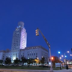
Old City Hall

Trenton City Hall
City Hall

Germantown Town Hall
Transit and Meeting Points
Useful pickup, handoff, or rendezvous points close to Beverly.
Cornwells Heights
Pennsauken, NJ
Cherry Hill, New Jersey
North Philadelphia station
Flight Path Map
This map shows the direct air route between Ewing and Camden. Straight-line distance: 29.15 mi (46.92 km).

#1 Ewing
Township in Mercer County, New Jersey
| Population | 36,442 |
| Coordinates | 40.2698300, -74.7998800 |
| Altitude | 45 |
| Country | United States |
#2 Camden
The most populous city in Camden County, New Jersey.
| Population | 73,740 |
| Coordinates | 39.9259500, -75.1196200 |
| Altitude | 6 |
| Country | United States |
End: Broadway (-75.119608, 39.92595)
Estimated Travel Time
Distance: 62 km by road
| Speed | Time |
|---|---|
| 30 mph (48.3 km/h) | 01h 17m |
| 40 mph (64.37 km/h) | 00h 57m |
| 50 mph (80.47 km/h) | 00h 46m |
| 60 mph (96.56 km/h) | 00h 38m |
| 70 mph (112.65 km/h) | 00h 33m |
| 80 mph (129 km/h) | 00h 28m |
Fuel, Round Trip and CO2
Estimated fuel cost and emissions for this route.
| Fuel | $/gal | One way | Round trip |
|---|---|---|---|
| Regular gas | $4.09 | $5.56 | $11.11 |
| Mid-grade | $4.60 | $6.25 | $12.51 |
| Premium | $4.95 | $6.74 | $13.47 |
| Diesel | $5.98 | $8.13 | $16.27 |
Assumes 8.3 L/100 km (about 28.3 MPG). CO2 is an estimate and varies by vehicle, fuel blend, traffic, and terrain.
Prices in New Jersey · Aug 03, 2026
Distance to Other Cities
Planning a road trip? See the full trip guide on Trip.ovh — stops, fuel costs, weather, and departure timing.