How far is Eton Hill, VA from Vinton, VA?
The driving distance from Eton Hill, VA to Vinton, VA is about 9.8 miles (15.8 km), with a travel time of about 00h 18m by car.
- The straight-line flight distance is about 7.2 miles (11.6 km).
- For a round trip, plan for roughly 00h 37m of driving time before adding stops, traffic, or weather delays.
- A comfortable departure window is usually 7:00 AM to 7:00 PM EDT.
Reverse, save, or send this route
This is an easy same-day return drive. Copy the route link, send it to another device, or print a clean version before you head out.
This is an easy same-day return drive.
Flight Distance
Driving Distance
Gas Cost Calculator
Leave and Arrive Planner
Pick a departure time to see your estimated arrival and same-day return window.
Drive time stays fixed at 00h 18m.
This is a short drive, so your comfort window is wide. Traffic and current weather matter more than the clock.
This departure sits inside the recommended comfort window for the route.
Halfway Point
A useful midpoint for breaks, coffee, or meeting in the middle.
Town in Virginia
Route Weather Snapshot
Check the forecast at both ends before you head out.
Chance Rain Showers
Patchy Fog
Driving Route Map
The map below follows the saved road route between Eton Hill and Vinton.
Turn-by-Turn Driving Directions
Step-by-step road directions between Eton Hill and Vinton.
-
1
Start on Vest Drive
819 ft · 41 sec · Vest Drive
-
2
Turn left onto Colonial Avenue
2353 ft · 59 sec · Colonial Avenue
-
3
Turn right onto Electric Road
1.8 mi · 4 min · Electric Road
-
4
Take the ramp slight right toward US 220 North
867 ft · 21 sec
-
5
Merge slight left onto Roy L. Webber Expressway
3.4 mi · 5 min · Roy L. Webber Expressway
-
6
Take the exit slight right toward VA 24: Elm Avenue, Vinton
627 ft · 25 sec
-
7
Turn right onto Elm Avenue Southeast
562 ft · 9 sec · Elm Avenue Southeast
-
8
Continue on Jamison Avenue Southeast
130 m · 7 sec · Jamison Avenue Southeast
-
9
Keep slight right to continue on Bullitt Avenue Southeast
1.1 km · 1 min · Bullitt Avenue Southeast
-
10
Continue on Jamison Avenue Southeast
993 ft · 19 sec · Jamison Avenue Southeast
-
11
Continue on Dale Avenue Southeast
1.1 km · 1 min · Dale Avenue Southeast
-
12
Continue on West Virginia Avenue
2309 ft · 50 sec · West Virginia Avenue
-
13
Turn left onto South Pollard Street
1970 ft · 47 sec · South Pollard Street
-
14
Turn right onto Washington Avenue
27 m · 1 sec · Washington Avenue
-
15
Arrive at your destination
0 m · 1 sec · Washington Avenue
Car Route Details
A richer read on the saved driving route between Eton Hill and Vinton.
Turn-heavy local drive
The route has frequent decision points for its length, so lane choice and turn timing will matter more than cruising speed.
Roy L. Webber Expressway
Merge slight left onto Roy L. Webber Expressway
3.44 mi · 00h 05m
Route Summary
A quick read on whether this route feels easy, ambitious, or worth planning around.
A short regional drive
This route is short enough to handle as a quick errand, commute, or easy same-day return without much planning overhead.
Chance Rain Showers leaving Eton Hill and Patchy Fog near Vinton.
Trip Questions
Direct answers travelers usually want before committing to the drive.
How long does it take to drive from Eton Hill to Vinton?
The road trip is about 9.8 miles (15.8 km) and usually takes 00h 18m in normal driving conditions.
Is this a same-day trip or an overnight route?
This route is short enough to handle as a quick errand, commute, or easy same-day return without much planning overhead.
What is the halfway point on this route?
Cedar Bluff is a useful midpoint, sitting about 4.3 miles from Eton Hill and 5.5 miles from Vinton.
How much longer is the road route than the straight-line distance?
The direct path is about 7.2 miles (11.6 km), while the road route adds roughly 2.6 extra miles because roads do not follow the straight air line.
When is the best time to leave for this route?
A good departure window is usually 7:00 AM to 7:00 PM EDT. If you want a more comfortable same-day return, try to leave by 7:52 PM EDT.
How much will gas cost for this route?
Using about 28.3 MPG, regular gas is estimated at $1.39 one way or $2.77 round trip. Estimated CO2 is about 3.1 kg one way.
What should you check before leaving?
Before you leave, expect Chance Rain Showers around Eton Hill and Patchy Fog near Vinton.
Stop Ideas Near Cedar Bluff
Useful break, food, and waypoint ideas within about 15 miles of the route midpoint.

The City Market Building
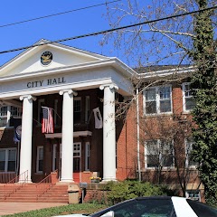
Salem City Hall

Charter Hall at the City Market Building
Transit and Meeting Points
Useful pickup, handoff, or rendezvous points close to Cedar Bluff.
Roanoke
Blacksburg, VA
Clifton Forge
White Sulphur Springs
Flight Path Map
This map shows the direct air route between Eton Hill and Vinton. Straight-line distance: 7.21 mi (11.6 km).
#1 Eton Hill
Eton Hill is a place in Virginia, United States.
| Population | 0 |
| Coordinates | 37.2256900, -80.0080900 |
| Altitude | 356 |
| Country | United States |

#2 Vinton
City in Iowa
| Population | 8,128 |
| Coordinates | 37.2809700, -79.8969800 |
| Altitude | 282 |
| Country | United States |
End: Washington Avenue (-79.897018, 37.280859)
Estimated Travel Time
Distance: 16 km by road
| Speed | Time |
|---|---|
| 30 mph (48.3 km/h) | 00h 19m |
| 40 mph (64.37 km/h) | 00h 14m |
| 50 mph (80.47 km/h) | 00h 11m |
| 60 mph (96.56 km/h) | 00h 09m |
| 70 mph (112.65 km/h) | 00h 08m |
| 80 mph (129 km/h) | 00h 07m |
Fuel, Round Trip and CO2
Estimated fuel cost and emissions for this route.
| Fuel | $/gal | One way | Round trip |
|---|---|---|---|
| Regular gas | $3.96 | $1.39 | $2.77 |
| Mid-grade | $4.43 | $1.55 | $3.10 |
| Premium | $4.78 | $1.67 | $3.34 |
| Diesel | $5.62 | $1.97 | $3.94 |
Assumes 8.3 L/100 km (about 28.3 MPG). CO2 is an estimate and varies by vehicle, fuel blend, traffic, and terrain.
Prices in Virginia · Jun 10, 2026
Distance to Other Cities
Planning a road trip? See the full trip guide on Trip.ovh — stops, fuel costs, weather, and departure timing.