How far is El Dorado Springs, MO from New York, MO?
The driving distance from El Dorado Springs, MO to New York, MO is about 157.5 miles (253.5 km), with a travel time of about 02h 49m by car.
- The straight-line flight distance is about 125 miles (201.2 km).
- For a round trip, plan for roughly 05h 38m of driving time before adding stops, traffic, or weather delays.
- A comfortable departure window is usually 8:00 AM to 10:00 AM CDT.
Reverse, save, or send this route
This route works well as a day trip with time at the destination. Copy the route link, send it to another device, or print a clean version before you head out.
This route works well as a day trip with time at the destination.
Flight Distance
Driving Distance
Gas Cost Calculator
Leave and Arrive Planner
Pick a departure time to see your estimated arrival and same-day return window.
Drive time stays fixed at 02h 49m.
A morning start gives you useful time at the destination and keeps the return out of the late evening.
You are leaving earlier than the recommended window, which gives you extra margin for breaks and traffic.
Halfway Point
A useful midpoint for breaks, coffee, or meeting in the middle.
City in Texas, USA
Route Weather Snapshot
Check the forecast at both ends before you head out.
Mostly Sunny then Chance Showers And Thunderstorms
Showers And Thunderstorms Likely
Driving Route Map
The map below follows the saved road route between El Dorado Springs and New York.
Turn-by-Turn Driving Directions
Step-by-step road directions between El Dorado Springs and New York.
-
1
Start on East Spring Street
2527 ft · 57 sec · East Spring Street
-
2
Turn left onto South 1st Street
1.5 km · 2 min · South 1st Street
-
3
Turn right
17.2 mi · 20 min
-
4
Take the ramp left
925 ft · 28 sec
-
5
Merge slight left
81.5 mi · 1 hr 28 min
-
6
Take the exit slight right toward I 435 North: Des Moines
1474 ft · 36 sec
-
7
Merge slight left
17.6 mi · 20 min
-
8
Continue on I435 N
1.3 mi · 1 min · I435 N
-
9
Continue straight
724 ft · 10 sec
-
10
Take the exit slight right toward I 35: Kansas City, Des Moines
599 ft · 15 sec
-
11
Keep slight right to continue on I 35 North, MO 110 East: Des Moines
2281 ft · 56 sec
-
12
Merge slight left onto Chicago-Kansas City Expressway
6.3 mi · 7 min · Chicago-Kansas City Expressway
-
13
Keep slight left to continue on Chicago-Kansas City Expressway
34.5 mi · 37 min · Chicago-Kansas City Expressway
-
14
Take the exit slight right toward US 36, MO 110 East, I 35 Business: Cameron, Hamilton
1213 ft · 33 sec
-
15
Turn right onto Chicago-Kansas City Expressway
15.9 mi · 18 min · Chicago-Kansas City Expressway
-
16
Turn right
3.5 mi · 8 min
-
17
Arrive at your destination
0 m · 1 sec
Car Route Details
A richer read on the saved driving route between El Dorado Springs and New York.
Interchange-aware route
The drive includes several ramps, exits, or merges, so checking the next few maneuvers before busy interchanges is useful.
South 1st Street
Merge slight left
81.5 mi · 01h 28m
Route Summary
A quick read on whether this route feels easy, ambitious, or worth planning around.
A comfortable day-trip route
This route works well as a day trip. You can leave in the morning, spend meaningful time at the destination, and still return the same day.
Mostly Sunny then Chance Showers And Thunderstorms leaving El Dorado Springs and Showers And Thunderstorms Likely near New York.
Trip Questions
Direct answers travelers usually want before committing to the drive.
How long does it take to drive from El Dorado Springs to New York?
The road trip is about 157.5 miles (253.5 km) and usually takes 02h 49m in normal driving conditions.
Is this a same-day trip or an overnight route?
This route works well as a day trip. You can leave in the morning, spend meaningful time at the destination, and still return the same day.
What is the halfway point on this route?
Belton is a useful midpoint, sitting about 90.3 miles from El Dorado Springs and 67.2 miles from New York.
How much longer is the road route than the straight-line distance?
The direct path is about 125 miles (201.2 km), while the road route adds roughly 32.5 extra miles because roads do not follow the straight air line.
When is the best time to leave for this route?
A good departure window is usually 8:00 AM to 10:00 AM CDT. If you want a more comfortable same-day return, try to leave by 12:52 PM CDT.
How much will gas cost for this route?
Using about 28.3 MPG, regular gas is estimated at $20.97 one way or $41.93 round trip. Estimated CO2 is about 49.4 kg one way.
What should you check before leaving?
Before you leave, expect Mostly Sunny then Chance Showers And Thunderstorms around El Dorado Springs and Showers And Thunderstorms Likely near New York.
Stop Ideas Near Belton
Useful break, food, and waypoint ideas within about 15 miles of the route midpoint.

Leawood Community Center
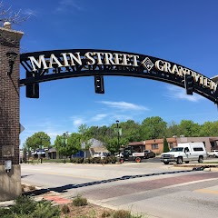
City of Grandview
Grandview DMV
Transit and Meeting Points
Useful pickup, handoff, or rendezvous points close to Belton.
Lee's Summit
Union Station
Independence
Lawrence
Flight Path Map
This map shows the direct air route between El Dorado Springs and New York. Straight-line distance: 125.04 mi (201.24 km).

#1 El Dorado Springs
City in Cedar County, Missouri, USA
| Population | 3,601 |
| Coordinates | 37.8769800, -94.0213300 |
| Altitude | 259 |
| Country | United States |
#2 New York
Human settlement in Missouri, United States of America
| Population | 264 |
| Coordinates | 39.6852900, -93.9268800 |
| Altitude | 244 |
| Country | United States |
End: Northeast State Highway B (-93.92718, 39.685291)
Estimated Travel Time
Distance: 253 km by road
| Speed | Time |
|---|---|
| 30 mph (48.3 km/h) | 05h 14m |
| 40 mph (64.37 km/h) | 03h 56m |
| 50 mph (80.47 km/h) | 03h 08m |
| 60 mph (96.56 km/h) | 02h 37m |
| 70 mph (112.65 km/h) | 02h 14m |
| 80 mph (129 km/h) | 01h 57m |
Fuel, Round Trip and CO2
Estimated fuel cost and emissions for this route.
| Fuel | $/gal | One way | Round trip |
|---|---|---|---|
| Regular gas | $3.77 | $20.97 | $41.93 |
| Mid-grade | $4.25 | $23.65 | $47.29 |
| Premium | $4.65 | $25.88 | $51.75 |
| Diesel | $5.30 | $29.49 | $58.98 |
Assumes 8.3 L/100 km (about 28.3 MPG). CO2 is an estimate and varies by vehicle, fuel blend, traffic, and terrain.
Prices in Missouri · Jun 11, 2026
Distance to Other Cities
Planning a road trip? See the full trip guide on Trip.ovh — stops, fuel costs, weather, and departure timing.