How far is Concord, NC from Bryson City, NC?
The driving distance from Concord, NC to Bryson City, NC is about 199.7 miles (321.4 km), with a travel time of about 04h 09m by car.
- The straight-line flight distance is about 161.5 miles (259.9 km).
- For a round trip, plan for roughly 08h 18m of driving time before adding stops, traffic, or weather delays.
- A comfortable departure window is usually 6:00 AM to 8:00 AM EDT.
Reverse, save, or send this route
This drive is better planned with a longer stop or an overnight stay. Copy the route link, send it to another device, or print a clean version before you head out.
This drive is better planned with a longer stop or an overnight stay.
Flight Distance
Driving Distance
Gas Cost Calculator
Leave and Arrive Planner
Pick a departure time to see your estimated arrival and same-day return window.
Drive time stays fixed at 04h 09m.
An early departure helps you fit a real stop into the day without turning the return into a late-night drive.
You are leaving earlier than the recommended window, which gives you extra margin for breaks and traffic.
Halfway Point
A useful midpoint for breaks, coffee, or meeting in the middle.
Town in Polk County, North Carolina, United States
Route Weather Snapshot
Check the forecast at both ends before you head out.
Patchy Fog then Chance Showers And Thunderstorms
Driving Route Map
The map below follows the saved road route between Concord and Bryson City.
Turn-by-Turn Driving Directions
Step-by-step road directions between Concord and Bryson City.
-
1
Start on Spring Street Southwest
125 m · 20 sec · Spring Street Southwest
-
2
Turn left onto Cabarrus Avenue West
1.4 km · 2 min · Cabarrus Avenue West
-
3
Enter the roundabout and take exit 2 toward Cabarrus Avenue West
26 m · 2 sec · Cabarrus Avenue West
-
4
Exit the roundabout onto Cabarrus Avenue West
1 mi · 2 min · Cabarrus Avenue West
-
5
Turn left onto Concord Parkway South
6.7 mi · 10 min · Concord Parkway South
-
6
Continue on North Tryon Street
1 mi · 2 min · North Tryon Street
-
7
Take the ramp right toward I 485 Outer North
1573 ft · 38 sec
-
8
Merge slight left onto Governor James G Martin Freeway
2414 ft · 30 sec · Governor James G Martin Freeway
-
9
Continue on H Allen Tate Jr Highway
7.9 mi · 8 min · H Allen Tate Jr Highway
-
10
Continue on Craig Lawing Freeway
10.3 mi · 11 min · Craig Lawing Freeway
-
11
Take the exit slight right toward I 85, US 29, US 74: Greensboro, Spartanburg, Wilkinson Boulevard
2308 ft · 56 sec
-
12
Keep slight right to continue on I 85 South: Gastonia, Spartanburg
1.4 km · 2 min
-
13
Merge slight left
19.1 mi · 23 min
-
14
Take the exit slight right toward US 74 West: Kings Mountain, Shelby
3242 ft · 50 sec
-
15
Continue on Senator J. Ollie Harris Highway
7.6 mi · 9 min · Senator J. Ollie Harris Highway
-
16
Continue on Andrew Jackson Highway
1.8 mi · 3 min · Andrew Jackson Highway
-
17
Continue on East Dixon Boulevard
12 mi · 17 min · East Dixon Boulevard
-
18
Take the ramp straight toward West Dixon Boulevard
15.7 mi · 18 min · West Dixon Boulevard
-
19
Continue on Lieutenant Governor Walter H Dalton Highway
18.3 mi · 20 min · Lieutenant Governor Walter H Dalton Highway
-
20
Merge slight left onto Andrew Jackson Highway
34.3 mi · 41 min · Andrew Jackson Highway
-
21
Take the exit slight left toward I 40 West, US 74: Canton, Knoxville
18.4 mi · 23 min
-
22
Take the exit slight right toward US 74 West: Clyde, Waynesville, Maggie Valley, Franklin, Murphy, Atlanta
22 mi · 29 min
-
23
Keep slight left to continue on Great Smoky Mountains Expressway
18.4 mi · 23 min · Great Smoky Mountains Expressway
-
24
Take the exit slight right toward US 19 CONN: Bryson City
1492 ft · 36 sec
-
25
Keep slight right to continue on US 19 CONN: Bryson City
114 m · 9 sec
-
26
Turn straight onto Veterans Boulevard
3177 ft · 1 min · Veterans Boulevard
-
27
Continue on Highway 19 South
113 m · 8 sec · Highway 19 South
-
28
Continue on Slope Street
1582 ft · 57 sec · Slope Street
-
29
Turn right onto Bryson Avenue
137 m · 25 sec · Bryson Avenue
-
30
Turn left
19 m · 5 sec
-
31
Arrive at your destination
0 m · 1 sec
Car Route Details
A richer read on the saved driving route between Concord and Bryson City.
Highway-focused drive
Most of the mileage stays on named highways, so the important moments are ramps, exits, merges, and the final local approach.
Andrew Jackson Highway
Merge slight left onto Andrew Jackson Highway
34.3 mi · 00h 41m
Route Summary
A quick read on whether this route feels easy, ambitious, or worth planning around.
A longer out-and-back drive
This is still possible in one day, but it becomes a long driving day. Leaving early and planning your stop window matters more here.
Sunny leaving Concord and Patchy Fog then Chance Showers And Thunderstorms near Bryson City.
Trip Questions
Direct answers travelers usually want before committing to the drive.
How long does it take to drive from Concord to Bryson City?
The road trip is about 199.7 miles (321.4 km) and usually takes 04h 09m in normal driving conditions.
Is this a same-day trip or an overnight route?
This is still possible in one day, but it becomes a long driving day. Leaving early and planning your stop window matters more here.
What is the halfway point on this route?
Columbus is a useful midpoint, sitting about 99.7 miles from Concord and 99.9 miles from Bryson City.
How much longer is the road route than the straight-line distance?
The direct path is about 161.5 miles (259.9 km), while the road route adds roughly 38.2 extra miles because roads do not follow the straight air line.
When is the best time to leave for this route?
A good departure window is usually 6:00 AM to 8:00 AM EDT. If you want a more comfortable same-day return, try to leave by 8:42 AM EDT.
How much will gas cost for this route?
Using about 28.3 MPG, regular gas is estimated at $27.93 one way or $55.85 round trip. Estimated CO2 is about 62.7 kg one way.
What should you check before leaving?
Before you leave, expect Sunny around Concord and Patchy Fog then Chance Showers And Thunderstorms near Bryson City.
Stop Ideas Near Columbus
Useful break, food, and waypoint ideas within about 15 miles of the route midpoint.

Town Hall of Tryon
Town of Rutherfordton
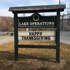
Town of Lake Lure, Lake Operations Office
Transit and Meeting Points
Useful pickup, handoff, or rendezvous points close to Columbus.
Spartanburg
Greenville
Clemson
Gastonia
Flight Path Map
This map shows the direct air route between Concord and Bryson City. Straight-line distance: 161.48 mi (259.88 km).

#1 Concord
The most populous city in Cabarrus County, North Carolina.
| Population | 98,500 |
| Coordinates | 35.4088800, -80.5815800 |
| Altitude | 228 |
| Country | United States |

#2 Bryson City
City in Swain County, North Carolina, United States of America
| Population | 1,443 |
| Coordinates | 35.4312700, -83.4494400 |
| Altitude | 528 |
| Country | United States |
End: Bryson City (-83.44944, 35.43127)
Estimated Travel Time
Distance: 321 km by road
| Speed | Time |
|---|---|
| 30 mph (48.3 km/h) | 06h 39m |
| 40 mph (64.37 km/h) | 04h 59m |
| 50 mph (80.47 km/h) | 03h 59m |
| 60 mph (96.56 km/h) | 03h 19m |
| 70 mph (112.65 km/h) | 02h 51m |
| 80 mph (129 km/h) | 02h 29m |
Fuel, Round Trip and CO2
Estimated fuel cost and emissions for this route.
| Fuel | $/gal | One way | Round trip |
|---|---|---|---|
| Regular gas | $3.96 | $27.93 | $55.85 |
| Mid-grade | $4.43 | $31.22 | $62.45 |
| Premium | $4.78 | $33.68 | $67.37 |
| Diesel | $5.62 | $39.65 | $79.30 |
Assumes 8.3 L/100 km (about 28.3 MPG). CO2 is an estimate and varies by vehicle, fuel blend, traffic, and terrain.
Prices in North Carolina · Jul 15, 2026
Distance to Other Cities
Planning a road trip? See the full trip guide on Trip.ovh — stops, fuel costs, weather, and departure timing.