How far is Colonie, NY from Amherst, NY?
The driving distance from Colonie, NY to Amherst, NY is about 278 miles (447.4 km), with a travel time of about 04h 10m by car.
- The straight-line flight distance is about 252.2 miles (405.8 km).
- For a round trip, plan for roughly 08h 21m of driving time before adding stops, traffic, or weather delays.
- A comfortable departure window is usually 6:00 AM to 8:00 AM EDT.
Reverse, save, or send this route
This drive is better planned with a longer stop or an overnight stay. Copy the route link, send it to another device, or print a clean version before you head out.
This drive is better planned with a longer stop or an overnight stay.
Flight Distance
Driving Distance
Gas Cost Calculator
Leave and Arrive Planner
Pick a departure time to see your estimated arrival and same-day return window.
Drive time stays fixed at 04h 10m.
An early departure helps you fit a real stop into the day without turning the return into a late-night drive.
You are leaving earlier than the recommended window, which gives you extra margin for breaks and traffic.
Halfway Point
A useful midpoint for breaks, coffee, or meeting in the middle.
Village in Onondaga County, New York, United States
Route Weather Snapshot
Check the forecast at both ends before you head out.
Areas Of Smoke
Areas Of Smoke
Driving Route Map
The map below follows the saved road route between Colonie and Amherst.
Turn-by-Turn Driving Directions
Step-by-step road directions between Colonie and Amherst.
-
1
Start on Central Avenue
2604 ft · 60 sec · Central Avenue
-
2
Take the ramp slight right toward I 87 South
1839 ft · 1 min
-
3
Merge slight left onto Adirondack Northway
2537 ft · 39 sec · Adirondack Northway
-
4
Keep slight right to continue on I 87 South, I 90: Boston, Albany, New York, Buffalo
1694 ft · 32 sec
-
5
Continue on I 87 South, I 90 West: New York, Buffalo
2619 ft · 51 sec
-
6
Keep slight left
272 mi · 5 hr 15 min
-
7
Take the exit slight right toward I 290: Niagara Falls
2277 ft · 37 sec
-
8
Continue on Youngmann Expressway
1.8 mi · 2 min · Youngmann Expressway
-
9
Take the exit slight right toward NY 324, NY 240: Sheridan Drive, Harlem Road
1117 ft · 30 sec
-
10
Turn left onto Sheridan Drive
1.4 km · 2 min · Sheridan Drive
-
11
Turn left onto Millersport Highway
143 m · 14 sec · Millersport Highway
-
12
Arrive at your destination
0 m · 1 sec · Millersport Highway
Car Route Details
A richer read on the saved driving route between Colonie and Amherst.
Highway-focused drive
Most of the mileage stays on named highways, so the important moments are ramps, exits, merges, and the final local approach.
I 87 South
Keep slight left
272 mi · 05h 15m
Route Summary
A quick read on whether this route feels easy, ambitious, or worth planning around.
A longer out-and-back drive
This is still possible in one day, but it becomes a long driving day. Leaving early and planning your stop window matters more here.
Areas Of Smoke leaving Colonie and Areas Of Smoke near Amherst.
Trip Questions
Direct answers travelers usually want before committing to the drive.
How long does it take to drive from Colonie to Amherst?
The road trip is about 278 miles (447.4 km) and usually takes 04h 10m in normal driving conditions.
Is this a same-day trip or an overnight route?
This is still possible in one day, but it becomes a long driving day. Leaving early and planning your stop window matters more here.
What is the halfway point on this route?
Liverpool is a useful midpoint, sitting about 138.4 miles from Colonie and 139.5 miles from Amherst.
How much longer is the road route than the straight-line distance?
The direct path is about 252.2 miles (405.8 km), while the road route adds roughly 25.8 extra miles because roads do not follow the straight air line.
When is the best time to leave for this route?
A good departure window is usually 6:00 AM to 8:00 AM EDT. If you want a more comfortable same-day return, try to leave by 8:38 AM EDT.
How much will gas cost for this route?
Using about 28.3 MPG, regular gas is estimated at $39.33 one way or $78.66 round trip. Estimated CO2 is about 87.2 kg one way.
What should you check before leaving?
Before you leave, expect Areas Of Smoke around Colonie and Areas Of Smoke near Amherst.
Stop Ideas Near Liverpool
Useful break, food, and waypoint ideas within about 15 miles of the route midpoint.
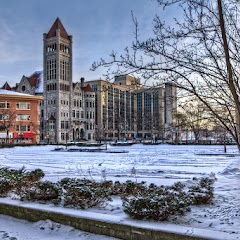
City Hall Cafe
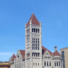
Syracuse City Hall
Transit and Meeting Points
Useful pickup, handoff, or rendezvous points close to Liverpool.
Empire Expo Center
William F. Walsh Regional Transportation Center
Rome station
Union Station
Flight Path Map
This map shows the direct air route between Colonie and Amherst. Straight-line distance: 252.18 mi (405.85 km).

#1 Colonie
Town in Albany County, New York, United States
| Population | 7,564 |
| Coordinates | 42.7178600, -73.8334600 |
| Altitude | 95 |
| Country | United States |

#2 Amherst
Town in New York, United States
| Population | 120,809 |
| Coordinates | 42.9783900, -78.7997600 |
| Altitude | 182 |
| Country | United States |
End: Millersport Highway (-78.799874, 42.978447)
Estimated Travel Time
Distance: 447 km by road
| Speed | Time |
|---|---|
| 30 mph (48.3 km/h) | 09h 15m |
| 40 mph (64.37 km/h) | 06h 56m |
| 50 mph (80.47 km/h) | 05h 33m |
| 60 mph (96.56 km/h) | 04h 37m |
| 70 mph (112.65 km/h) | 03h 58m |
| 80 mph (129 km/h) | 03h 28m |
Fuel, Round Trip and CO2
Estimated fuel cost and emissions for this route.
| Fuel | $/gal | One way | Round trip |
|---|---|---|---|
| Regular gas | $4.01 | $39.33 | $78.66 |
| Mid-grade | $4.48 | $43.96 | $87.92 |
| Premium | $4.86 | $47.69 | $95.37 |
| Diesel | $4.69 | $46.05 | $92.10 |
Assumes 8.3 L/100 km (about 28.3 MPG). CO2 is an estimate and varies by vehicle, fuel blend, traffic, and terrain.
Prices in New York · Jul 15, 2026
Distance to Other Cities
Planning a road trip? See the full trip guide on Trip.ovh — stops, fuel costs, weather, and departure timing.