How far is Clifton Heights, PA from Upper Darby, PA?
Fastest route
To travel from Clifton Heights, Pennsylvania 19018, to Upper Darby, Pennsylvania, the best route, given the traffic conditions, is via E Baltimore Ave and Shadeland Ave. The distance to be covered is approximately 3.0 miles (4.8 kilometers), and the estimated travel time is 9 minutes.
Directions
- 🚗 Head northeast on E Baltimore Ave toward S Diamond St for 0.8 miles (1.3 kilometers).
- 🔄 Turn left onto Burmont Rd for 0.1 miles (0.16 kilometers).
- ➡️ Turn right onto Shadeland Ave for 0.8 miles (1.3 kilometers).
- ➡️ Turn right onto Garrett Rd. Be aware that parts of this road may be closed at certain times or days. Continue for 0.7 miles (1.1 kilometers).
- ⬅️ Turn left onto N Lansdowne Ave. You'll pass by Perkins Restaurant & Bakery on the left in 0.5 miles (0.8 kilometers) for 0.6 miles (0.97 kilometers).
Tips & Suggestions
- 🚦 Check for real-time traffic updates before starting your journey to avoid unexpected delays.
- ⛽️ Ensure your vehicle has enough fuel for the trip.
- 🗺️ Use a GPS or map application to navigate through the route effectively.
- 🚧 Stay updated on road closures or construction activities that may affect your journey.
- 🚗 Drive within the speed limit and follow all traffic rules for a safe trip.
- 🕑 Allow some extra time in case of unforeseen circumstances or traffic jams.
- 🍴 Consider exploring local eateries and attractions in Upper Darby once you reach your destination.
Reverse, save, or send this route
This is an easy same-day return drive. Copy the route link, send it to another device, or print a clean version before you head out.
This is an easy same-day return drive.
Flight Distance
Driving Distance
Gas Cost Calculator
Leave and Arrive Planner
Pick a departure time to see your estimated arrival and same-day return window.
Drive time stays fixed at 00h 03m.
This is a short drive, so your comfort window is wide. Traffic and current weather matter more than the clock.
This departure sits inside the recommended comfort window for the route.
Halfway Point
A useful midpoint for breaks, coffee, or meeting in the middle.
Borough of Pennsylvania
Route Weather Snapshot
Check the forecast at both ends before you head out.
Mostly Sunny then Scattered Showers And Thunderstorms
Mostly Sunny then Scattered Showers And Thunderstorms
Driving Route Map
The map below follows the saved road route between Clifton Heights and Upper Darby.
Turn-by-Turn Driving Directions
Step-by-step road directions between Clifton Heights and Upper Darby.
-
1
Start on the route
51 m · 18 sec
-
2
Turn left onto South Springfield Road
1.5 km · 2 min · South Springfield Road
-
3
Turn left onto East Providence Road
2223 ft · 1 min · East Providence Road
-
4
Arrive at your destination
0 m · 1 sec · West Providence Road
Car Route Details
A richer read on the saved driving route between Clifton Heights and Upper Darby.
Turn-heavy local drive
The route has frequent decision points for its length, so lane choice and turn timing will matter more than cruising speed.
South Springfield Road
Turn left onto South Springfield Road
0.9 mi · 00h 02m
Route Summary
A quick read on whether this route feels easy, ambitious, or worth planning around.
A short regional drive
This route is short enough to handle as a quick errand, commute, or easy same-day return without much planning overhead.
Mostly Sunny then Scattered Showers And Thunderstorms leaving Clifton Heights and Mostly Sunny then Scattered Showers And Thunderstorms near Upper Darby.
Trip Questions
Direct answers travelers usually want before committing to the drive.
How long does it take to drive from Clifton Heights to Upper Darby?
The road trip is about 1.4 miles (2.2 km) and usually takes 00h 03m in normal driving conditions.
Is this a same-day trip or an overnight route?
This route is short enough to handle as a quick errand, commute, or easy same-day return without much planning overhead.
What is the halfway point on this route?
Aldan is a useful midpoint, sitting about 0.7 miles from Clifton Heights and 0.7 miles from Upper Darby.
How much longer is the road route than the straight-line distance?
The direct path is about 1.2 miles (1.9 km), while the road route adds roughly 0.2 extra miles because roads do not follow the straight air line.
When is the best time to leave for this route?
A good departure window is usually 7:00 AM to 7:00 PM EDT. If you want a more comfortable same-day return, try to leave by 8:22 PM EDT.
How much will gas cost for this route?
Using about 28.3 MPG, regular gas is estimated at $0.20 one way or $0.41 round trip. Estimated CO2 is about 0.4 kg one way.
What should you check before leaving?
Before you leave, expect Mostly Sunny then Scattered Showers And Thunderstorms around Clifton Heights and Mostly Sunny then Scattered Showers And Thunderstorms near Upper Darby.
Stop Ideas Near Aldan
Useful break, food, and waypoint ideas within about 15 miles of the route midpoint.

Bluestone Lane City Hall Coffee Shop

Dilworth Park
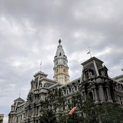
Philadelphia Marriage License

City Hall
Transit and Meeting Points
Useful pickup, handoff, or rendezvous points close to Aldan.
30th Street Station
Ardmore
North Philadelphia station
Pennsauken, NJ
Flight Path Map
This map shows the direct air route between Clifton Heights and Upper Darby. Straight-line distance: 1.19 mi (1.92 km).

#1 Clifton Heights
Borough in Delaware County, Pennsylvania, United States
| Population | 6,695 |
| Coordinates | 39.9292800, -75.2963000 |
| Altitude | 49 |
| Country | United States |

#2 Upper Darby
Town in Delaware County, Pennsylvania, United States
| Population | 82,883 |
| Coordinates | 39.9284500, -75.2738000 |
| Altitude | 20 |
| Country | United States |
End: West Providence Road (-75.273806, 39.928457)
Estimated Travel Time
Distance: 2 km by road
| Speed | Time |
|---|---|
| 30 mph (48.3 km/h) | 00h 02m |
| 40 mph (64.37 km/h) | 00h 02m |
| 50 mph (80.47 km/h) | 00h 01m |
| 60 mph (96.56 km/h) | 00h 01m |
| 70 mph (112.65 km/h) | 00h 01m |
| 80 mph (129 km/h) | 00h 01m |
Fuel, Round Trip and CO2
Estimated fuel cost and emissions for this route.
| Fuel | $/gal | One way | Round trip |
|---|---|---|---|
| Regular gas | $4.09 | $0.20 | $0.41 |
| Mid-grade | $4.60 | $0.23 | $0.46 |
| Premium | $4.95 | $0.25 | $0.50 |
| Diesel | $5.98 | $0.30 | $0.60 |
Assumes 8.3 L/100 km (about 28.3 MPG). CO2 is an estimate and varies by vehicle, fuel blend, traffic, and terrain.
Prices in Pennsylvania · Jul 27, 2026
Distance to Other Cities
Planning a road trip? See the full trip guide on Trip.ovh — stops, fuel costs, weather, and departure timing.