How far is Chula Vista, CA from San Diego Country Estates, CA?
The driving distance from Chula Vista, CA to San Diego Country Estates, CA is about 38.8 miles (62.5 km), with a travel time of about 00h 54m by car.
- The straight-line flight distance is about 30.8 miles (49.5 km).
- For a round trip, plan for roughly 01h 49m of driving time before adding stops, traffic, or weather delays.
- A comfortable departure window is usually 8:00 AM to 10:00 AM PDT.
Reverse, save, or send this route
This route works well as a day trip with time at the destination. Copy the route link, send it to another device, or print a clean version before you head out.
This route works well as a day trip with time at the destination.
Flight Distance
Driving Distance
Gas Cost Calculator
Leave and Arrive Planner
Pick a departure time to see your estimated arrival and same-day return window.
Drive time stays fixed at 00h 54m.
A morning start gives you useful time at the destination and keeps the return out of the late evening.
This departure sits inside the recommended comfort window for the route.
Halfway Point
A useful midpoint for breaks, coffee, or meeting in the middle.
A city in San Diego County, California.
Route Weather Snapshot
Check the forecast at both ends before you head out.
Mostly Sunny
Sunny
Driving Route Map
The map below follows the saved road route between Chula Vista and San Diego Country Estates.
Turn-by-Turn Driving Directions
Step-by-step road directions between Chula Vista and San Diego Country Estates.
-
1
Start on F Street
16 m · 3 sec · F Street
-
2
Turn left onto 4th Avenue
1.5 km · 2 min · 4th Avenue
-
3
Continue on Highland Avenue
146 m · 11 sec · Highland Avenue
-
4
Take the ramp right toward CA 54 East
1007 ft · 25 sec
-
5
Merge slight left onto South Bay Freeway
5.3 mi · 6 min · South Bay Freeway
-
6
Continue straight
3.3 mi · 4 min
-
7
Keep slight left to continue on CA 125 North
2.5 mi · 3 min
-
8
Take the exit slight right toward I 8 East
3267 ft · 1 min
-
9
Merge slight left onto Mission Valley Freeway
2.8 mi · 3 min · Mission Valley Freeway
-
10
Take the exit slight right toward CA 67 North
1.3 km · 56 sec
-
11
Continue on San Vicente Freeway
5 mi · 6 min · San Vicente Freeway
-
12
Take the exit slight right toward Mapleview Street East, Business District
48 m · 5 sec
-
13
Turn right onto Mapleview Street
1503 ft · 40 sec · Mapleview Street
-
14
Turn left onto Ashwood Street
1.6 km · 2 min · Ashwood Street
-
15
Continue on Wildcat Canyon Road
6.3 mi · 9 min · Wildcat Canyon Road
-
16
Continue on Barona Road
631 ft · 11 sec · Barona Road
-
17
Continue on Wildcat Canyon Road
5.8 mi · 9 min · Wildcat Canyon Road
-
18
At the end of the road, turn right onto San Vicente Road
2.6 mi · 5 min · San Vicente Road
-
19
Turn left onto Ramona Oaks Road
1.2 mi · 3 min · Ramona Oaks Road
-
20
Turn left onto Sass Way
70 m · 10 sec · Sass Way
-
21
Arrive at your destination
0 m · 1 sec · Sass Way
Car Route Details
A richer read on the saved driving route between Chula Vista and San Diego Country Estates.
Turn-heavy local drive
The route has frequent decision points for its length, so lane choice and turn timing will matter more than cruising speed.
Wildcat Canyon Road
Continue on Wildcat Canyon Road
6.27 mi · 00h 09m
Route Summary
A quick read on whether this route feels easy, ambitious, or worth planning around.
A comfortable day-trip route
This route works well as a day trip. You can leave in the morning, spend meaningful time at the destination, and still return the same day.
Mostly Sunny leaving Chula Vista and Sunny near San Diego Country Estates.
Trip Questions
Direct answers travelers usually want before committing to the drive.
How long does it take to drive from Chula Vista to San Diego Country Estates?
The road trip is about 38.8 miles (62.5 km) and usually takes 00h 54m in normal driving conditions.
Is this a same-day trip or an overnight route?
This route works well as a day trip. You can leave in the morning, spend meaningful time at the destination, and still return the same day.
What is the halfway point on this route?
Santee is a useful midpoint, sitting about 19.4 miles from Chula Vista and 19.4 miles from San Diego Country Estates.
How much longer is the road route than the straight-line distance?
The direct path is about 30.8 miles (49.5 km), while the road route adds roughly 8 extra miles because roads do not follow the straight air line.
When is the best time to leave for this route?
A good departure window is usually 8:00 AM to 10:00 AM PDT. If you want a more comfortable same-day return, try to leave by 4:40 PM PDT.
How much will gas cost for this route?
Using about 28.3 MPG, regular gas is estimated at $7.90 one way or $15.81 round trip. Estimated CO2 is about 12.2 kg one way.
What should you check before leaving?
Before you leave, expect Mostly Sunny around Chula Vista and Sunny near San Diego Country Estates.
Stop Ideas Near Santee
Useful break, food, and waypoint ideas within about 15 miles of the route midpoint.

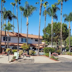
Singing Hills Golf Resort at Sycuan
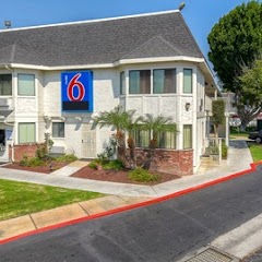
Motel 6 El Cajon, CA - San Diego
Vacationer RV Resort
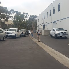
City of San Diego - Engineering Field Office
Transit and Meeting Points
Useful pickup, handoff, or rendezvous points close to Santee.
Old Town Transit Center
Santa Fe Depot
Sorrento Valley station
Solana Beach
Flight Path Map
This map shows the direct air route between Chula Vista and San Diego Country Estates. Straight-line distance: 30.76 mi (49.51 km).

#1 Chula Vista
The second most populous city in San Diego County, California.
| Population | 272,979 |
| Coordinates | 32.6400500, -117.0842000 |
| Altitude | 21 |
| Country | United States |

#2 San Diego Country Estates
Census-designated place in San Diego County, California
| Population | 10,109 |
| Coordinates | 33.0067100, -116.7836400 |
| Altitude | 460 |
| Country | United States |
End: San Diego Country Estates (-116.78364, 33.00671)
Estimated Travel Time
Distance: 63 km by road
| Speed | Time |
|---|---|
| 30 mph (48.3 km/h) | 01h 17m |
| 40 mph (64.37 km/h) | 00h 58m |
| 50 mph (80.47 km/h) | 00h 46m |
| 60 mph (96.56 km/h) | 00h 38m |
| 70 mph (112.65 km/h) | 00h 33m |
| 80 mph (129 km/h) | 00h 29m |
Fuel, Round Trip and CO2
Estimated fuel cost and emissions for this route.
| Fuel | $/gal | One way | Round trip |
|---|---|---|---|
| Regular gas | $5.77 | $7.90 | $15.81 |
| Mid-grade | $6.07 | $8.31 | $16.62 |
| Premium | $6.24 | $8.55 | $17.11 |
| Diesel | $7.57 | $10.37 | $20.73 |
Assumes 8.3 L/100 km (about 28.3 MPG). CO2 is an estimate and varies by vehicle, fuel blend, traffic, and terrain.
Prices in California · Jun 11, 2026
Distance to Other Cities
Planning a road trip? See the full trip guide on Trip.ovh — stops, fuel costs, weather, and departure timing.