How far is Chinook, MT from Whitefish, MT?
The driving distance from Chinook, MT to Whitefish, MT is about 276.2 miles (444.5 km), with a travel time of about 04h 48m by car.
- The straight-line flight distance is about 234.1 miles (376.7 km).
- For a round trip, plan for roughly 09h 37m of driving time before adding stops, traffic, or weather delays.
- A comfortable departure window is usually 6:00 AM to 8:00 AM MDT.
Reverse, save, or send this route
This drive is better planned with a longer stop or an overnight stay. Copy the route link, send it to another device, or print a clean version before you head out.
This drive is better planned with a longer stop or an overnight stay.
Flight Distance
Driving Distance
Gas Cost Calculator
Leave and Arrive Planner
Pick a departure time to see your estimated arrival and same-day return window.
Drive time stays fixed at 04h 48m.
An early departure helps you fit a real stop into the day without turning the return into a late-night drive.
You are leaving earlier than the recommended window, which gives you extra margin for breaks and traffic.
Halfway Point
A useful midpoint for breaks, coffee, or meeting in the middle.
City in Glacier County, Montana, United States
Route Weather Snapshot
Check the forecast at both ends before you head out.
Partly Sunny
Light Rain Likely then Chance Showers And Thunderstorms
Driving Route Map
The map below follows the saved road route between Chinook and Whitefish.
Turn-by-Turn Driving Directions
Step-by-step road directions between Chinook and Whitefish.
-
1
Start on Indiana Street
1775 ft · 1 min · Indiana Street
-
2
Turn left onto 1st Street West
123.6 mi · 2 hr 19 min · 1st Street West
-
3
Continue on Main Street
1.2 km · 2 min · Main Street
-
4
Turn right onto 5th Avenue North
138 m · 17 sec · 5th Avenue North
-
5
Continue on West Roosevelt Highway
58 mi · 1 hr 8 min · West Roosevelt Highway
-
6
Continue on East Central Avenue
1 km · 2 min · East Central Avenue
-
7
Enter the roundabout and take exit 3 toward the route
75 m · 4 sec
-
8
Exit the roundabout
72.3 mi · 1 hr 20 min
-
9
Turn right
842 ft · 1 min
-
10
At the end of the road, turn left onto Old US 2
1930 ft · 1 min · Old US 2
-
11
Turn right onto US Route 2
7.5 mi · 10 min · US Route 2
-
12
Continue on US 2
3 mi · 4 min · US 2
-
13
Continue on 9th Street
2 mi · 5 min · 9th Street
-
14
Continue on US 2
1.6 km · 1 min · US 2
-
15
Continue straight
4.5 mi · 6 min
-
16
Turn right onto US 93 South
2584 ft · 51 sec · US 93 South
-
17
Continue on Spokane Avenue
1.7 mi · 4 min · Spokane Avenue
-
18
Turn left onto East 2nd Street
536 ft · 22 sec · East 2nd Street
-
19
Turn right
51 m · 12 sec
-
20
Arrive at your destination
0 m · 1 sec
Car Route Details
A richer read on the saved driving route between Chinook and Whitefish.
Straightforward drive
The saved road route has a manageable number of maneuvers and should be easy to follow with normal attention to signs.
1st Street West
Turn left onto 1st Street West
124 mi · 02h 19m
Route Summary
A quick read on whether this route feels easy, ambitious, or worth planning around.
A longer out-and-back drive
This is still possible in one day, but it becomes a long driving day. Leaving early and planning your stop window matters more here.
Partly Sunny leaving Chinook and Light Rain Likely then Chance Showers And Thunderstorms near Whitefish.
Trip Questions
Direct answers travelers usually want before committing to the drive.
How long does it take to drive from Chinook to Whitefish?
The road trip is about 276.2 miles (444.5 km) and usually takes 04h 48m in normal driving conditions.
Is this a same-day trip or an overnight route?
This is still possible in one day, but it becomes a long driving day. Leaving early and planning your stop window matters more here.
What is the halfway point on this route?
Cut Bank is a useful midpoint, sitting about 138.1 miles from Chinook and 138.2 miles from Whitefish.
How much longer is the road route than the straight-line distance?
The direct path is about 234.1 miles (376.7 km), while the road route adds roughly 42.1 extra miles because roads do not follow the straight air line.
When is the best time to leave for this route?
A good departure window is usually 6:00 AM to 8:00 AM MDT. If you want a more comfortable same-day return, try to leave by 7:22 AM MDT.
How much will gas cost for this route?
Using about 28.3 MPG, regular gas is estimated at $37.96 one way or $75.91 round trip. Estimated CO2 is about 86.6 kg one way.
What should you check before leaving?
Before you leave, expect Partly Sunny around Chinook and Light Rain Likely then Chance Showers And Thunderstorms near Whitefish.
Stop Ideas Near Cut Bank
Useful break, food, and waypoint ideas within about 15 miles of the route midpoint.
Old Shelby Town Hall
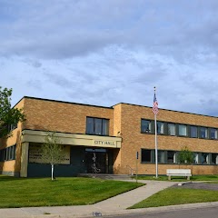
Shelby City Hall
Cut Bank Volunteer Fire Department
Transit and Meeting Points
Useful pickup, handoff, or rendezvous points close to Cut Bank.
Cut Bank
Shelby
Browning
East Glacier Park
Flight Path Map
This map shows the direct air route between Chinook and Whitefish. Straight-line distance: 234.06 mi (376.69 km).
#1 Chinook
City in Montana
| Population | 1,230 |
| Coordinates | 48.5900000, -109.2312800 |
| Altitude | 740 |
| Country | United States |

#2 Whitefish
City in Flathead County, Montana, United States
| Population | 8,713 |
| Coordinates | 48.4110800, -114.3376300 |
| Altitude | 923 |
| Country | United States |
End: (-114.337485, 48.411081)
Estimated Travel Time
Distance: 445 km by road
| Speed | Time |
|---|---|
| 30 mph (48.3 km/h) | 09h 12m |
| 40 mph (64.37 km/h) | 06h 54m |
| 50 mph (80.47 km/h) | 05h 31m |
| 60 mph (96.56 km/h) | 04h 36m |
| 70 mph (112.65 km/h) | 03h 56m |
| 80 mph (129 km/h) | 03h 26m |
Fuel, Round Trip and CO2
Estimated fuel cost and emissions for this route.
| Fuel | $/gal | One way | Round trip |
|---|---|---|---|
| Regular gas | $3.89 | $37.96 | $75.91 |
| Mid-grade | $4.23 | $41.25 | $82.50 |
| Premium | $4.55 | $44.35 | $88.71 |
| Diesel | $5.41 | $52.77 | $105.53 |
Assumes 8.3 L/100 km (about 28.3 MPG). CO2 is an estimate and varies by vehicle, fuel blend, traffic, and terrain.
Prices in Montana · Jun 10, 2026
Distance to Other Cities
Planning a road trip? See the full trip guide on Trip.ovh — stops, fuel costs, weather, and departure timing.