How far is Charleston, MI from Ann Arbor, MI?
The driving distance from Charleston, MI to Ann Arbor, MI is about 153.6 miles (247.2 km), with a travel time of about 02h 39m by car.
- The straight-line flight distance is about 109.4 miles (176 km).
- For a round trip, plan for roughly 05h 18m of driving time before adding stops, traffic, or weather delays.
- A comfortable departure window is usually 8:00 AM to 10:00 AM EDT.
Reverse, save, or send this route
This route works well as a day trip with time at the destination. Copy the route link, send it to another device, or print a clean version before you head out.
This route works well as a day trip with time at the destination.
Flight Distance
Driving Distance
Gas Cost Calculator
Leave and Arrive Planner
Pick a departure time to see your estimated arrival and same-day return window.
Drive time stays fixed at 02h 39m.
A morning start gives you useful time at the destination and keeps the return out of the late evening.
You are leaving earlier than the recommended window, which gives you extra margin for breaks and traffic.
Halfway Point
A useful midpoint for breaks, coffee, or meeting in the middle.
Route Weather Snapshot
Check the forecast at both ends before you head out.
Mostly Sunny
Slight Chance Rain Showers then Mostly Sunny
Driving Route Map
The map below follows the saved road route between Charleston and Ann Arbor.
Turn-by-Turn Driving Directions
Step-by-step road directions between Charleston and Ann Arbor.
-
1
Start on Charleston Road
6 m · 3 sec · Charleston Road
-
2
Turn right onto Bay City Forestville Road
3.3 mi · 5 min · Bay City Forestville Road
-
3
Continue on Cedar Avenue
2802 ft · 1 min · Cedar Avenue
-
4
Turn right onto 3rd Street
1.3 km · 1 min · 3rd Street
-
5
Continue on Lakeshore Road
15.4 mi · 23 min · Lakeshore Road
-
6
Continue on North Ridge Street
1 km · 51 sec · North Ridge Street
-
7
Continue on South Lakeshore Road
10.4 mi · 12 min · South Lakeshore Road
-
8
Continue on Main Street
1.2 mi · 1 min · Main Street
-
9
Continue on Lakeshore Road
7.6 mi · 9 min · Lakeshore Road
-
10
Continue on Kimball Drive
2.9 mi · 3 min · Kimball Drive
-
11
Continue on Lakeshore Road
4.4 mi · 5 min · Lakeshore Road
-
12
Turn straight onto 24th Avenue
2.5 mi · 3 min · 24th Avenue
-
13
Continue on Pine Grove Avenue
1.2 mi · 2 min · Pine Grove Avenue
-
14
Keep slight right to continue on Pine Grove Connector
1761 ft · 25 sec · Pine Grove Connector
-
15
Take the exit straight toward I 69 West, I 94 West
1865 ft · 45 sec
-
16
Merge slight left
2.3 mi · 2 min
-
17
Keep slight left
42.7 mi · 46 min
-
18
Take the exit slight right toward I 696 West: Lansing, 11 Mile Road
1395 ft · 34 sec
-
19
Keep slight right to continue on I 696 West: Lansing
1647 ft · 35 sec
-
20
Continue on Walter P Reuther Freeway
26.8 mi · 29 min · Walter P Reuther Freeway
-
21
Take the exit slight right toward I 96 East, I 275: Toledo
2135 ft · 52 sec
-
22
Keep slight left to continue on I 96 East, I 275: Toledo
1.3 km · 2 min
-
23
Keep slight left to continue on I 96, I 275: Detroit, Toledo
1875 ft · 23 sec
-
24
Merge slight right onto Disabled American Veterans Memorial Highway
5.8 mi · 6 min · Disabled American Veterans Memorial Highway
-
25
Take the exit slight right toward M 14: Ann Arbor
1 km · 1 min
-
26
Merge slight left
16.5 mi · 18 min
-
27
Keep slight left to continue on M 14: Ann Arbor
1.7 mi · 2 min
-
28
Take the exit right toward US 23 BUS: Downtown Ann Arbor
1.5 km · 2 min
-
29
Turn left onto Depot Street
1969 ft · 1 min · Depot Street
-
30
Turn right
36 m · 7 sec
-
31
Continue on North State Street
3204 ft · 1 min · North State Street
-
32
Arrive at your destination
0 m · 1 sec · South State Street
Car Route Details
A richer read on the saved driving route between Charleston and Ann Arbor.
Interchange-aware route
The drive includes several ramps, exits, or merges, so checking the next few maneuvers before busy interchanges is useful.
I 69 West
Keep slight left
42.7 mi · 00h 46m
Route Summary
A quick read on whether this route feels easy, ambitious, or worth planning around.
A comfortable day-trip route
This route works well as a day trip. You can leave in the morning, spend meaningful time at the destination, and still return the same day.
Mostly Sunny leaving Charleston and Slight Chance Rain Showers then Mostly Sunny near Ann Arbor.
Trip Questions
Direct answers travelers usually want before committing to the drive.
How long does it take to drive from Charleston to Ann Arbor?
The road trip is about 153.6 miles (247.2 km) and usually takes 02h 39m in normal driving conditions.
Is this a same-day trip or an overnight route?
This route works well as a day trip. You can leave in the morning, spend meaningful time at the destination, and still return the same day.
What is the halfway point on this route?
Casco is a useful midpoint, sitting about 76 miles from Charleston and 77.5 miles from Ann Arbor.
How much longer is the road route than the straight-line distance?
The direct path is about 109.4 miles (176 km), while the road route adds roughly 44.2 extra miles because roads do not follow the straight air line.
When is the best time to leave for this route?
A good departure window is usually 8:00 AM to 10:00 AM EDT. If you want a more comfortable same-day return, try to leave by 1:12 PM EDT.
How much will gas cost for this route?
Using about 28.3 MPG, regular gas is estimated at $20.44 one way or $40.88 round trip. Estimated CO2 is about 48.2 kg one way.
What should you check before leaving?
Before you leave, expect Mostly Sunny around Charleston and Slight Chance Rain Showers then Mostly Sunny near Ann Arbor.
Stop Ideas Near Casco
Useful break, food, and waypoint ideas within about 15 miles of the route midpoint.
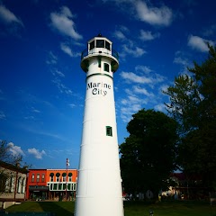
Marine City City Hall
Mount Clemens City Hall
Transit and Meeting Points
Useful pickup, handoff, or rendezvous points close to Casco.
Port Huron
Troy Transit Center
Birmingham, Michigan
Royal Oak station
Flight Path Map
This map shows the direct air route between Charleston and Ann Arbor. Straight-line distance: 109.34 mi (175.97 km).
#1 Charleston
Township in Sanilac County, Michigan, United States
| Population | 2,048 |
| Coordinates | 43.6591800, -82.6860400 |
| Altitude | 228 |
| Country | United States |

#2 Ann Arbor
The most populous city in Washtenaw County, Michigan.
| Population | 119,280 |
| Coordinates | 42.2775600, -83.7408800 |
| Altitude | 269 |
| Country | United States |
End: South State Street (-83.740762, 42.277562)
Estimated Travel Time
Distance: 247 km by road
| Speed | Time |
|---|---|
| 30 mph (48.3 km/h) | 05h 07m |
| 40 mph (64.37 km/h) | 03h 50m |
| 50 mph (80.47 km/h) | 03h 04m |
| 60 mph (96.56 km/h) | 02h 33m |
| 70 mph (112.65 km/h) | 02h 11m |
| 80 mph (129 km/h) | 01h 54m |
Fuel, Round Trip and CO2
Estimated fuel cost and emissions for this route.
| Fuel | $/gal | One way | Round trip |
|---|---|---|---|
| Regular gas | $3.77 | $20.44 | $40.88 |
| Mid-grade | $4.25 | $23.05 | $46.10 |
| Premium | $4.65 | $25.22 | $50.45 |
| Diesel | $5.30 | $28.75 | $57.50 |
Assumes 8.3 L/100 km (about 28.3 MPG). CO2 is an estimate and varies by vehicle, fuel blend, traffic, and terrain.
Prices in Michigan · Jun 27, 2026
Distance to Other Cities
Planning a road trip? See the full trip guide on Trip.ovh — stops, fuel costs, weather, and departure timing.